We first visited Yellowstone in 1976 and loved the beauty and strangeness of it so much that it's always on our minds as we travel across the north country of the western US. But it's a lot harder to visit now because so many other people love it too. In 1976 there were 2.5 million visitors. In 2022 that number had almost doubled so parking lots fill fast and all of the campgrounds including the smaller ones managed by the park service (instead of Xanterra) require reservations.
We visited several times in the 1990s and could drive the figure eight loop of the park roads and get campsites along the way or by waiting in line in the morning as people checked out. We visited again in 2006 and I think I made some reservations but it wasn't very crowded with fewer than 3 million people visiting that year, By
2016 the numbers were over 4 million but we still could get first come/first serve sites by waiting in line. Not anymore. Getting reservations this year was especially difficult because some of the campgrounds in the upper loop of the figure eight were closed due the flooding in June 2022 but I managed to get five days - one day in Madison, two days in Grant, and one day in Bay Bridge. That gave us enough time to see most of what we wanted to in the lower loop. The upper loop will have to wait until our next visit.
Some of the changes are good. The parking lot at Gibbon Falls has been enlarged and improved.There's now a wide accessible walkway that allows everyone to get a great view of the falls.

There were fewer large tour groups. Most tour groups use small shuttle type buses and the smaller groups mean less congestion on the boardwalks but to save room for tour buses some of the parking spaces that are marked for buses and RVs had signs reserving them for buses only.
The larger number of visitors means waiting in lines of traffic and filled parking lots but the roads themselves are not that busy. There was a line at the most used, western entrance but we waited less than 15 minutes. Our first day we headed north from Madison and stopped to see the roadside hot springs. When we got to Norris Geyser Basin we found a full parking lot and cars lining both sides of main road. Luckily for us it started to rain so we ate dinner and had almost empty trails when the rain stopped. Norris Geyser Basin is not accessible but we did do the southern loop which has narrow sections, rough gravel, and steep hills. The northern section, which we did not do, has many steps.


The next day we went south and skipped by Lower and Midway Geyser Basins because of the full parking lots and instead started at Old Faithful. There are numerous trails and a visitor center so it's possible to spend most of the day there but even the very large parking lot fills. This is the most accessible area of the park.

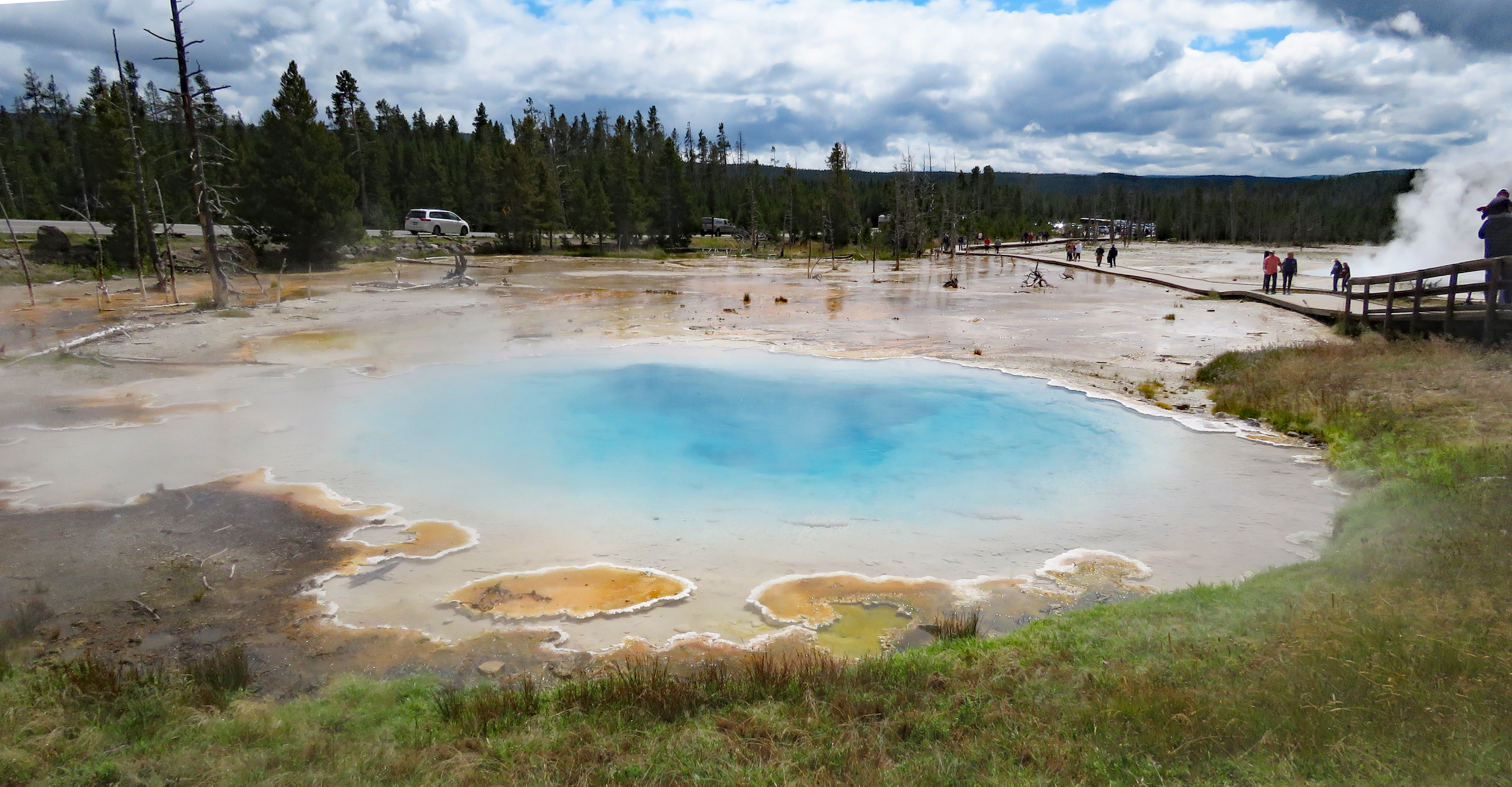
On day three we were up early to get parking spaces at Lower and Midway Geyser Basin. Other people had the same idea but it was much better than the day before when there were lines to get into the lots and many cars parking along the road. The geyser basins are fairly accessible but there are steep hills and one loop has steps so backtracking is necessary. The traffic and parking lots were congested again when we left and drove south to our campsite at Grant Village.
Day four we visited West Thumb which isn't super popular so the parking lot doesn't fill. It's definitely worth visiting for views of hot springs with Yellowstone Lake in the background. We continued to Bridge Bay Campground and wandered around the campground and the marina where people who have never driven a boat are given a quick lesson before they putt out to the lake.
Day five, before heading out of the park, we walked/rolled to the Natural Bridge, a two mile out and back trip along old roads and gravel trail. The last section, that must be traversed to get a good view, is very rocky and wheelchair users will need assistance. A steep but short, non- accessible trail continues to the base of the bridge. The parking area along the road is large enough for RVs.
The large and small wildlife. The buffalo grazed right outside our door for several hours. The mouse was hardly bigger than a cotton ball and totally unafraid.
Even though we didn't get to spend as much time as we would have liked this was still an enjoyable trip. Fellow visitors were patient and cheerful, not
minding the crowds or the weather. If you have a chance to go, don't
miss it!
Accessibility information Yellowstone West Entrance -
44.65702, -111.09015


 We first visited Yellowstone in 1976 and loved the beauty and strangeness of it so much that it's always on our minds as we travel across the north country of the western US. But it's a lot harder to visit now because so many other people love it too. In 1976 there were 2.5 million visitors. In 2022 that number had almost doubled so parking lots fill fast and all of the campgrounds including the smaller ones managed by the park service (instead of Xanterra) require reservations.

 There were fewer large tour groups. Most tour groups use small shuttle type buses and the smaller groups mean less congestion on the boardwalks but to save room for tour buses some of the parking spaces that are marked for buses and RVs had signs reserving them for buses only.