Showing posts with label GHOST TOWNS. Show all posts

Sunday, June 8, 2025

South Pass City

(National Park Service photo) 
South Pass is a twenty mile wide gentle slope that travelers on the California, Oregon, and Mormon Trails in southern Wyoming used to cross the Continental Divide. The grade is so gradual that most people were not even aware when they had reached the 7,412 foot summit. The trail followed the Sweetwater River and isn't used today. Instead Route 28 climbs up and over the pass. 

South Pass City is just a couple miles off of Route 28 and was founded after gold was discovered in1867. Large gold deposits were never discovered and the town declined in just five years but investors continued to hope and poured money into the mines to no avail. By 1949 it was a ghost town. Most of the miners, shop keepers, saloon and hotel operators had moved on.

Today the town is a state park with over twenty restored buildings featuring rooms furnished with period pieces. Some of the buildings have interpretive displays. A video of the area history can be watched in the South Pass Hotel and Restaurant. 

The Clarissa Mill which was moved from nearby Atlantic City, another mining town, was refurbished after WWII but the mining and milling operations did not pay off and it closed in 1955. Tours are conducted Thursday to Sunday at 2 PM. We did not go on a tour. 

 
The town site is partly accessible. A ramp is located on the right side of the information/admission building. A boardwalk leads to about eight of the buildings situated on either side of Main Street. The rest of the street is dirt without boardwalks or ramps into the buildings. The video in the South Pass Hotel and Restaurant includes tours of the buildings that aren't accessible. A log (very bumpy) bridge goes across Willow Creek. There are no paths or ramps to the four buildings located there. 
Other access problems include high thresholds and glare from the plexiglass used to block entry to the rooms in the buildings. The Smith-Sherlock Company Store is the only building without plexiglass blocking off the exhibits.  

There are four intersecting loop trails. We did not attempt any of them but I suspect that even the easiest is not accessible.  

The dirt road from Route 28 to South Park City is in good condition, passable by any vehicle. The parking lot is large enough for any vehicle.  South Pass City  42.46867, -108.80331


Friday, April 25, 2025

Frisco Ghost Town & Cemetery

There's little left of Frisco so the site would be more aptly named a ghost mine. Silver was discovered in 1875 and by 1877 two smelters had been constructed to process the ore. Frisco grew rapidly to over 6000 people when a rail line was built in1880 to connect it to Murray, Utah where ore was sent for processing. The rail line also brought supplies to Frisco which was so isolated that all necessities even water had to be brought in from outside. Old ties can still be found along the road.

The five charcoal kilns are the most intact feature on the site. There are also ruins of buildings, cellar pits, a cemetery, and old machinery that was too large to cart away. The Horn Silver Mine, located about 1.5 miles from the kilns, was the most profitable of the numerous mines in the area and had sixteen levels and a 1,600 feet main shaft. In 1885, after the night shift had returned to the surface, the foreman noticed tremors and kept the day shift men from going down into the mine. A massive cave in closed the mine for almost a year. Even though it kept producing until the 1940s the mine and town never completely recovered. The town was mostly deserted by the late 1920s. Over its lifetime the mine produced 17 million ounces of silver, 25 thousand ounces of gold, 9 million pounds of copper, 196 thousand tons of lead, and 23 thousand tons of zinc. 

Due to the terrain and condition of the roads the kilns and ruins are not accessible to people with limited mobility but can be seen by driving a short distance on old Ely Highway. The road to the cemetery has a washed out area and can not be accessed by a vehicle without four wheel drive. 

 
We managed to push up the roads and get to the kilns and cemetery so even though it's tough it's doable with a strong helper and by going slow and resting a lot.. There's a fence around the kilns but we found an unlocked gate at the south side that gave us access. Do not go into the kilns as they are dangerous due to falling rocks. 
Most of the graves at the cemetery are young children - very sad.

 
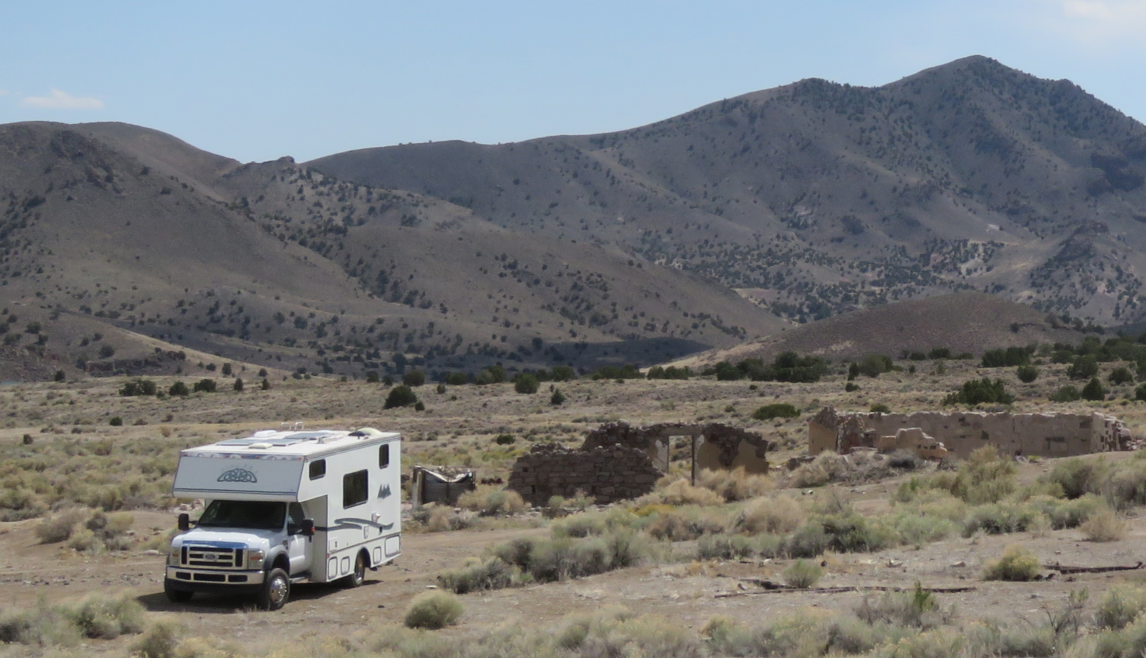
We camped by a pull out near the largest stone ruin. This was a far as we felt we could safely drive. Four wheel drive trucks and ATVs can go farther but there are huge rough spots. The Frisco town site and Horn Silver Mine are privately owned. It's okay to explore the kiln area and the cemetery but the Horn Silver Mine is too dangerous with open mine shafts and poisonous gases. I zoomed in to get the photo of the tipple.

 
The road to our camp spot and the road to the washed out area before the cemetery are accessible by any vehicle.  Frisco  38.45984, -113.25907


Friday, April 28, 2023

Candelaria Ghost Town

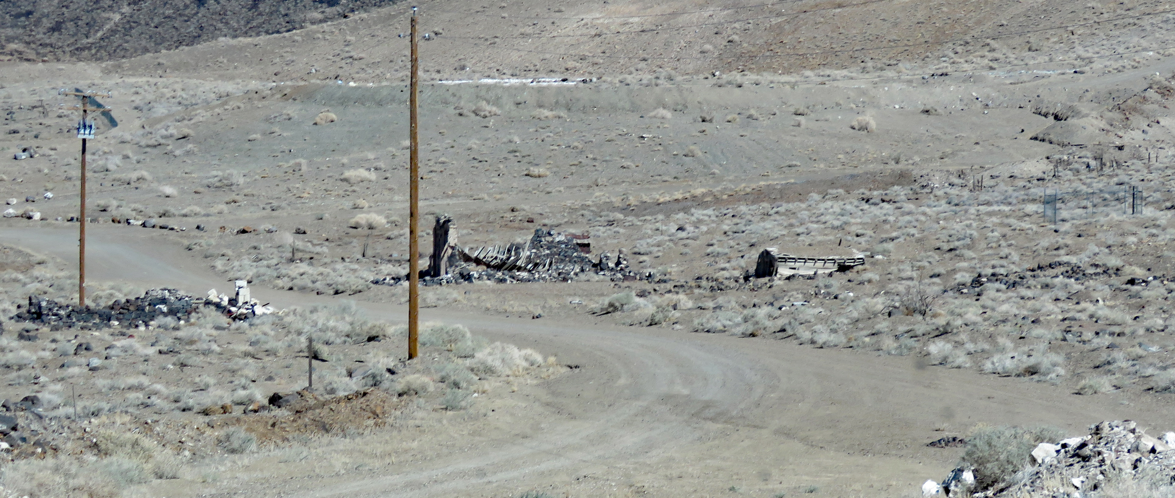
Silver ore was discovered in Candelaria in 1864 but not much happened until 1873 when the Northern Belle Mine went into production. A 20-stamp mill with three furnaces was built to process the ore. The dry stamping process created a fine dust that settled in the lungs of residents causing respiratory tract infections, diseases and even death. The town's population grew to over a thousand but the lack of water plus the 1893 economic depression lead to its downfall. Very little is left but the scars on the mountains, the ruins of the stamp mill, a few wooden structures, the brick front of a collapsed building, and a cemetery.
Follow the paved road off of US 95 for about 6 miles to the town site. It's very barren and desolate and must have been an unpleasant place to work and live. The pavement ends at the town site but if you have high clearance there's a network of dirt roads to explore.
This is all BLM land except for the mine property.We couldn't find a good spot to camp near the town and instead turned up a dirt road on our way back to US 95 and found a quarry which may have been the source of sand used to cover the mine dumps during reclamation work. The view is nice and the ground is level and solid.
The paved road to Candelaria and the dirt road to the boondocking spot are suitable for any RV. Candelaria  38.16227, -118.0828  Boondocking

Wednesday, April 28, 2021

Silver Reef Museum

  Silver was discovered in the sandstone at Silver Reef in 1866. Silver in sandstone is unusual and the discovery was dismissed until 1875 when a couple of speculators staked 21 claims in the sandstone hills. The ensuing silver rush brought enough people to town to support a mile long main street with a hotel, boarding houses, nine stores, six saloons, five restaurants, a bank, two dance halls, a newspaper  and eight dry goods stores. By 1884 labor disputes, falling silver prices, and water in the mines lead to the closure of almost all of the mines.

  Most of the buildings were sold for their lumber and stone. The only original buildings still standing are the Wells Fargo Office and a small jail. Several more have been reconstructed. The ruins of a few remain but new houses have been built just outside the park boundary.

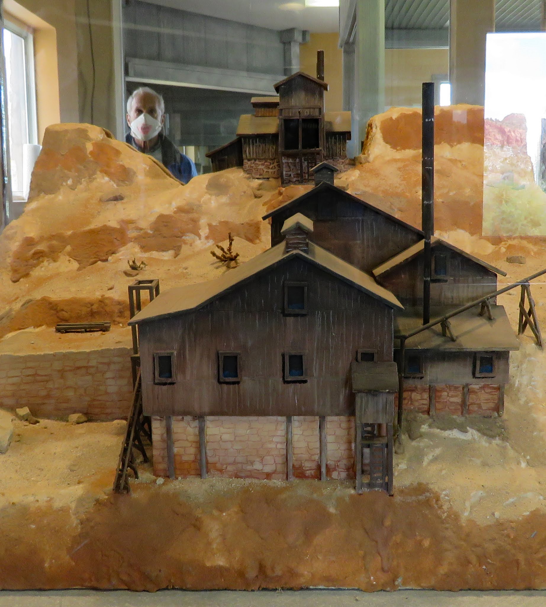
  A nice little museum is housed in the Wells Fargo Office. The Cassidy Powder House has been reconstructed and has a diorama of Silver Reef, models of the mining structures, and an audio narrative of the town’s history. A trail makes a 1/2 mile loop past the ruins. Pick up a trail guide in the museum.
  This is not a very accessible site. The sidewalk to the museum entrance does not meet flush with the ground making a short step up. The first section of the museum and gift shop is accessible. The second section is accessed by a high step. The path is surfaced with loose stone which is difficult to push through even with assistance. The Cassidy Powder House is accessible.
  The parking lot is large enough for RVs. Museum  37.2526, -113.36707