Showing posts with label WA DISCOVER PASS. Show all posts

Monday, September 1, 2025

Round Lake WDFW

 Three small lakes are strung out along Aeneas Valley Road. All of them are operated by the Washington Department of Fish and Wildlife. None are designated as camping locations on the WDFW website but as far as I know camping is permitted in all of them.  The first in line is Long Lake which has a very sloped parking area. We moved on to the next one, Round Lake, and camped on the hill overlooking the lake. It looks like there are some nice spots on the other side of the lake too but we did not check it out or go to Ell Lake, the last lake in the line.  

 All of the lakes have boat ramps and vault toilets but no other amenities. 

These camping spots may not be suitable for large RVs.  Lake  48.6085, -119.12775


Sunday, August 24, 2025

Deception Pass State Park

 After we left the rain forest it was time to make our annual trip back to our unofficial home base. Our daughter and son-in-law had a few more days of vacation so they tagged along. We got the only available sites -113 and 114 - at Deception pass, probably because they are considered a double site. They must be reserved together and each has a separate reservation fee.

Site 113 and 114 are fairly short and slightly uphill.The tables have long overhangs and the ground is hard packed - not accessible but usable. 

We only stayed the night so we didn't check out the park or the accessible sites. The Dunes Interpretive Trail is designated as accessible.  Campground  48.40028, -122.66194


Thursday, July 27, 2023

Federation Forest State Park

 Concern about the destruction of old growth forests led the General Federation of Woman's Clubs of Washington State to start a “Save a Tree” campaign. In 1929 they purchased 62 acres of forest to form Big Tree Park.  Unfortunately in the early 1930s  windstorms, fires, and nearby logging destroyed the forest and the club began looking for a new site. The current site was acquired by Washington State Parks, named Federation State Forest, and dedicated in 1949.  

The park has a campground, picnic shelters, a  small interpretive center and 12 miles of interconnecting trails that loop through stands of Douglas-fir, western hemlock, Sitka spruce, and western red cedar trees. 

The interpretive center is accessible. We did not visit the campground. The Whispering Hemlocks Trail is accessible, surfaced with hard packed dirt. The other trails have roots and hills. We were confused by the signs because the sign at the start of  trail system did not indicated that the interpretive trail was the Whispering Hemlocks Trail. It also do not indicate that it was the accessible trail. At the first directional signs go to the left on the Whispering Hemlocks Trail as shown by the arrow. Trail Map

The parking lot is large enough for RVs. Park  47.15222, -121.68776


Thursday, July 13, 2023

Coppermine Bottom Campground

 Although it's surrounded by extensive logging, this small campground is in a relatively untouched section of the state forest - pretty with big trees and lots of moss. It's tiny, only eleven sites and a parking area with access to the shallow river

I didn't notice an accessible site. Most of the site are usable with hard packed ground for easy rolling.

The sites are long enough to accommodate larger RVs. The gravel access road is 1.5 miles long, narrow and in good condition with one slightly steep grade. Campground  47.65573, -124.1879


Saturday, July 8, 2023

Porter Creek Campground- DNR

Even though the DNR website lists this campground as popular with ATV riders we found it to be quiet in the middle of the week. Some sites have access to the creek and all are surrounded by lush greenery and old growth forest - very pretty.
The sites have tables with extended tops and the ground is hard packed. Some sites may not be suitable for wheelchair users because of uneven and sloping ground.

About 1 mile of the access road is one lane gravel. We were a little concerned about logging trucks since there was active logging along the road but we didn't encounter any traffic. There are two camping loops off of B Line Road, one on each side of the road. The western loop has smaller sites so continue on B Line if the sites in the first loop are too small. Campground  46.97759, -123.25558

Friday, June 30, 2023

Millersylvania State Park

Over 8 miles of intersecting trails wind through old growth forest, meadows, and lake shore allowing visitors to chose the length of their hike.
Most of the trails could be made accessible fairly easily however it seems this was not a consideration when planning. We found very narrow boardwalks without any edge guards. Ramps from the ground to the boardwalks are steep and most boardwalks ends do not meet the ground evenly. We walked/rolled about three miles along the route marked in green on the map. Aside from the narrow ramps we also encountered a very steep hill leading to the western most loop trails and a short hill near the park headquarters. For all of these reasons I don't recommend these trails for wheelchair users.
We parked at the small craft launch lot which has plenty of room for RVs. Park  46.90988, -122.91583

Monday, May 30, 2022

Steptoe Butte State Park

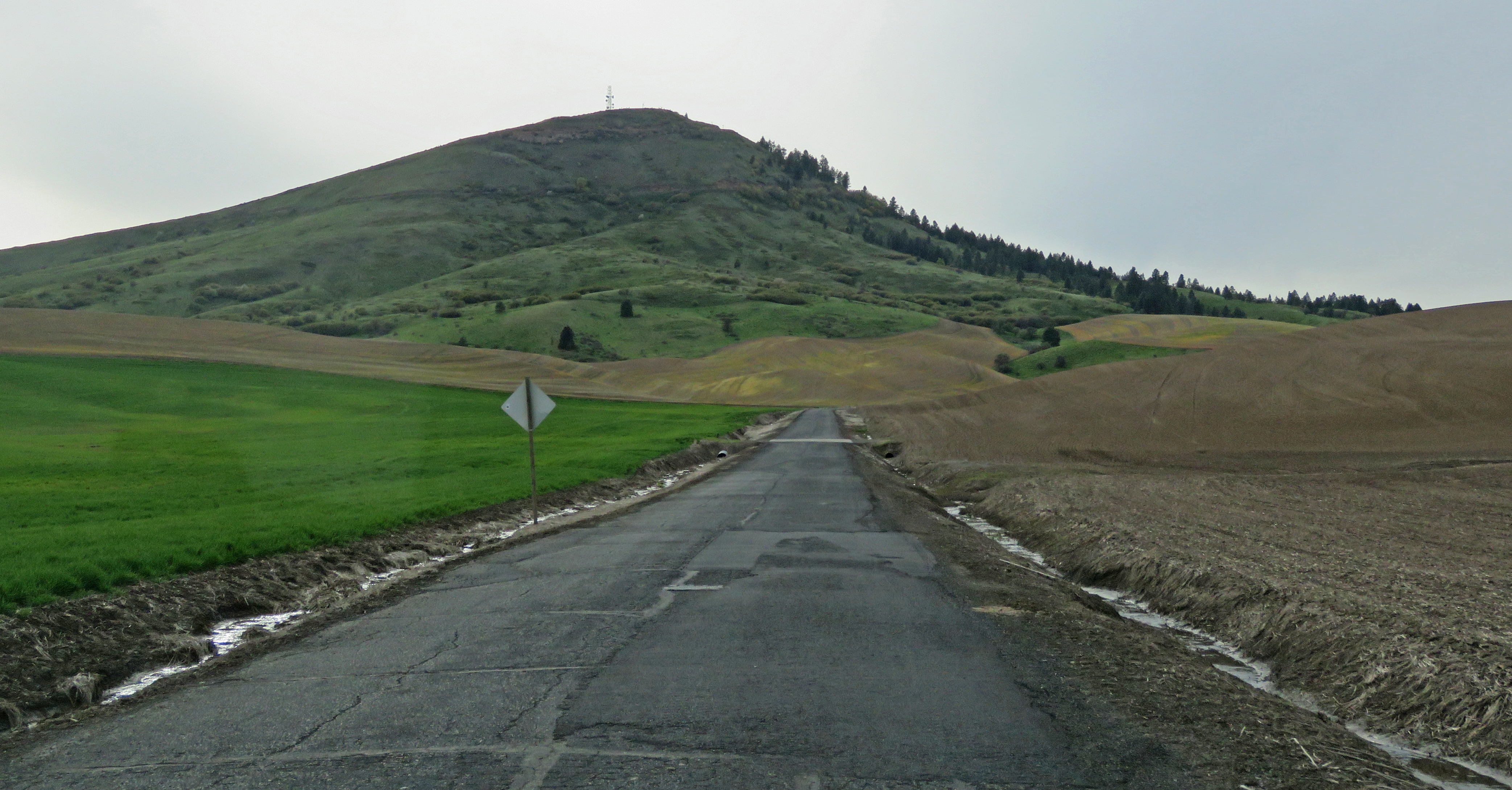
The rolling hills of the Palouse Prairie spread over 19,000 sq miles of southeastern Washington, western Idaho, and northeastern Oregon. The soil, which built up over thousands to tens of thousands of years, was created by wind-blown sediments that were originally deposited in central Washington during the Lake Missoula floods. In some places it's over 200' deep! The soil is very fertile and supports crops such wheat, barley, and legumes. Little of the native prairie is left.

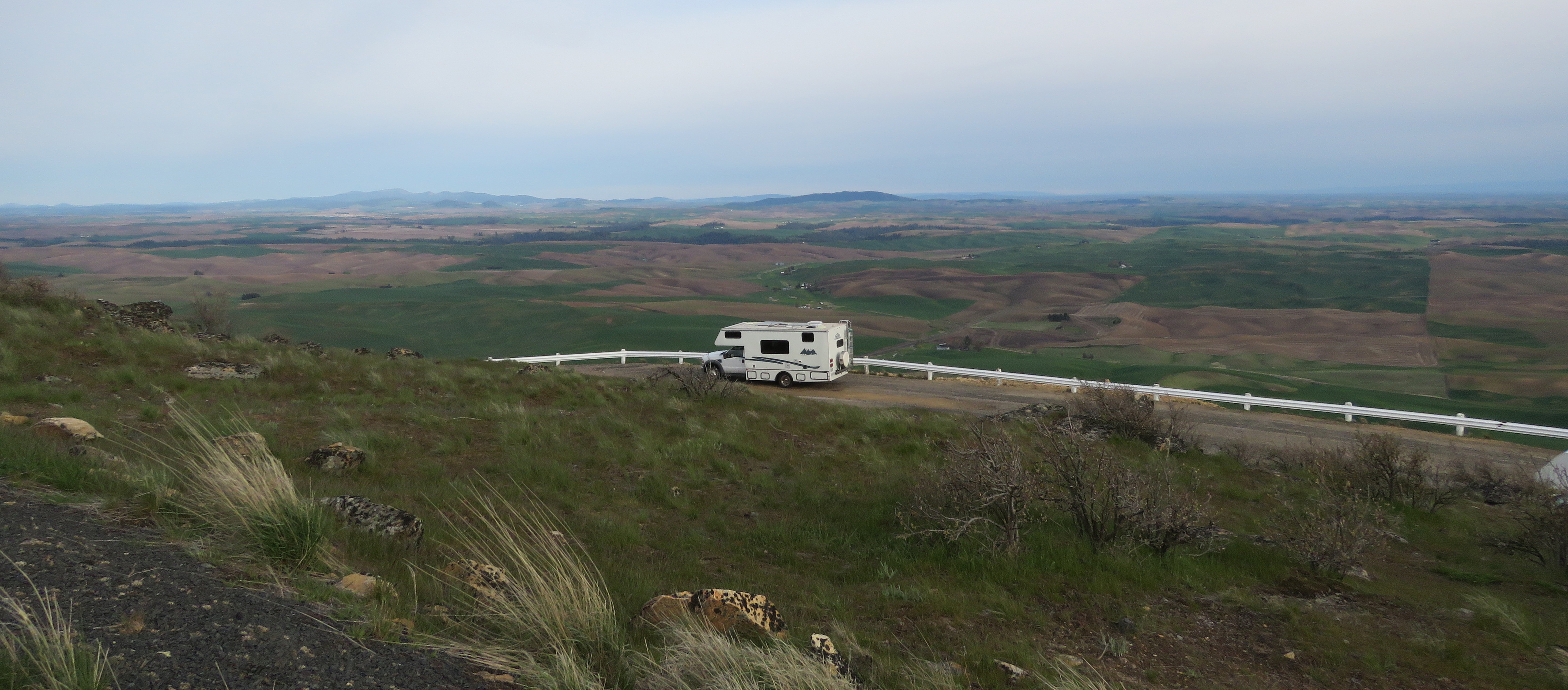
Steptoe Butte, a 400 million years old mound of quartzite, is an anomaly in the surrounding sea of wheat fields. It's elevation, 1000' feet above the fields, gives visitors who drive the 4 mile road to the summit an expansive 360 degree view.

The are no barriers blocking the view at the top, just a short guardrail so it completely accessible. The view can also be seen without leaving your vehicle.

Buses are driven on the road so it's okay for large RVs but be aware that it's narrow, steep and does not have guardrails. The parking area is large. There's another lot on the actual summit that is much smaller. We walked/rolled up the very steep, short road to see the view from that lot.  Park  47.03166, -117.29673

Sunday, May 29, 2022

Columbia Plateau Trail State Park

The trail is 130 miles long, running almost all the way from Spokane to Kennewick. There are a few paved sections but most of it's ballast or gravel with some dirt or grass. We wanted to go on the section that runs through the Turnbull National Wildlife Refuge but there are few access points so we had to start in Cheney which meant we had 1.5 miles of trail before we got to the refuge.

The trail from Chaney goes steeply downhill before leveling out to almost flat. It's elevated above the farmland that surrounds it so the views are nice. The gravel is loose making pushing difficult even with assistance.

When the trail enters the refuge it's much harder packed and easier to roll along. The farmland gives way to ponds and marshes with a lot of wildlife. We didn't have enough time to go very far but we enjoyed the refuge section much more than the farmland section. 
The parking lot in Cheney is large enough for any RV. A Discover Pass is required. Trail  47.47967, -117.56031

Tuesday, August 10, 2021

McLane Creek Trail

  Ponds with lily pads, ducks, and dragonflies, old growth forest, and salmon streams can all be found along this double loop trail. The Pond Trail is about 1.5 miles in total. A connector trail accesses the Forestry Trail for an additional mile.
    

  The first section of the Pond Trail is gravel and boardwalk and is accessible. The two loops are formed by an old railroad grade that bisects the Pond Trail. There are steps at the intersection. Parts of the trail are very narrow boardwalk, barely wide enough for a wheelchair and leaving no room for people to pass. I don’t remember how much of the trail is accessible but it’s worth going as far as possible from the parking lot in one direction then turning around and going in the opposite direction. The Forestry Trail is not accessible.
  The parking lot is small. It loops around and there is a wide spot on the loop where longer RV may fit. Trail  47.00105, -123.00254