Friday, December 20, 2019

Camping Down by the River

   We’re hanging out in Ehrenberg, Arizona on little piece of public land by a back channel of the Colorado River. We’ll probably be here until late December, enjoying the company of friends and completing little projects on the RV, so I won’t be posting very often. Happy Holidays to everyone!

Sunday, December 15, 2019

Desert Signpost & Shoe Fence

   It seems that people find driving across the desert boring and do strange things to amuse themselves. ;-)
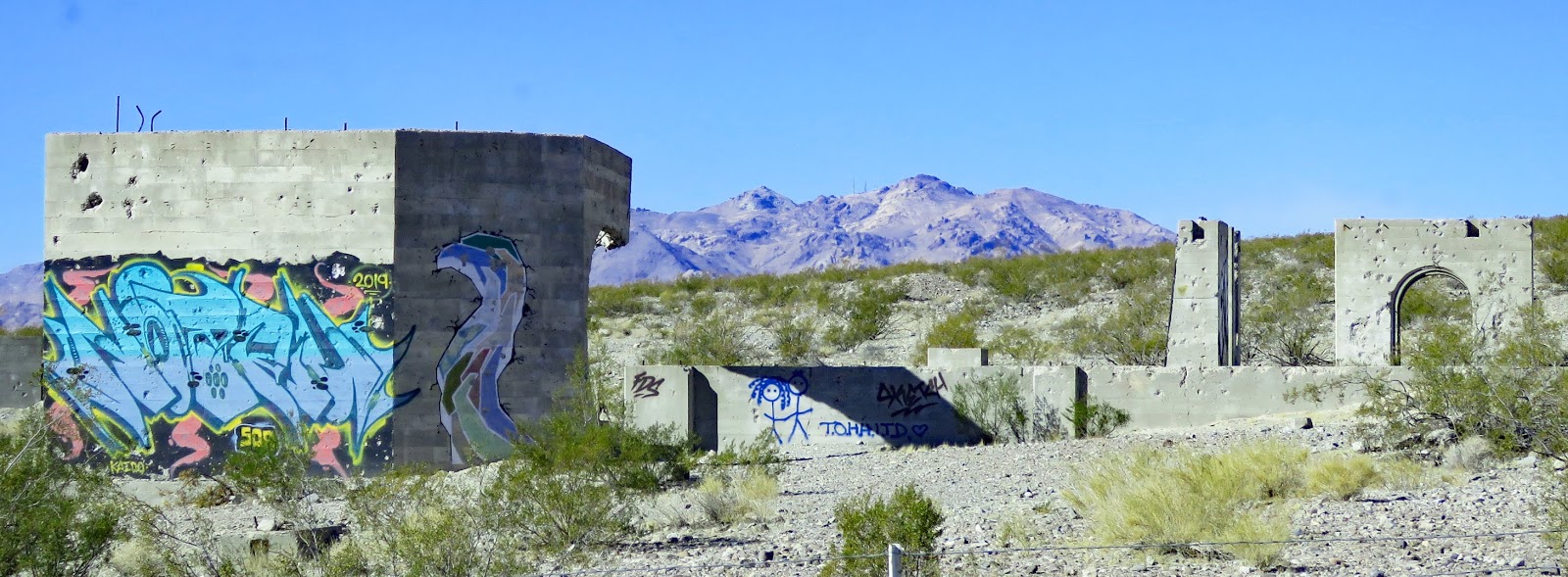
   The desert signpost, abandoned gas station and graffiti wall, and the shoe fence are on a 15 mile stretch of California 62 to the west of the non-existent town of Rice.

   All of the sites have parking areas large enough for RVs. All can be viewed without leaving your vehicle. Signpost  34.08839, -115.10448  Shoe Fence  34.08313, -114.8477
https://www.google.com/maps/d/edit?mid=1xJqWzy65eI4BVW6oU8R89jdR0oY&msa=0&ll=34.0960877138894%2C-115.09660680952987&spn=5.452431%2C8.031006&z=11

Thursday, December 12, 2019

Tortoise Rock Casino

    The lot designated for overnight stays is in the northeast corner. It has a slope so leveling may be needed. Check-in at the security desk is required.

   The chairs are a bit hard to move. The money and card slots are easy to reach. Casino  34.11999, -116.05046
https://www.google.com/maps/d/edit?mid=1xJqWzy65eI4BVW6oU8R89jdR0oY&msa=0&ll=34.12122032292863%2C-116.05229298738237&spn=5.452431%2C8.031006&z=16

Monday, December 9, 2019

Noah Purifoy Desert Art Museum of Assemblage Art

   Noah Purifoy, who was 87 when he died, spent the last 15 years of his life creating more than 100 works of arts which are spread over 10 acres of desert land. Purifoy earned a BFA from Chouinard Art Institute and his art has been featured in galleries around the world.
   The art is created with found materials and many of the sculptures are changing are they react to the elements.
   The ground is mostly hard packed sand but some areas on the outskirts are soft and hard to push through.

    Many of the streets are unpaved and narrow. Follow the directions on the website you’ll be fine however turning around if you’re towing may be a bit difficult. Parking is located across the road from the site. Art   34.19529, -116.28845
https://www.google.com/maps/d/edit?mid=1xJqWzy65eI4BVW6oU8R89jdR0oY&msa=0&ll=34.202642143876936%2C-116.29363101591747&spn=5.452431%2C8.031006&z=12

Saturday, December 7, 2019

Desert Christ Park

   A partnership in the 1950s between a preacher and a self- taught sculptor resulted in this park which features over forty steel-reinforced, concrete statues depicting scenes of Jesus’s life. My favorite is the one with dreadlocks.

   The park is on a hillside with paths that wind past the statues. A few are located on the church property next door.

   The park is not accessible due to the steep slopes and sandy soil but it’s possible to see some of the statues without leaving your vehicle.

  The gravel road to the parking lot is very steep and narrow but the parking lot is large enough for RVs. Park  34.12943, -116.43942
https://www.google.com/maps/d/edit?mid=1xJqWzy65eI4BVW6oU8R89jdR0oY&msa=0&ll=34.202642143876936%2C-116.29363101591747&spn=5.452431%2C8.031006&z=12

Thursday, December 5, 2019

Dixon May Fair RV Park

   Twenty-eight spaces, lined up side by side on two edges of the parking lot, are available for RVers except when events are taking place at the fairgrounds. The sites are fairly wide and sixteen are full hookup. Even though this is one of our least favorite types of camping we needed to charge our batteries (no sun!) and dump our tanks while visiting family over Thanksgiving so we were happy to find the RV park opened.

    The spaces can not be reserved and special arrangements must be made for after-hours and holiday arrivals. We didn’t do this so we were, again, happy to find the gate opened. We checked for a drop box at the office, called the number which didn’t have an option for leaving a message, and couldn’t find the camp host so I sent a check to their mailing address. Hope we don’t get fined for breaking the rules. ;-)  RV Park  38.43804, -121.82189
https://www.google.com/maps/d/edit?mid=1MRNOAwb5okCy61LKgjYrbg3sfpE&msa=0&ll=38.43804616807158%2C-121.82195289882696&spn=10.53912%2C16.062012&z=18

Monday, December 2, 2019

Bodie State Historic Park

   Gold was discovered in Bodie in 1859 but the town’s growth was slow until 1875 when a mine collapse exposed a rich vein of ore. During it’s most productive period, from 1877 – 1881, the town had 30 mines, nine stamp mills, 60 salons, and around 8,000 people. News of gold strikes in Arizona, Montana, and Utah lured many miners away but Bodie’s mines stayed active until the last one closed in 1942. Caretakers watched over the deserted town until 1962 when California State Parks bought it.
   This is one of the best-preserved ghost towns in the US. Most of the buildings fell prey to fire and decay but the 5% that survived are in wonderful condition. The interiors remain as the last occupants left them with miscellaneous furniture, stocked shelves, and stacks of school books.
   Get a walking tour brochure at the visitor center or the red barn. There are 50 stops on the tour. A video about the town runs continuously at the red barn. When we visited the Miller house and the Methodist church were opened. The visitor center was not opened. The mill buildings and surrounding area are open for tours during the summer only.
   Attempts have been made to provide accessibility however most visitors in wheelchairs will still need assistance. The path that goes downhill from the parking lot to the townsite is concrete. The main streets are hardpacked. The red barn is accessible. During the summer arrangements can be made to drive to the barn and borrow a balloon tired wheelchair. The Miller House and Methodist church are not accessible due to steps. The visitor center has a ramp and boardwalk. Peeking in the windows of the buildings is difficult because of the window height, uneven ground, and other obstacles.
   The park is thirteen miles east of US 395 on Bodie Road. The first 10 miles are narrow but paved. The last three miles are washboard dirt – very rough but worth the trip. Parking for RVs is limited to the side of the road past the main parking lot. Since it wasn’t busy when we visited we parked in the main lot and got permission from a park ranger. The road to the park is closed after the first heavy snowfall. Bodie  38.21343, -119.01504

https://www.google.com/maps/d/edit?mid=1MRNOAwb5okCy61LKgjYrbg3sfpE&msa=0&ll=38.21575443226601%2C-119.02660465968353&spn=10.53912%2C16.062012&z=13

Friday, November 29, 2019

Mono Lake - South Tufa Trail

   Years ago when the level of Mono Lake was higher the tufa formations would have been underwater. They’re created when calcium-bearing freshwater springs react with the alkaline lake water to form limestone. Mono Lake has no outlet and historically the water level only dropped through evaporation or because of scanty rainfall however in 1941 the City of Los Angeles began diverting the streams that feed the lake. In 1994 measures to protect the lake were enacted and lake level is slowly rising.
   Activities at Mono Lake include hiking trails, swimming, boating, dispersed camping, and visitor center programs.

   The visitor center was closed during our visit and we only had time to go on the South Tufa Trail. The formations on this trail are said to be the best in the park. The trail goes from asphalt to boardwalk to hard-packed dirt. Wheelchair users may need assistance. About 2/3 of the way around the loop the trail becomes narrow and overgrown so backtracking is necessary. The visitor center and two more trails are accessible.
   To access the Tufa Trail lot drive east about 4 1/2 miles on Mono Lake Basin Road then another mile on dirt road to the parking lot. This is navigable by any vehicle and the parking lot is large enough for RVs. The visitor center lot has long spaces and the other trails have lots that are large enough for RVs. The dispersed camping rules are a little vague so it may be best to check with a ranger.  Mono Lake  37.93871, -119.02715
https://www.google.com/maps/d/edit?mid=1MRNOAwb5okCy61LKgjYrbg3sfpE&msa=0&ll=37.943992159692215%2C-119.04277267581006&spn=10.53912%2C16.062012&z=13

Wednesday, November 27, 2019

Gorge Road Boondocking

   A paved road off of US 395 leads to a power plant and popular rock climbing sites. It also branches off to head through BLM land and national forest land and eventually becomes a dirt road that joins back up with US 395. We wanted a spot for just one night so, after passing a couple of occupied sites, we found a small pull off with a wonderful view very close to the road. At this time of year, the road gets little traffic but at busy times I think better spots can be found by continuing down the road a way.  Gorge  37.46784, -118.56592
https://www.google.com/maps/d/edit?mid=1xJqWzy65eI4BVW6oU8R89jdR0oY&msa=0&ll=37.467294742887525%2C-118.57382885193681&spn=5.452431%2C8.031006&z=14

Monday, November 25, 2019

Ruins of the Cerro Gordo Smelter

   In 1865 silver ore was discovered at Cerro Gordo by Pablo Flores. Over the years millions of dollars worth of minerals were carted down the mountain to the smelters on the shore of Lake Owens. The ingots produced by the smelters were then shipped to Los Angles which helped the young city’s growth. An eight miles drive on narrow, winding, steep dirt road leads to the small ghost town. Four wheel drive is recommended. The town is privately owned and tours can be arranged by calling ahead.

   We did not attempt the drive to Cerro Gordo by we did try to get a closer look at the smelter ruins. The road we chose had a steep washout so we didn’t succeed but it may be possible to drive to ruins by using Cero Gordo Street.

   The pull off, which has a sign about the history, is large enough for RVs. Cerro Gordo  36.4866, -117.8665
https://www.google.com/maps/d/edit?mid=1xJqWzy65eI4BVW6oU8R89jdR0oY&msa=0&ll=36.48668028249213%2C-117.86681798240079&spn=5.452431%2C8.031006&z=18

Sunday, November 24, 2019

US 95 Boondocking

  The desert is full of mysteries, both natural and man made. This one is man made. Someone started a large project with multiple building foundations and partially finished poured concrete walls topped with rebar. It’s surrounded by a flimsy wire fence which doesn't deter graffiti artists.
   When I googled the coordinates to put them in this post I noticed a photograph titled Elizalde Cement Plant. More googling and the mystery is solved. This was going to be the site of a factory producing fancy cement made with crushed marble from a nearby quarry. A couple of events doomed the project. A fire in 1941 destroyed the just completed machine shop, storehouse, blacksmith shop and an office along with all the equipment. Rationing, after the US joined the fight against Germany and Japan in WWII, made it impossible to get the fuel need to run the factory.

 This whole area is BLM land so we spent a quiet night in a large flat spot that was probably destined to be a parking lot. BLM  36.81919, -116.71708

https://www.google.com/maps/d/edit?mid=1gxKwv9ahfkSb9e6MLeSt0hMDxaY&msa=0&ll=36.83990280248398%2C-116.74398454484685&z=13