.....Where to go! What to see! Will your RV fit in the parking lot? Is it accessible for wheelchair users?..... ----------------Please click on photos for a larger, clearer view. I'm not sure why they are so blurry----------------
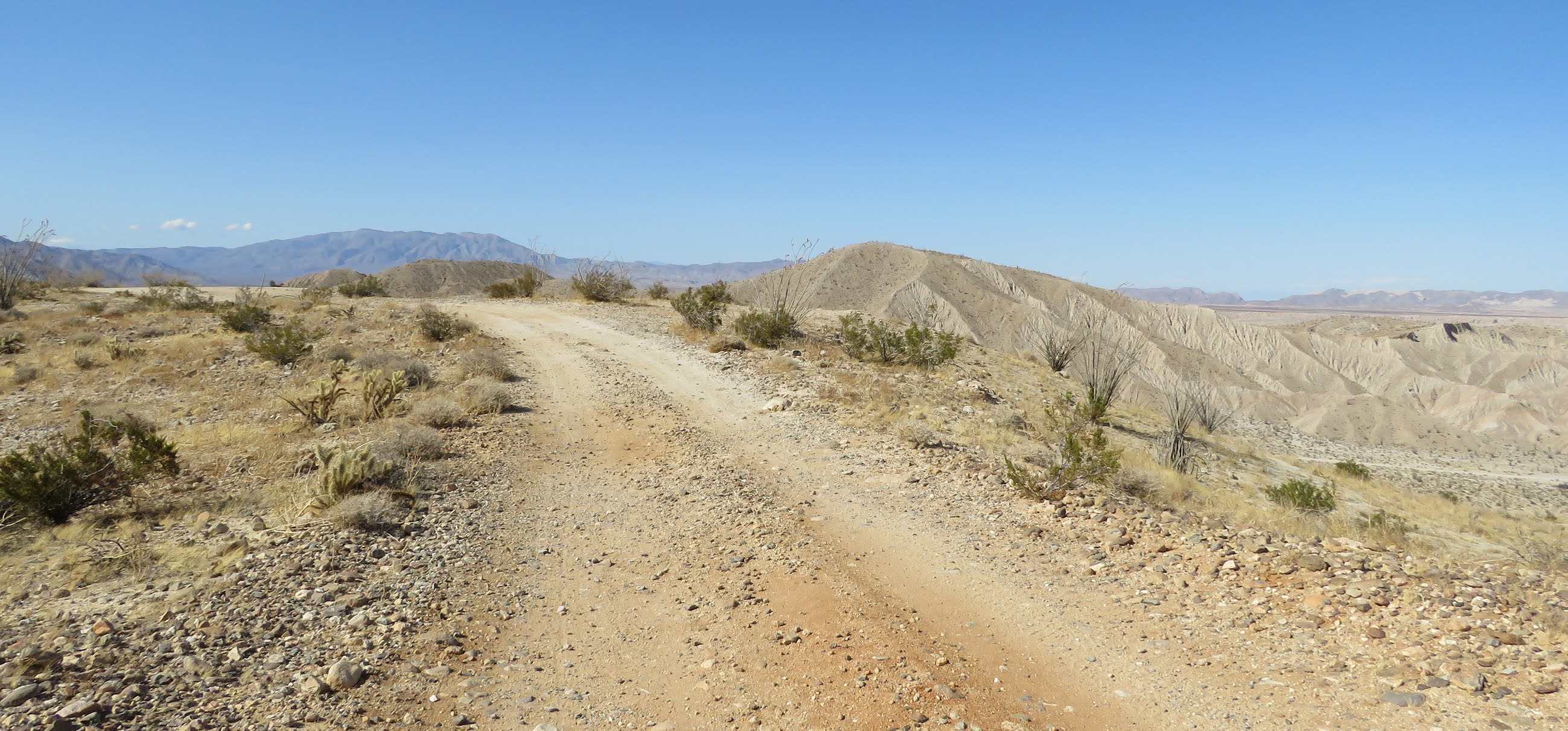
 For the most part Route S2 follows the old Butterfield Stage Route along the western edge of the park. It’s about 35 miles long with many opportunities to hike or explore the intersecting dirt roads. We stayed on the paved road for a scenic drive through varying terrain with nice boondocking spots at the beginning and end.


 Although we didn’t camp at Blair Valley we did stop to check out the free camping. Camping is restricted to an area close to the entrance and along the dirt roads on either side of the dry lake bed. No camping on the lake bed itself. We drove a short distance along the road by the base of the hills where the campsites were close to the road and busy. The road goes for a couple of miles so camping may be better farther in. The road is rough in spots. Blair Valley 33.03827, -116.40908


This is one of the few places in El Centro that isn’t flat. Small hills were created with the soil that was removed to construct the pond. They’re not steep but some wheelchair users may need assistance.


Update 2025 - Closed to camping
M. Penn Phillips made a fortune as a real estate developer, however, Salton City was not one of his successes. The subdivision of 12,000 residential lots with water, sewer, and power was promoted as the “Salton Riviera" and attracted a lot of attention when it opened in 1958. Plans included schools, churches, parks, community services, a championship 18-hole golf course, a $500,000 luxury hotel, yacht club, and the largest marina in California. Most of the buyers were speculators and the isolation, lack of jobs, flooding, and rising salinity in the lake added to the lack of interest in actually living in the city. 80% of the lots are still undeveloped.


 Water from springs feed a wetlands oasis where hundreds of palm trees and warm pools provide habit for birds, plants, and animals. It looks like a very cool place but unfortunately we could only view it from an overlook because there isn’t any wheelchair access.


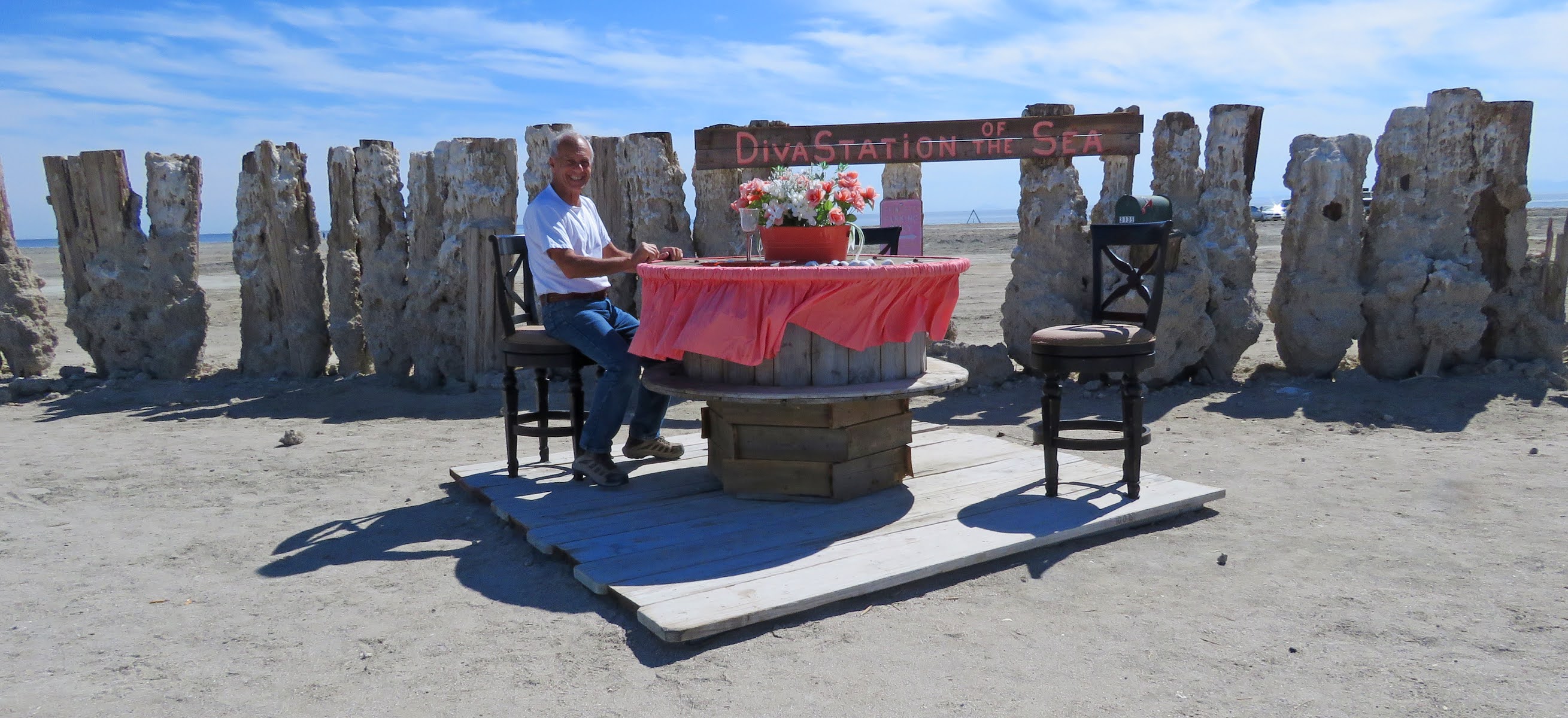
 Update 2026 - new art has been created on the beach and dry camping appears to be permitted. During the 1950s and 1960s the Sultan Sea was the place to be for summer fun of sports fishing, boat racing, water skiing, and swimming. Bombay Beach’s vacation cottages and trailer parks were filled every weekend until the floods of 1976 and 1977 destroyed half of the town. A dike was built to protect the rest of the town from future floods but declining water levels, increased salinity, and pollution from agricultural runoff contributed to town’s demise.


 The declining water level is one of the problems of the Salton Sea but in 1976 and 1977 the problem was too much water. Tropical storms flooded the agricultural towns north of the lake. When the water flowed into the lake the lake shore towns of the Salton Sea were inundated - another blow to the area that was already suffering from a decrease in tourism and declining property values.