Sunday, April 30, 2023

Mineral County Museum

Hawthorne, Nevada was founded in 1880 as a railroad division and distribution point for the mining towns in Mineral County. Mineral County, with less than 5,000 people, was never a populous county and now has more ghost towns than actual towns. Even so the residents have managed to save and donate a large amount of stuff to the museum including antique vehicles, mining equipment, photographs, minerals, and hobby collections.While everything is neatly arranged and labeled the museum displays do not follow a coherent timeline or provide much history of the county.
   The museum is accessible although some aisles are a bit tight. There's a ramp to the entrance with a slope up to an inward opening door so access is somewhat difficult. 
Our RV fit in the parking spaces on the opposite side of 10th Street. Longer RVs can be parked on D Street. Museum  38.53223, -118.62548 

Friday, April 28, 2023

Candelaria Ghost Town

Silver ore was discovered in Candelaria in 1864 but not much happened until 1873 when the Northern Belle Mine went into production. A 20-stamp mill with three furnaces was built to process the ore. The dry stamping process created a fine dust that settled in the lungs of residents causing respiratory tract infections, diseases and even death. The town's population grew to over a thousand but the lack of water plus the 1893 economic depression lead to its downfall. Very little is left but the scars on the mountains, the ruins of the stamp mill, a few wooden structures, the brick front of a collapsed building, and a cemetery.
Follow the paved road off of US 95 for about 6 miles to the town site. It's very barren and desolate and must have been an unpleasant place to work and live. The pavement ends at the town site but if you have high clearance there's a network of dirt roads to explore.
This is all BLM land except for the mine property.We couldn't find a good spot to camp near the town and instead turned up a dirt road on our way back to US 95 and found a quarry which may have been the source of sand used to cover the mine dumps during reclamation work. The view is nice and the ground is level and solid.
The paved road to Candelaria and the dirt road to the boondocking spot are suitable for any RV. Candelaria  38.16227, -118.0828  Boondocking

Tuesday, April 25, 2023

Old US 95 Boondocking - BLM

The section of old US 95 just south of Tonopah is a popular boondocking spot due to it's close location to town and a cellular tower. We've noted the number of RVs lining the road when we've traveled through Tonopah so we decided to stop short of town and try a more secluded spot. We turned right on a unnamed paved road road about five miles south of town and and found a level patch of sandy dirt overlooking US 95 - nice view of the mountain, not another RV in sight, and little noise from the highway.

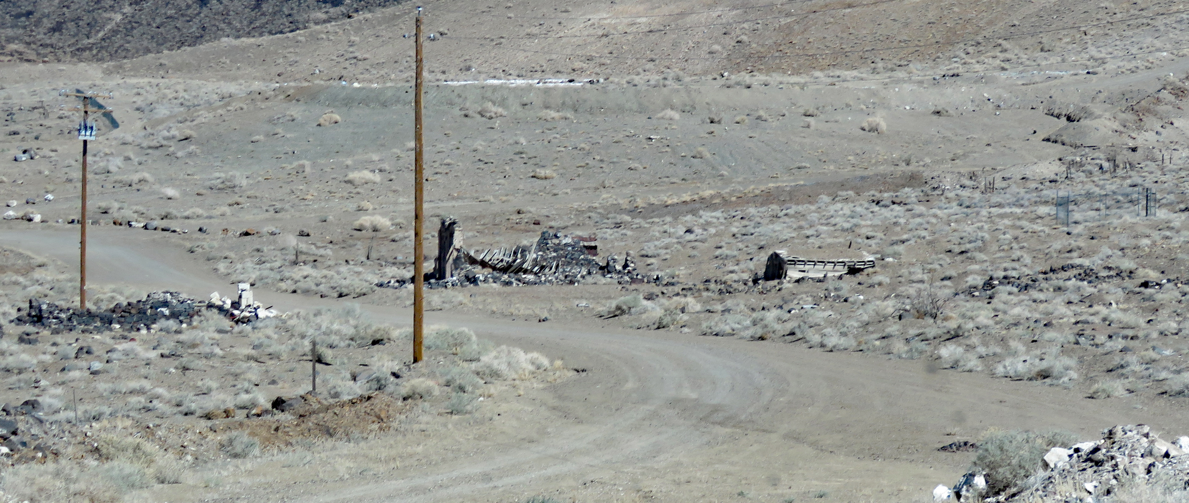
This section old road is paved. It parallels US 95 and goes through several old mining areas. The mining claims are private land but the rest is BLM with plenty boondocking spots. There are also many unpaved roads running through BLM land on both side of US 95. Dispersed Camping  38.02824, -117.2339

Friday, April 21, 2023

Bombo’s Pond Boondocking - BLM

This small spring feed pond fills a quarry created in the 1970s during road construction. It's really tiny but has been stocked with rainbow trout, largemouth bass, and catfish.

The camping area is a large dirt lot that can accommodate any RV. The most coveted spot is right on the water with easy access for fishing or even launching a kayak. 
We parked on the levee for a nice water view. There are a few spots under the trees that can be accessed by following the dirt road to the north. The road deteriorates after the trees but it's still passable by smaller RVs.
Bombo's Pond is barely off of US 95 so there's traffic noise that dies down at night. Pond  36.88234, -116.75327


Tuesday, April 18, 2023

Downtown Las Vegas Mural Walk

The murals are created during the Life is Beautiful festival that has been held every fall since 2013 with the except of 2020. While it's mainly a three day music festival there are also food venues, performances, and speakers. The festival is spread out over eighteen city blocks which are closed off and require pricey tickets for entry. We're not fans of loud music and crowded festivals so the chance of us attending the festival is very low but we really enjoyed walking/rolling around the city streets to view the murals.
I found an article and a map online to use as a guide but some of the murals may have been painted over because we didn't find them. We also saw some that are not listed and may not have been created as part of a Life is Beautiful festival. None of that is important though because the murals are beautiful!


The sidewalks along the walking tour are in good condition and the curb cuts are excellent. The level terrain makes the tour very accessible.
       
We stayed in the RV park at Main Street Station Casino which is very close to the start of the tour. Map Main Street Station  36.16764, -115.14033

Thursday, April 13, 2023

Historic Railroad Hiking Trail

I've wanted to take this trail for a long time. It's in the sun for the entire length but we decided since this spring was cooler than normal it was a perfect time for the hike. The trail follows the old railroad corridor that was built in the early 1930s to transport materials used in construction of the Hoover Dam. It's goes uphill gradually until it's high above Lake Mead with great views of the lake and surrounding hills. The trail travels through five tunnels that were blasted through the rock adding an interesting aspect to the hike.
We spotted a couple of young bighorn sheep butting horns. There were also patches of spring flowers.
The trails is hard packed sandy soil and is about 7 miles round trip from the trail head on Lakeshore Road to Hoover Dam parking garage. The first 2.2 miles are along the rail corridor but some of the last 1.3 miles deviate off the corridor and are much steeper. Wheelchair users will need assistance on the last section. Strong users may be able to push up the entire 2.2 miles of rail corridor. The return trip is all downhill.  Shipping containers for protection from falling rocks have been installed in two of the tunnels. They do not fit flush to the ground but most users will be able to navigate over the lip. We turned around at the 2.6 mark because we ran out of time to finish the trail in daylight. 
The parking lot is large enough for RVs. Additional parking is available at the Lake Mead Visitor Center. A paved trail connects to the rail trail.  Trail    36.01198, -114.794

Friday, April 7, 2023

Lake Havasu Museum of History

In 1963 Robert McCulloch bought 26 acres of desert land near Lake Havasu so that he could use the lake to test his racing engines. He also moved his chain saw factory to the area in hopes of attracting new residents and growing the city. This worked to a small extent but to attract more people McCulloch began offering free flights and all expense paid mini vacations to Lake Havasu. People who took advantage of the offer received a multi-day sales pitch of the city. The free flights continued for 15 years until 1978. Today Lake Havasu City is a thriving city with 60,000 residents and a million yearly tourists who come for the sunshine, water sports, outdoor activities, and the unusual attraction of a relocated 1831 London bridge - bought, dismantled, and reassembled by McCulloch to span the channel between the mainland and the island.
The museum tells McCullough's story along with exhibits on natural history and Native American tribes who lived along the Colorado River before the dam that formed Lake Havasu was built. 
The museum is accessible.

The museum is located in a strip shopping center and there's plenty of parking for RVs if they're pull through the spaces or parked lengthwise. Museum  34.48044, -114.35002