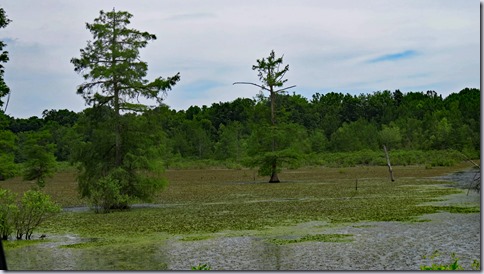
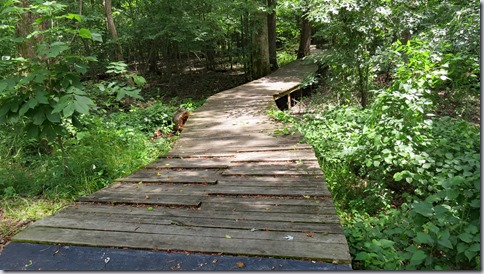
The trail is accessible but completing the loop requires climbing a hill so wheelchair users may need assistance. We circled it twice because it was so easy.
The parking lot is large enough for any vehicle. Park 36.80367, -90.43165


.....Where to go! What to see! Will your RV fit in the parking lot? Is it accessible for wheelchair users?..... ----------------Please click on photos for a larger, clearer view. I'm not sure why they are so blurry----------------
The trail is accessible but completing the loop requires climbing a hill so wheelchair users may need assistance. We circled it twice because it was so easy.
The parking lot is large enough for any vehicle. Park 36.80367, -90.43165
 A lot has happened in the Patee House which was built in 1858 as a luxury hotel. The short-lived Pony Express established it’s headquarters on the first floor in 1860. Over the next 26 years the building served as a courtroom during the Civil War, housed the Patee Female College, became a hotel again, housed St. Joseph Female College, became a hotel once again, and finally was converted to the R.L. McDonald shirt factory in 1886. The factory closed in the late 1950s. The building was scheduled for demolition but fortunately was saved by the Pony Express Historical Association which owns and operates the museum today.


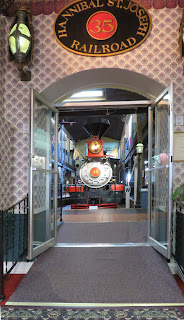 RVs can be parked on the street in front of the museum. Museum 39.75582, -94.84545


Twenty-five thousand years ago the Mississippi River meandered across the southeast corner of Missouri. Seven thousand years later the river had shifted 50 miles east leaving behind a fertile swamp where cypress and tupelo trees grew into vast forests. The T.J. Moss Tie Company started cutting the forests in the late 1880s. and by 1935 most of the trees were gone. In an attempt to create farmland from the now barren swamps, drainage canals were constructed. The swamp of the refuge was hard to subdue and remained opened to indiscriminate logging and hunting, and as a pasture for free range cattle and pigs,
The Fish and Wildlife Service bought 21,676 acres of Mingo Swamp in 1945 and set about repairing the damage. Most of the native plants and animals have been restored. Today the swamp is home to over 38 species of mammals, 23 species of amphibians, 37 species of reptiles and supports over 250 species of birds.
The refuge has a visitor center with good exhibits and an eight minute video. A short trail leads to an overlook. Another trail goes to the 1 mile Swampwalk Nature Trail. The refuge roads can be walked and some are open for auto touring.
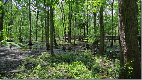
The visitor center and the overlook trail are accessible. The trail from the visitor center to the Swampwalk Trail is not accessible. The Swampwalk Trail is part boardwalk, part asphalt and is accessible but steep where the boardwalk meets the asphalt and one end has wooden cleating. We did not walk/roll on any of the refuge roads but I think they may be too rough for comfort.
The visitor center parking lot is large enough for RVs. The Swampwalk Trail is small but RVs will fit if it’s not busy. The refuge roads are gravel, in good condition, and passable by any RV. Refuge 36.9693, -90.15022
All 19 sites in this small campground feature large areas of mowed grass surrounded by mature trees and low growing vegetation. They’re widely spaced for good privacy. The picnic area provides kayaking, canoeing, and fishing access to the Eleven Point National Scenic River. There’s also a hiking trail along the river that starts in the campground and a trail to Greer Spring from the parking area about 1 mile south on Route 19. A restored mill can be seen from the road but it’s only opened for special occasions.
All of the sites have tables with extended tops, high sided fire rings, and low hooks on the lantern posts. The ground is hard packed so rolling is easy. The trails are not accessible.
The sites are large enough for any RV. The parking area for the spring trail is large enough for small RVs. Campground 36.79394, -91.32968
Like most small town museums this one has many old items donated by local families but it also has a wonderful collection of charcoal drawings by Lennis Broadfoot.
Lennis Broadfoot roamed the Ozark hills as a child before leaving to pursue a career as an illustrator which eventually took him to California. He returned home in the 1930s to continue his first love – drawing character sketches of his friends and neighbors. As he drew, his subjects talked of their lives which he carefully noted.
The sketches were published in a book in 1944. The museum was fortunate to receive all of the originals which were donated by Broadfoot’s family after his death.
The museum is minimally accessible. The basement level which has an assortment of stuff can be accessed from a door that opens to the parking lot. The first level, where the sketches are displayed has a ramp, but getting to it is difficult. There isn’t a paved walkway so accessing the ramp involves to push up a grassy hill. We were told that it’s okay to drive on the grass to the ramp.
RVs will fit in the parking lot. Museum 36.72668, -91.85495