Monday, July 27, 2020

Shoshone Falls Park

    Around 16,000 years ago Lake Bonneville, a huge landlocked lake that filled the Great Basin area of Utah, broke through a
sediment dam and rushed into streams flowing to the Snake River. The weaker basalt layer downstream of the falls was carved away by the immense amount of water, forming a 212 foot drop.

   A small park with a paved trail and overlooks is located on the south side of the canyon. A longer paved trail climbs about a mile uphill and continues for another mile to the site of Evel Knievel’s attempt to jump over the Snake River canyon in a specially designed rocket-powered cycle.

   The paved trail makes the park accessible but full views of the waterfall are blocked by vegetation and railings. We did not realize that the longer trail is paved and could not find an easy way to access it.
    The road down to the park is narrow and steep but can be accessed by any vehicle. RVs and trailers are not permitted in the small overlook parking lot at the fee booth. Continue down the road to the first parking lot on the right side of the road which is reserved for RVs. Falls  42.59567, -114.39826

https://www.google.com/maps/d/u/0/edit?mid=12hm-KNrcbP_QwbBVzOpHMRStMzg&msa=0&ll=42.59453539657164%2C-114.39944566023733&z=16

Friday, July 24, 2020

Milner Historic Recreation Area

  Six gravel spur roads head north off of the three mile, paved park road to campsites along the shore of Milner Lake. The campsites are all different  - some are grouped closely together and some are small single sites; many are rough and well used while others have recently been built. Trees grow along the shoreline but since the sites get southern exposure there isn’t much opportunity for shade. Most of the sites have tables and fire rings. Some have trash cans and there’s a dumpster at the boat ramp parking lot.
    The park road intersects with West Milner Road (rough washboard gravel) at both ends. There’s a pay station at each entrance but RVs can only access the west end due to a low railroad underpass at the east end. Internet reviews mention the smell from either feedlots or manure spread on fields. We noticed just a slight odor in the evenings when the wind changed direction.

  We camped in site 9 and although we didn’t check out all of the sites we liked this one more than any of the others that we did see. The wide-open view to the west is of lake, sagebrush, and farm fields. Trees on the east side block noise from the other sites and add a lot of privacy. I really enjoyed the parade of birds that came every morning, one after another, to sit on the top of the pyramid-shaped rock and survey their world before beginning their day. Besides all of the rather common birds, we also were visited by a great horned owl that landed in the tree just feet away from our RV.


   The campsites are rocky and uneven making access difficult. A paved trail has a small parking area where short RVs will fit. The trail has gentle slopes and is accessible. It follows along a portion of the Oregon Trail. In the right light the ruts can be seen. Campground  42.52966, -113.99279

  https://www.google.com/maps/d/u/0/edit?mid=12hm-KNrcbP_QwbBVzOpHMRStMzg&msa=0&ll=42.52797308200638%2C-114.00279986380231&z=13

Monday, July 20, 2020

Lud Drexler Park

  Salmon Falls Creek was dammed in 1910 creating a long narrow reservoir to control flooding and provide irrigation water storage.
  The park and campground sit on the hill above the dam and most sites have a nice view of the water and the distant mountains. Amenities include picnic tables with shade shelters, grills, fire rings, vault toilets, fresh water, and a dump station. Campers have a choice of sunny or shady sites. Camping is also permitted on a short section of shoreline. Some of the sites have been upgraded and have new shade shelters. Amenities include picnic tables with shade shelters, grills, fire rings, vault toilets, fresh water, boat ramps, and a dump station.

   Uneven, rocky ground makes rolling around a little difficult. The tables have short overhangs and the toilets are not accessible.

   Most of the sites are large enough for motorhomes. Campground   42.21001, -114.73003

https://www.google.com/maps/d/u/0/edit?mid=12hm-KNrcbP_QwbBVzOpHMRStMzg&msa=0&ll=42.20990758580237%2C-114.73049225699079&z=12

Friday, July 17, 2020

Angel Lake Campground

   The campground is in a beautiful setting featuring views of steep, rocky mountains and ribbons of waterfalls that feed a small lake contained in a dammed glacier-carved cirque. We visited here in 2016 when the campground was still closed for the season and liked it so much that we knew we’d be back.
   The campground is small and fills quickly so make reservations or arrive early. Only one site is designated as accessible but since the tables and fire rings are set on concrete patios many sites are useable.  A short, graveled, accessible trail that starts at the day parking lot follows the edge of the lake for about 800’ before becoming too narrow for wheelchairs. The other trails are not accessible.
 
     The road from Well Nevada climbs for 12 miles and gains about 3,000’ before dead ending at the lake. Its's suitable for any RV except for the last few miles where there are steep drop offs and no guard rails. The sites in the campground are small but there are some long enough for 35’ RVs. Angel Creek Campground is a good alternative for people with larger RVs or a fear of heights.  Angel Lake  41.02668, -115.08482
https://www.google.com/maps/d/edit?mid=1gxKwv9ahfkSb9e6MLeSt0hMDxaY&msa=0&ll=41.026816415439626%2C-115.08436421429005&z=15

Tuesday, July 14, 2020

Metropolis Ghost Town

   Metropolis was founded as a planned city by Henry Pierce and the Pacific Reclamation Company in the early 1900s. An amusement hall, a post office, a school, a train depot, and a modern hotel were built. The Church of Latter-day Saints encouraged their members to move to the town and by 1912 700 people were living there.

   A huge planning mistake was soon discovered. Pierce had neglected to obtain water rights and the town was entitled to just a small portion of water impounded by a dam that the company had built across Bishop Creek. Years of drought and cricket infestations added to the problems. By 1924 the population had dropped to 200 and the town was completed deserted by 1950. There isn’t much left – just a few foundations and depressions in the ground, a small cemetery, and the very cool entry arch of the Lincoln School.
   The site is not accessible but most of it can be seen without leaving your vehicle.

   It’s a bit of a trek to get to Metropolis. Go north on 8th Street ( North Metropolis Road) of about 5.5 miles, turn left on the dirt road(County Road on Google maps) and drive about 6 miles to the town site. You can stay on North Metropolis Road and get to the town site that way but it’s longer plus the road is in horrible condition. The dirt road is much smoother. The roads and parking area are fine for most RVs. Metropolis  41.22802, -115.06057
https://www.google.com/maps/d/edit?mid=1gxKwv9ahfkSb9e6MLeSt0hMDxaY&msa=0&ll=41.23770808635003%2C-115.06493774235418&z=12

Friday, July 10, 2020

Ruby Lake National Wildlife Refuge

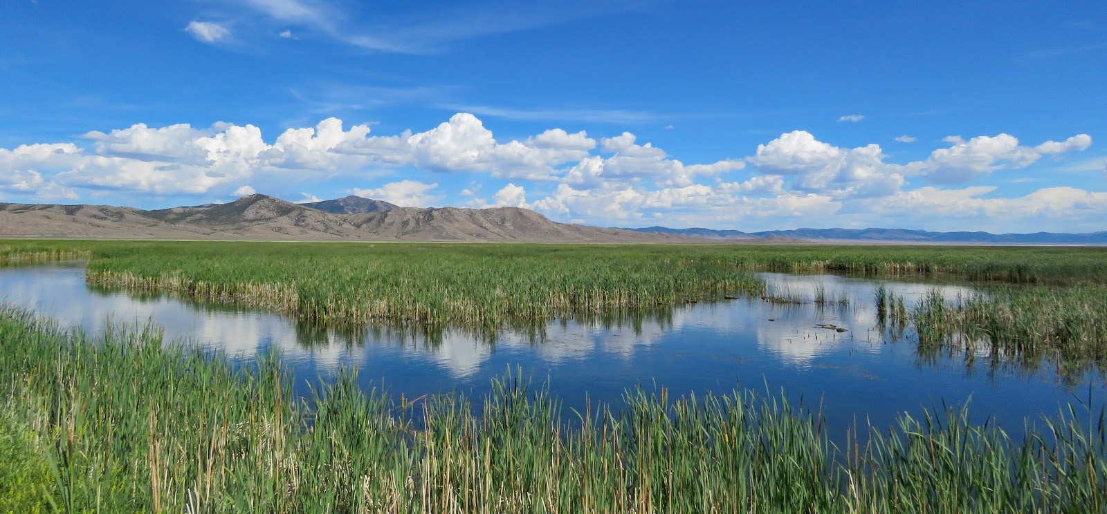
   During the Pleistocene Era, Ruby Valley, which runs along the eastern side of the Ruby Mountains, was covered by the 200’ deep Franklin Lake. Today the Franklin lakebed supports large ranches in the north and the 37,632-acre open-water marsh of the wildlife refuge in the south. The ecosystems in the refuge - riparian habitats, marsh, meadows, and shrub-steppe – provide homes for a diversity of wildlife seldom found in the high desert.
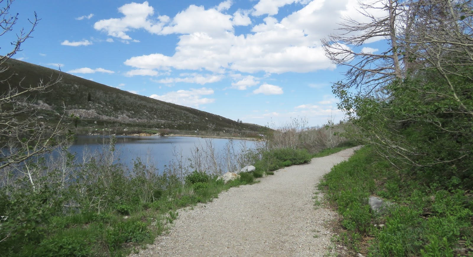
   An auto tour travels along seven miles of gravel roads on top of the dikes. The tour starts at the Bressman Cabin, a log house built by Jacob Bressman, his daughter Deby, and son-in-law Lew Benson in 1880. We drove the straight section of the tour and walked/rolled the Brown Dike loop at the southern end. Walking is the best way to spot the many birds along the shoreline and in the grasses.
   There’s a pull off by the Bressman cabin with informative signs which are too far away to be read without leaving your vehicle. Rough, hilly terrain make access difficult. The refuge headquarters was closed during our visit but it looked to be accessible. To walk the dike roads, we parked across from the vault toilet at Brown Dike Road where there’s a short paved walkway and an attempt at accessibility. The gravel road is a little rough for rolling even with my FreeWheel but worth the effort to get a close up look at the wildlife.
     
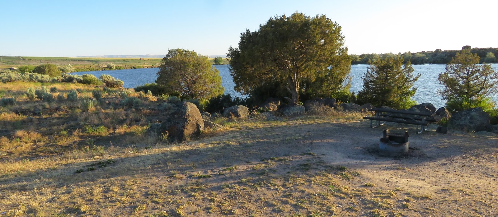
   South Ruby Campground is located south of the headquarters. We opted to camp on public land and drove about 1/2 south of the  vacation cottage settlement of Shanty Town and turned west onto a dirt road that headed to the forest.  After just 1/3 mile the road opens to an large campsite under the trees but road itself is narrow and has a couple of large rocks in the middle – not good for low clearance or wide vehicles. We couldn’t get level plus the hot day brought out flies so we backtracked down the road and found a spot with low vegetation that looked like it had been used as a camp sometime in the past. We had nice breeze and a beautiful view of the marsh. : –)

    The tour route, the refuge headquarters parking lot, and the parking lot at Brown Dike Road are all suitable for RVs. Ruby Valley Road from where we camped north to Neff Mill is a gravel road for 35 miles but whatever is used to harden the surface works well. It’s the best gravel road we driven on (better than many paved roads!) although there are a few washboard sections. It’s suitable for RVs. Refuge  40.20196, -115.49309
https://www.google.com/maps/d/edit?mid=1gxKwv9ahfkSb9e6MLeSt0hMDxaY&msa=0&ll=40.18580231759258%2C-115.49119386487044&z=13