Monday, May 27, 2019

Minivan Conversion

   Bob Wells started a blog around 2008 explaining how to live cheaply in an RV, van, or car. So many people had lost everything in the stock market crash and were looking for answers so it didn’t take long for him to gather a following. The CRVL forum (now vanliving)gave everyone a place to exchange information and offer encouragement. The establishment of the forum was followed quickly by the RTR gatherings in the desert near Quartzsite Arizona.
   From the very beginning it was apparent that many people needed help – sometimes financial, sometimes educational, and sometimes emotional. The educational help is fairly easy, the emotional help is a bit tougher and the financial help is complicated. Gofundme or personal donations can only go so far. This led to the founding of HOWA or Homes on Wheels Alliance  which was established in August 2018. HOWA will supply vehicles, training, and support to people in need. There will be a fairly rigorous application process to determine whether the program is suitable for the applicant because helping them make a successful transition into vandwelling is a top priority.

    After nine months of hard work by Bob, Suanne Carlson, and their team, HOWA is ready to start their first van build! Tony and I are camped in the Oregon forest with a group of volunteers who will be brainstorming and building a minivan into a comfortable home on wheels. We don’t know what that will involve but I think the aim is to design a very simple build with a cot and plastic bins and then design and build a more sophisticated model. Videos and documentation will allow van builders across the country build similar minivan homes.

   Making a minivan into a comfortable home sounds almost impossible but many people have done it. My favorite is this guy -  Eric Enjoys Earth
  I’ll be posting updates as the van build progresses. We may be here for month or more.

Thursday, May 23, 2019

Science Works Hands-On Museum

  The largest section of the museum explores sound and music with many hands-on  exhibits. Other exhibits feature optical illusions, giant soap bubble tables, and puzzles to solve. There’s a big play area for kids five and under. A climbing wall and more exhibits are located outside.
   The exhibits are interesting enough to entertain older kids and adult. We happened to visit on a day when there weren’t any school groups and had the museum almost entirely to ourselves for a couple of hours. :)
    Most of the exhibits can be experienced from a wheelchair.

    RVs can be parked through two spaces or along the edge in the bus spaces. Museum  42.19298, -122.68992
https://www.google.com/maps/d/u/0/edit?ll=42.19320886539361%2C-122.69158647894176&spn=7.911423%2C16.062012&hl=en&msa=0&z=17&ie=UTF8&mid=1gM7a_TAFMpg6ncUflVh6U6zexPE

Tuesday, May 21, 2019

Schneider Museum of Art

  Three galleries plus the lobby feature changing exhibits of contemporary art. It doesn’t take long to see the museum so visit the student art exhibits in the Art Building next door too.
   The buildings are accessible.

   There are a few visitor parking spaces behind the museum that are not long enough for RVs. A large parking lot where RVs will fit is located on the east side of Indiana Street. Payment is by phone, coins, or credit card – $1.00 an hour – and is good for any lot or space marked green, yellow, or white. To avoid a downhill and uphill trek follow the path near the handicapped spaces. There’s a short hill to the museum entrance. The sidewalks and curb cuts are in good condition.  Museum  42.18447, -122.69127
https://www.google.com/maps/d/u/0/edit?ll=42.184806520459404%2C-122.69229458212169&spn=7.911423%2C16.062012&hl=en&msa=0&z=18&ie=UTF8&mid=1gM7a_TAFMpg6ncUflVh6U6zexPE

Sunday, May 19, 2019

Orland Buttes Campground

  There are two campgrounds at Black Butte Lake- Orland Buttes and Buckhorn. Orland Buttes seemed like the lower usage one so we went there. None of the sites are designated as accessible plus the campground is hilly and many of the sites are not level. Since we had our choice of sites we picked #18 which has a wonderful view. The parking pad is narrow and isn’t flush with the ground but the site itself which is level and hard packed is pretty accessible. The sites are close together with no privacy.
   Before we left the park we drove to Buckhorn Campground to check it out. Buckhorn sits at lake level on flatter ground so even though it doesn't have any designated accessible sites many of them are usable. Most of the sites are nice but 66 – 92 are awful –  side by side spaces in an asphalt lot without picnic tables or trees for shade.

   The park has five hiking trails. The Paul Thomas Trail is the only one that can be accessed from Orlando Bluffs. The trail is about a mile out and back and goes to an overlook of the lake. It’s hilly and rough on spots so it’s not accessible. Campgrounds  39.77325, -122.35532

https://www.google.com/maps/d/edit?mid=1MRNOAwb5okCy61LKgjYrbg3sfpE&msa=0&ll=39.782309218138124%2C-122.36961307017742&spn=10.53912%2C16.062012&z=12

Thursday, May 16, 2019

Chico History Museum and Yo-Yo Museum

   The highlights of the museum are the alter and artifacts from an 1880s Chinese Temple. Other exhibits in the small museum cover early Chico history and the role of local citizens and soldiers in WWI.
   The accessible entrance is on the left side of the museum adjacent to the public parking lot. Follow the instructions for operating the lift. Someone will meet when you exit the lift to escort you to the front desk.

    After seeing the museum walk/roll one block east on 2nd Street then two block south to Bird in Hand, a really great toy and game store, to check out the Yo-Yo Museum and the World’s Largest Yo-Yo.  The museum is in the rear of the store and consists of a collection of hundreds of yo-yos and a bit of yo-yo history.
   The Chico Museum parking lot is too small for RVs but parking is available on the streets. We parked a few blocks south on Salem Street. The sidewalks and curb cuts are in good condition. Chico Museum  39.72936, -121.84229   Yo-Yo Museum  39.72869, -121.8403
https://www.google.com/maps/d/edit?mid=1MRNOAwb5okCy61LKgjYrbg3sfpE&msa=0&ll=39.72941193858392%2C-121.84231960586794&spn=10.53912%2C16.062012&z=20

Tuesday, May 14, 2019

Oroville Wildlife Area

   Until 1898, when gold mining dredges tore up the ground, the wildlife area was a riparian zone along the Feather River. The dredging lasted until 1952 leaving a wasteland of barren rock piles.  Construction of the Oroville Dam began in 1963 and a lot of the rocks were removed for fill. The wildlife area was partially restored with newly created ponds, lakes, and islands to provide habitat for fish and animals. Today there are large trees and grassy meadows but the scars are still very visible.
   Old roads circle the wildlife area and are good for walking and bike riding however some are surfaced with rounded river rock and are almost as bumpy as cobblestone roads. The smoothest and most accessible is the northern most one right near the wildlife area entrance. There’s also access to the Brad Freeman Memorial Bike Trail across Larkin Road from the wildlife area entrance. The path to the trail is narrow and steep. Easier access can be found at the parking lot about 1.5 miles west on Larkin Road.  There isn’t any shade on the roads or the bike trail.
   We’ve camped in some usual places but this is one of the strangest. The only place where camping is permitted is on top of four concrete slabs (possibly old building floors) where eight side by side spaces are marked out. There’s a vault toilet and a dumpster. North of the spaces is a large, ugly gravel lot. South of the spaces is the Feather River which is really pretty so we angled our RV to get a river view. The trees by the river are roosting spots for many bird species and evening and early morning are filled with bird song. Most of the other campers seemed to be locals and were using tents. We expected some late night partying but everything was quiet by 9 or 10.
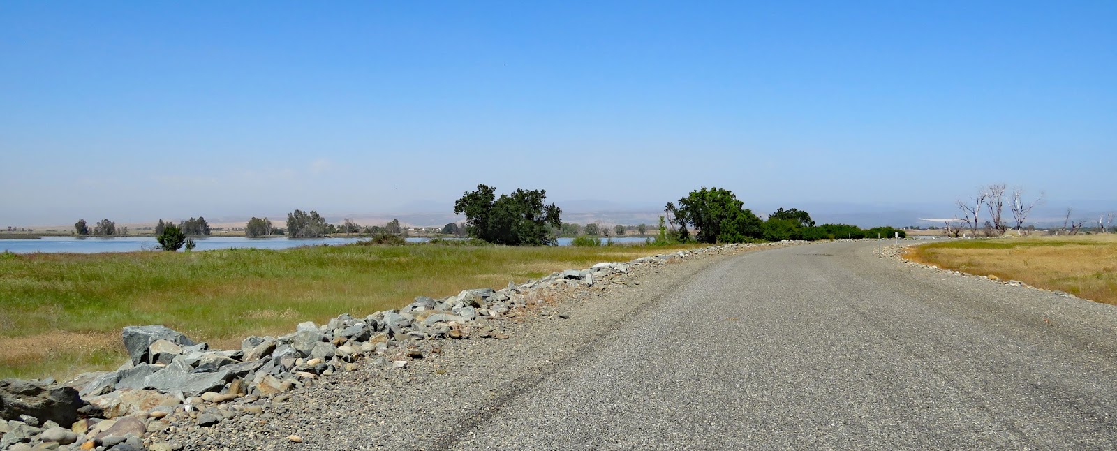
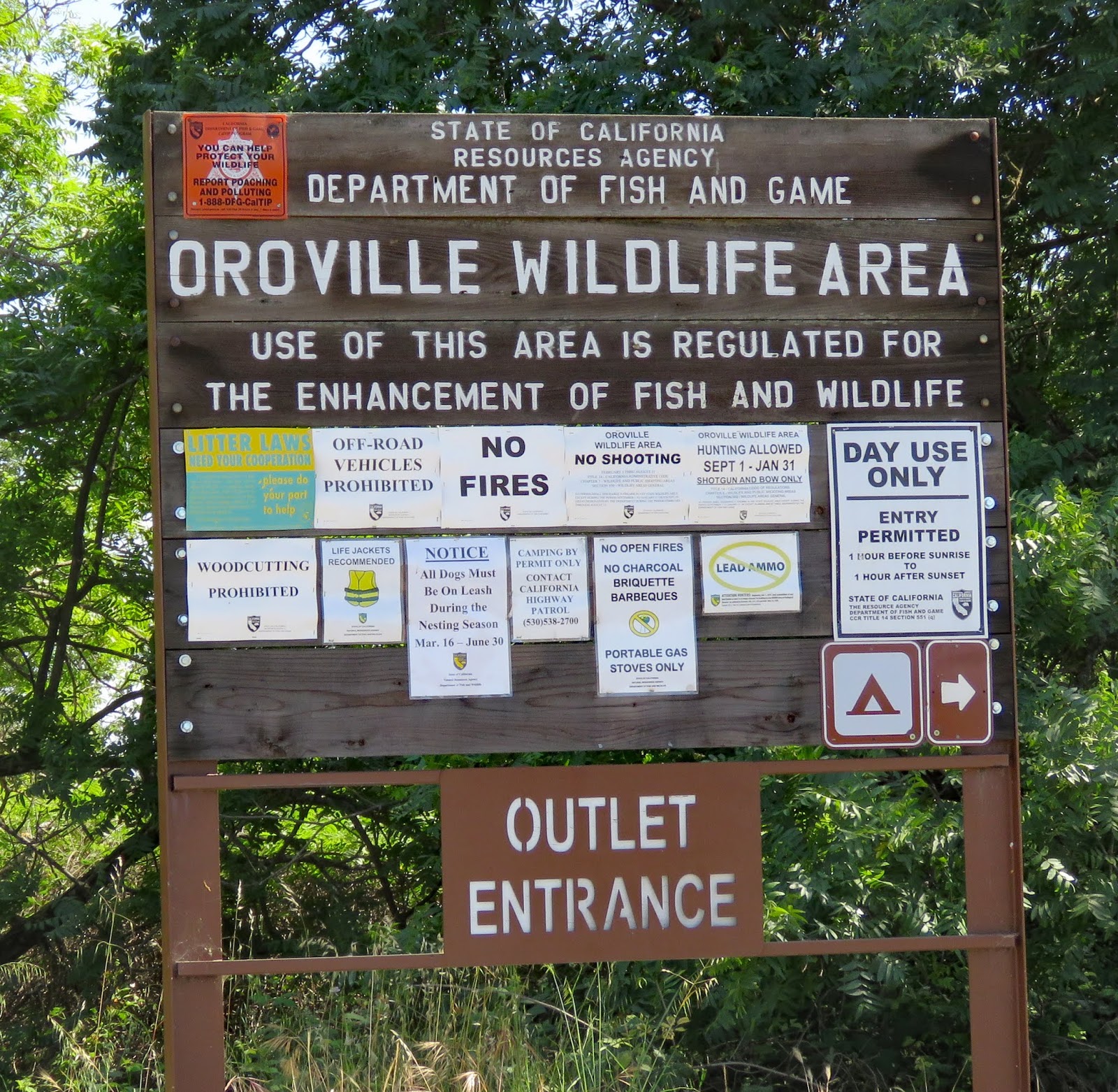
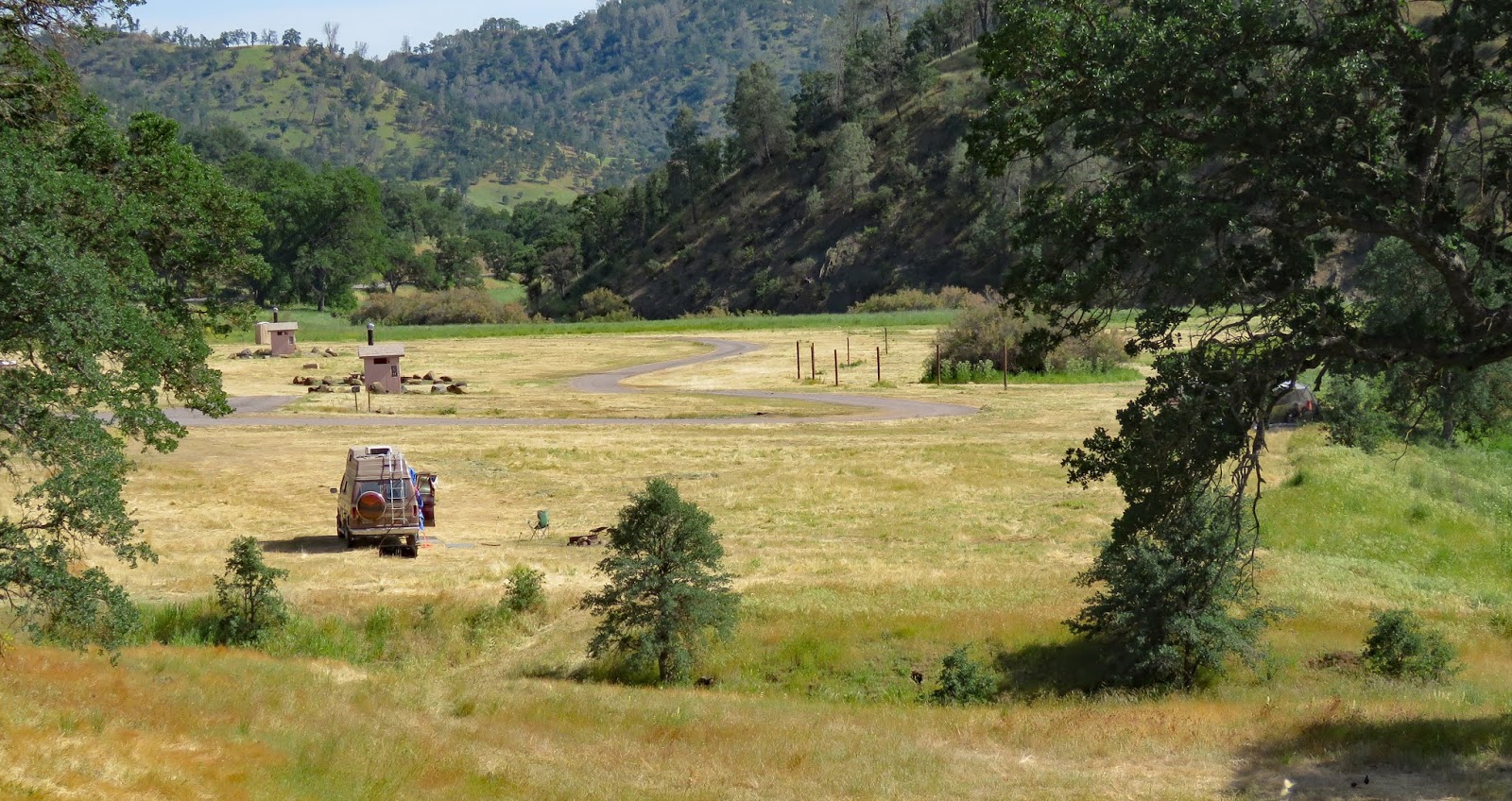
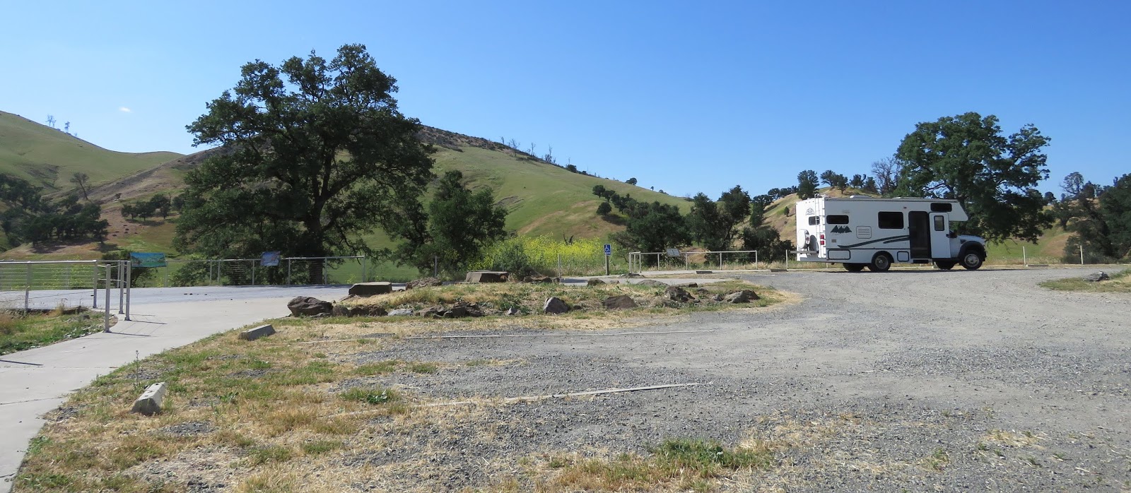
      The area is patrolled by the California Highway Patrol. Even though camping is free a pass is required. The only place to get one is in Oroville so go there first. Vehicle registration, proof of insurance, and official IDs for everyone in the camping group are required. Camping is limited to 7 days at a time and 14 days total in a year. Wildlife Area  39.45681, -121.63397  California Highway Patrol
https://www.google.com/maps/d/edit?mid=1MRNOAwb5okCy61LKgjYrbg3sfpE&msa=0&ll=39.45687748476782%2C-121.64261856441885&spn=10.53912%2C16.062012&z=14

Monday, May 13, 2019

Colusa Casino

  Follow the signs for RV and truck parking. There are seven RV parking spots in the gravel lot. They’re lined up right next to each other and could be a little tight for opposing side outs.  Truck parking is on the asphalt directly in front of the RV parking. Few trucks were parked when we visited but there was noise from the HVAC system and equipment in the adjoining orchards.

    The casino entrance is pretty far away but the walk/roll is level. The chairs are light and easy to move. The money slots are easy to reach but many of the card slots are out of reach. Casino  39.25384, -122.02929
https://www.google.com/maps/d/edit?mid=1MRNOAwb5okCy61LKgjYrbg3sfpE&msa=0&ll=39.257846151739116%2C-122.0302233404197&spn=10.53912%2C16.062012&z=15

Sunday, May 12, 2019

Cowboy Camp

    Hitching posts to tie up horses line both sides of the campground loop with a grassy oval in the middle for camping. The campground is popular for horse camping because there’s a large area of BLM land adjacent to it. It can get messy so the lightly used grassy area to the north of the loop is a good choice for tent or RV camping if you don’t have a horse. People also camp in the parking lots at the top of the hill which is where we spent the night. Update 2023 - the parking lots now have "No Camping" signs so head to the meadow to camp.
     There are a few tables, fire rings, and vault toilets.

     The ground in the parking lots is hard packed so rolling is easy. The view points, interpretive signs, and vault toilets are accessible. Campground  38.99779, -122.35493

https://www.google.com/maps/d/edit?mid=1MRNOAwb5okCy61LKgjYrbg3sfpE&msa=0&ll=38.998125105985864%2C-122.35521389828932&spn=10.53912%2C16.062012&z=18

Saturday, May 11, 2019

Sharpsteen Museum

   Samuel Brannan, a real estate developer, opened the Hot Springs Resort in Calistoga in 1862. It catered to the rich and famous with Victorian style cottages and a specially built trainline from Napa. Business dropped off in the 1880s and didn’t recover until the 1920s with the advent of the automobile.
   Ben Sharpsteen first visited his grandparent’s property in Calistoga in 1903 when he was 7. He spent summers there for the next 12 years before starting his career as a film animator. By 1929 he was working as an animator, director, and producer for Walt Disney. He worked on 50 films and won 11 Oscars. He retired in 1959 to his family’s property in Calistoga and, as a hobby, made a model of the resort town as it looked in the 1860s. To display his model Sharpsteen built the museum and donated it to the town.
   The museum is small but nicely done and covers many topics including Native Americans, the story of Samuel Brannan, and the early history of the town. One of three surviving cottages adjoins the museum and is furnished with period items.
   The museum is accessible. The model town is too high to be easily seen from a seated position.

   The parking lot is small so large RVs should be parked on the street. Museum  38.57879, -122.5804
https://www.google.com/maps/d/edit?mid=1MRNOAwb5okCy61LKgjYrbg3sfpE&msa=0&ll=38.57891568675282%2C-122.5806165219172&spn=10.53912%2C16.062012&z=20