The Dickey Ridge Visitor Center has a small exhibit area with a topographical relief map of the park and a theater with continuous videos. A short paved trail leads downhill to an overlook. The center is accessible and the view can be seen from the visitor center porch.
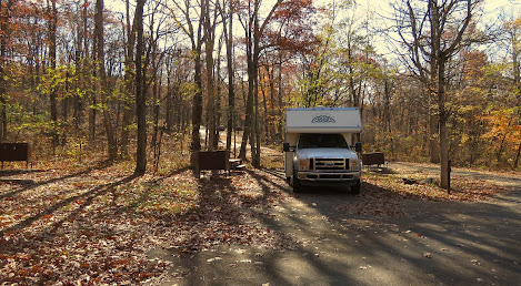
Matthew Arms Campground - reservations were not necessary so late in the season so we chose to go with first come/ first serve. We were given one of the two accessible sites (also first come/first serve) which was fairly level with a paved parking pad, high fire ring, and a table with an extended top. Most of the other sites look usable.
Massanutten Lodge - the lodge is not accessible and was not supposed to be open when we visited but we tried the door, it opened, we went it. An alarm sounded but nobody can so we checked out the exhibits. The lodge was part of a private resort that predated the park. It's a little hard to find. Take the road to Skyland then follow the signs to the Conference Hall. Park across from the Hall and walk/roll through the parking lots to get a view of the back of the lodge. The front entrance is up a steep hill.
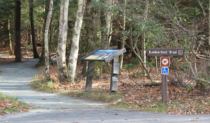
Limberlost Trail - this is the only trail designated as accessible. It's a 1.3 mile loop and surfaced with finely crushed stone. It passes through evergreen forests, mountain laurel shrubs, a small wetland, and an area where huge hemlock trees were killed by an invasive insect. The trail goes downhill and back up for the return trip. The grades are 9% and 10% so most wheelchair users will need assistance.Byrd Visitor Center - the park was authorized in May 1926 by Congress and President Calvin Coolidge but due to a lack of money and the need to relocate hundreds of people who owned and lived on the land, construction was not started until December 1935. The visitor center has great exhibits about the founding and construction of the park by the young men of the Civilian Conservation Corps plus the stories of the families forced to move from their homes and the racial segregation of the facilities that didn't end until 1950. The center is accessible.
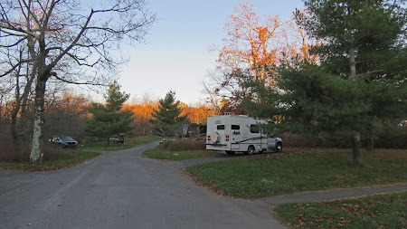
Big Meadows Campground - the sites in this campground are by reservation only. The five accessible sites were all taken so I chose a site by looking through the information and photographs on the Recreation.gov website to hopefully get one that was fairly level. C-138More pretty views as we meandered along to Loft Mountain Campground. Again we did not need to make a reservation and were given an accessible site - G 187.And out of the park the next morning.
While the park road is opened all year - as long as it's passable - the campgrounds, visitor centers, stores, and lodges close in late fall. The speed limit is 35 MPH. and the roads are twisty. Large RVs can be driven along the road but the overlooks may be too crowded to pull in. There's a gas station about halfway along and two places to exit the road at about 1/3 and 2/3 from the north end. Phone access is spotty. Park 38.90627, -78.19976


What a beautiful park and your first picture was so pretty.
ReplyDeleteThanks for sharing !
You're welcome! Glad you enjoyed it. :)
DeleteThose views in Shannandoah National Park are awesome. Have driven most of Skyline Drive, absolutely beautiful.
ReplyDeleteWe had wonderful weather too. :)
DeleteAgree, the park is a wonder, it's beauty is breathtaking. Loved your pics!
ReplyDeleteThanks!
Delete