We've been careful to avoid areas that are still cleaning up from hurricane Helene's destructive rain and wind. The southern half of the parkway suffered washouts and landslides so our plan was to drive 200 miles on the parkway and exit at Fancy Gap. After driving about 100 miles we got off at Roanoke for the night because the campgrounds were already closed for the season. Our journey along the parkway ended there when our truck starter developed a weird problem. It wouldn't shut off after the engine caught. Before taking it to a shop, Tony tried an easy fix by disconnecting the battery and reconnecting it. Apparently there was a glitch in the programing and it needed to reset because it's been fine since. :) We were still uneasy about being far from service shops and continued our trip in the valley.
So the first 100 miles of the Blue Ridge Parkway:
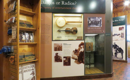
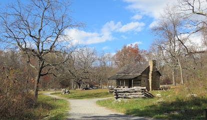
Humpback Rocks Visitor Center - this is a small visitor center with a few exhibits about life in the mountains. It is accessible. Historic buildings have been relocated to form a mountain farmstead. The first part of the trail to the farmstead is paved and accessible. The gravel section is accessible to the cabin after which it becomes steep and rocky. The buildings are not accessible. The parking lot is small and does not have any long spaces however it may be possible to park along the side of the loop road. James River Visitor Center - the visitor center was closed for the season but we tried walking/rolling along the short trail that leads to one of the few remaining locks from the Kanawha Canal. The trail is very steep with steps at the end of the pedestrian bridge so it's not accessible. The visitor center parking lot does not have long RV spaces. Shorter RVs may fit if backed up over the grass. Peaks of the Otter Visitor Center - this visitor center was closed for the season too. The parking lot is small with no RV spaces but shorter RVs may fit if backed up over the grass. We backtracked 1/3 a mile to the Peaks of the Otter Lodge where there are RV/bus spaces and walked/rolled on the paved loop trail around the lake. The trail is in good condition and fairly level although the access trail from the parking lot is pretty steep. An accessible parking space is located near the entrance to the lot where the trail access is not as steep.
RVs can be driven on the parkway but be aware that parking is limited at the overlooks and visitor centers, at least in the northern section that we drove along plus there are twenty five tunnels, some less then twelve feet high at edge of the lanes. Sections of the Parkway are closed from late fall through early spring due to snowfall in the high elevations. Parkway 38.03072, -78.85773


Back when we had your old F250 it did that once... I'm guessing Burt solved the problem in a slightly different manner.. he whacked the relay with a 2x4..
ReplyDeleteTried that but it didn't work. It's a more common and perplexing problem than you'd think according to Google searches. Disconnecting the battery didn't work for most people, in fact, I don't think we found anyone who actually fixed it. They just used work arounds so I'm glad ours was an easy fix!
DeleteWe've been on both the Parkway and in Shenandoah in autumn and fell in love with the scenery. Your photos brought back lots o' memories -- many thanks!
ReplyDeleteIt really is worth taking the slow route and enjoying the scenery!
Delete