Saturday, September 7, 2019

Dakota Territory Air Museum

  Three buildings hold WWII military airplanes, small civilian planes, displays on North Dakota’s early aviation years and military aviation with a few fire engines and other vehicles thrown in the mix. Follow the sidewalk to the third building. We did not realize that it was opened and almost missed it. All of the planes can be flown and are expertly restored.
   One of the planes in the third building and one in the outside display area have been painted with stripes. A few days before the D-Day invasion most of the Allied planes were temporarily striped to avoid confusion with enemy planes - a little tidbit of trivia that was new to us.
  The buildings are accessible but assistance may be needed due to heavy doors and high lips at the entrances. A small exhibit area that overlooks the planes in the second building is not accessible due to stairs and no elevator.

   Any RV will fit in the larger parking lot. Park on the far west edge to leave room for planes to exit the hanger. This is a Harvest Hosts site so members may stay overnight. Museum  48.27144, -101.29131

https://www.google.com/maps/d/edit?mid=1wRz9ffnP4VyHIy1h_FKAmQkFL0E&msa=0&ll=48.27267722508724%2C-101.29274393762398&z=16

Friday, September 6, 2019

McLeod Lake City Park

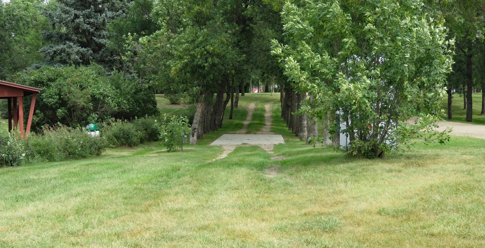
   A pretty little city park right by the lake. The campsites are a little strange and the rules are rigid but otherwise a nice place to camp. We camped along the road next to a grassy island where three or four electric boxes are lined up. Three more sites have concrete pads in the middle of a long pull-through driveway. Some have more than one electric box so maybe they’re meant to be shared?

     The park doesn’t offer much in the way of amenities – no fire rings or tables at the sites. There are restrooms. The train tracks are very close but the noise did not disturb our sleep.
   I did not check the accessibility but it looks rather limited because the concrete pads are narrow. Park  48.3393, -103.17182
https://www.google.com/maps/d/edit?mid=1wRz9ffnP4VyHIy1h_FKAmQkFL0E&msa=0&ll=48.33955028545262%2C-103.17205373877084&z=18

Thursday, September 5, 2019

Missouri-Yellowstone Confluence Interpretive Center

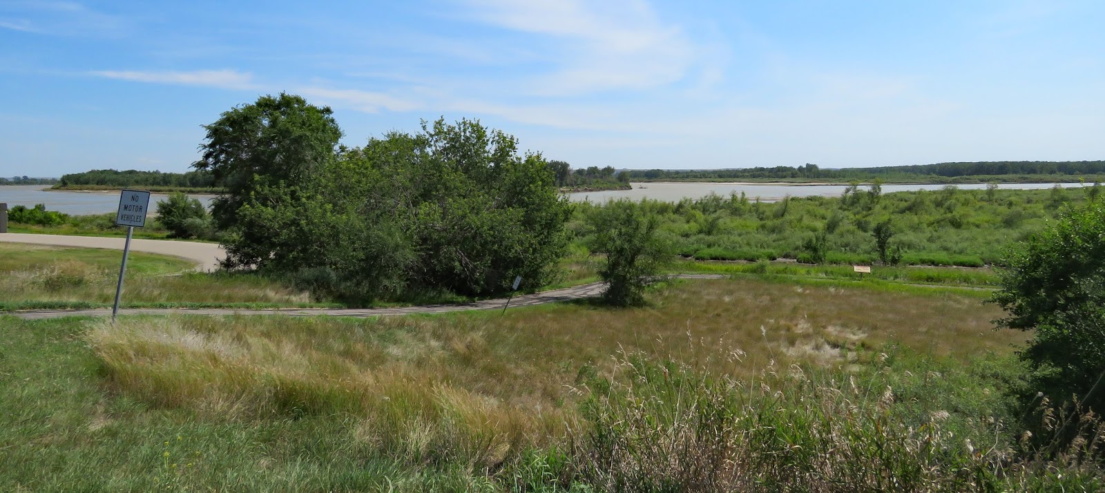
  The Lewis and Clark Expedition camped above the confluence on their way west and again as they made the return trip to Washington DC. Both men were impressed with the view but the rivers have changed course and the interpretive center hill is not quite high enough to get a good view of the Yellowstone joining the Missouri.
  The center is small with two exhibit galleries. The larger, permanent one covers the history of the area. The changing exhibit gallery, when we visited, had the story of rural electric co-ops. Electricity didn’t reach some rural areas until the late 1940s and early 1950s, but when it did it brought vast improvements to people’s lives. Besides the exhibits there’s 1/3 mile paved trail with interpretive signs that follows the bluff along the river.
   The interpretive center is accessible. The paved trail is in rough condition and has steep hills so it is not accessible without assistance.
    The parking lot is large enough for any RV. Center  47.98495, -103.98971
https://www.google.com/maps/d/edit?mid=1wRz9ffnP4VyHIy1h_FKAmQkFL0E&msa=0&ll=47.986071192402264%2C-103.98930202610086&z=16

Wednesday, September 4, 2019

Fort Buford State Historic Site

   Fort Buford was established in 1866 to protect settlers from attacks by the Lakota, led by Sitting Bull, as they traveled west on overland trails and river routes. Historically this fort is important as the place where Sitting Bull surrendered and also for the black regiments that were posted at the fort from 1891 and 1894.

   The fort was enlarged several times most notably in 1867–1868 when materials from the dismantled Fort Union trading post were used in the construction. By 1895 the fort was no longer needed and most of the buildings were sold and moved, or torn down. The 1872 Commanding Officer's Quarters, the 1875 stone Powder Magazine, and Guard/Officer of the Day hut remain on the grounds. One of the barracks has been reconstructed.
    Boardwalks lead to all of the buildings. Interpretive signs explain what took place in each area. The interpretive sign about the black regiments has been placed in a storage area instead of being on display outside which is disturbing and disrespectful. The Commanding Officer's Quarters and the barracks have exhibits inside.
   Several areas around the fort can also be explored. A small building west of the fort was built by the Masons and a horse statue was recently erected to honor the black soldiers. When the fort was in use there were two separate, segregated Mason Lodges. Follow the paved trail across from the fort parking lot to a small cemetery. After the fort was closed the soldiers bodies were moved to a military cemetery but wooden boards mark where their graves were and civilians are still buried in the cemetery.
    An added attraction is a beautiful free campground within walking distance of the fort. Camping is permitted for four nights. There are tables, fire rings, trash cans and a choice of shade or sun. Watch for low hanging branches. Restrooms are located at the fort parking lot. Update 2025 - still free! 

                     
   The fort site is fairly accessible. The boardwalks are bumpy but lead to ramps for entry to the Commanding Officer's Quarters and the barracks. The exhibits in the Officer’s Quarters are accessible. The barracks building was not open when we visited. The interpretive signs can be read from a seated position. The Mason building is not open to the public. The horse statue is surrounded by thick grass so it’s very difficult to push far enough to and close. The trail to the cemetery starts paved, becomes gravel road, then thick grass. The campground has tuffs of grass which make rolling difficult.

   The fort parking lot and campground are large enough for any RV. Fort  47.98591, -104.00097
https://www.google.com/maps/d/edit?mid=1wRz9ffnP4VyHIy1h_FKAmQkFL0E&msa=0&ll=47.98574470378091%2C-104.00188604749496&z=18

Tuesday, September 3, 2019

Fort Union Trading Post National Historic Site

  Fort Union, which operated from 1828 – 1867, was the most important trading post of John Jacob Astor's American Fur Company. Although the construction resembled a military fort it was a private business built specifically to trade with the Assiniboine, Plains Cree, Blackfeet, Plains Chippewa, Mandan, Hidatsa and Arikiara tribes who exchanged buffalo hides, beaver pelts, and other furs for manufactured goods such as cloth, guns and ammunition, clothing, pipes, and beads.

   By the 1860s settlers had begun moving into the area and fur bearing animals were becoming scarce. In response to clashes between Native Americans and settlers the US government bought Fort Union, dismantled it, and built Fort Buford, three miles east of the trading post.

   The trading post has been partly reconstructed to include the palisade walls, the bourgeois house, the clerk's office, the Indian trade house, and a few outbuildings. The museum exhibits in the house cover the history of the fort very well plus the rangers and staff are available to answer questions.
   Nothing about the fort is very accessible. The ground surface is either rough, lumpy grass or loose gravel. The ramp to the porch of the house does not meet the ground evenly and the ramp at the entrance door is very steep. The entrance to access the clerk's office and  the Indian trade house has a high step. A video of the  the clerk's office and the Indian trade house is available at the house/visitor center. The Bodmer Overlook trail and the trail to the Missouri River are not accessible.
   RV/bus parking spaces are located in the first parking lot. Continue on the road to the smaller lot if you have a car or a very short RV. A 1/3 mile paved walkway goes from the first lot to the trading post. It has an uphill grade so visitors with mobility issues may wish to be dropped off at the smaller lot. Contact a ranger to get a golf cart ride (not wheelchair accessible) from this lot to the fort.
   Fort  48.00021, -104.04501
https://www.google.com/maps/d/u/0/edit?mid=16S1XSQFlpi0ge-wyYekABveTLWQ&msa=0&ll=48.00533162060739%2C-104.10900693155259&spn=8.532591%2C16.062012&z=11

Monday, September 2, 2019

Bruegger Centennial Park

  The RV parking area is just a paved lot but it’s right next to a really nice public park with picnic shelters, tables, a playground, and restrooms. There’s also a dump station and potable water. Free camping for up to five days.
   The lot is not very large but RVs could be parked in two rows if it gets crowded. Parking on the streets is not permitted. Park  48.14682, -104.51266
https://www.google.com/maps/d/u/0/edit?mid=16S1XSQFlpi0ge-wyYekABveTLWQ&msa=0&ll=48.14674607804074%2C-104.51314556566513&spn=8.532591%2C16.062012&z=17

Sunday, September 1, 2019

Fort Peck Interpretive Center


  Fort Peck Dam, a New Deal Public Works Administration project, is the largest hydraulically filled dam in the US. At the project’s peak in July 1936 10,546 workers were employed. Temporary boomtowns sprang up to house the men with families who couldn’t stay in the dormitories. Along with interesting exhibits about building the dam, the interpretive center also has a large aquarium with native and game fish, and life sized casts of dinosaur and sea creature fossils found in Montana.
     Several miles of paved trail wind along the river and around small ponds.
        
   The museum is accessible. The door to the overlook locks when closed and the exterior push button does not work. If that happens follow the path to the east to get back to the parking lot. The paved path has a hill and uneven high spots so wheelchair users made need assistance.

   The parking lot has long bus/RV spaces. Center 48.00949, -106.42048
https://www.google.com/maps/d/u/0/edit?mid=16S1XSQFlpi0ge-wyYekABveTLWQ&msa=0&ll=48.0102633299025%2C-106.42224264834027&spn=8.532591%2C16.062012&z=16