 After the Revolutionary War the US Congress passed the Land Ordinance of 1785. Land west of the Appalachian Mountains was divided into 6 mile square townships which were then divided into 36 sections, each 1 mile square. The money raised by selling the land provided a revenue stream for the new country.
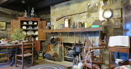
 The fort was built to protect the surveyors from the Native Americans who lived in the area. Fire destroyed the fort in 1790 and it never rebuilt because by that time the surveying teams had moved farther west. A replica of the fort has been constructed on the original site. The fort buildings and the small museum are filled with a remarkable number of artifacts. The First Federal Land Office has been relocated on the grounds and can be toured.


 The museum is accessible. The automatic opener mechanisms on the doors do not work well so the doors must be pushed to open. Most of the fort buildings have ramps but there are many small obstacles – loose gravel, uneven ground, steep ramps, and high thresholds. It would be difficult to visit without assistance. The Land Office has steps and is not accessible.
 Small RVs and vans will fit in the parking lot. Large RVs can be parked on Adams Street. Fort 40.35861, -80.61383


When I see a bed with the mosquito netting I always wonder about the area.
ReplyDeleteThe fort was on the Ohio River so, yeah, probably lots of bugs in the summer!
DeleteYikes, count me out!
Delete