Monday, May 8, 2023

Ruhstaller Farm

Ruhstaller Farm is a very unique Harvest Hosts site. The owner considers it a farm because he grows hops and walnuts on the 40 acres of land that surround the brewery. The brewery is housed in a large open-air building featuring two hop kiln chimneys that are used during the September harvest to cure the hops. The space beneath the chimneys and an adjacent building are filled with chairs and couches making it a cozy place to gather with friends for a few drinks and snacks from the food truck. We were there to attend a drink and dessert gathering with this cute couple, 

                                our nephew and his girlfriend,

who were getting married the next day so being able to stay overnight was great.

   Besides the inside seating area, there's a garden area with a stage, hay bails for seating, a fire pit, a play area for kids, and fenced-in and free-roaming farm animals.

The buildings are accessible with paved handicapped parking and a boardwalk from the parking lot. I'm not sure how accessible the outside area is because the one entrance that I used had a steep curb but didn't try the other entrances.

The parking is tight. The HH request page states less than 20' but they accommodate larger RVs. We were advised to arrive as early as possible - they open at 3:00 - to get a parking spot. Farm  38.48827, -121.81653


Saturday, May 6, 2023

Lockewood Acres

Ben and Denise grow a wide variety of fruits and vegetables on their small organic farm plus raise chickens, goats, sheep, and pigs. The farm is a Harvest Hosts site so we were looking forward to buying fresh produce, honey, jams, and eggs. Unfortunately the rains this year made early planting impossible and last year's drought resulted in a very poor harvest. Nothing to buy!
We still were welcome to stay on the farm. Both Ben and Denise were busy with obligations away from the farm but we talked to Ben on the phone and were greeted by Denise and shown where to park before she had to leave. The Harvest Hosts site is on a strip of grassy land with peach trees on one side and vegetable plots on the other side. This is a working farm with all kinds of old equipment and material saved for future projects so don't expect pristine conditions. Farm  38.44247, -121.9486

Thursday, May 4, 2023

Wilson Canyon Recreation Area

Wilson Canyon has both an official state rest area and a BLM dispersed camping area. The rest area is very nice, fronting on Walker River and featuring large cottonwood trees, picnic tables, trash cans, and a vault toilet. Stays at the rest area are limited to 18 hours every two weeks.
We stayed overnight at the rest area but just across the river, accessed by Copperbelt Drive, is an OHV camp area. Camping is allowed along Copperbelt for about 3/4 of a mile going west from Route 208. Past that the land is privately owned. The camping limit is 14 days.
The picnic tables are not very accessible because the ground is covered with loose gravel that is difficult to push through.
The rest area and camping area are large enough for any RV.  Canyon  38.80876, -119.23018

Tuesday, May 2, 2023

Hawthorne Ordnance Museum

Hawthorne, Nevada is pretty much in the middle of nowhere. It's over 70 miles from any large city and has a population of fewer than 3,000 people. But it does have the world’s largest artillery storage facility. In 1926, after lightening struck a building at the New Jersey Lake Denmark Naval Ammunition Storage Depot and started a fire that exploded 600,000 tons of munitions, destroyed 187 buildings, and killed 19 people, the US Congress established a Board of Officers to find an isolated spot to store munitions. Hawthorne with about 200 residents at the time and surrounded by the flat terrain of an ancient lake bed was perfect. Construction started in 1928 and by WWII the base employed 5,625 people and stored most of the munitions used in the war. Today far fewer people are employed but the base is still the main reason of the existence of the town.
The museum is packed with inert missiles, bombs, rockets,and nuclear weapons plus displays of guns, uniforms, miscellaneous artifacts, photographs, and even a tank. A little disturbing but interesting. The volunteers are very friendly and knowledgeable.
Check the hours before going. We didn't realize the museum closed early on Saturday and didn't have enough time to see everything. There are exhibits outside that can be explored when the museum is closed. The base where the live munitions are stored is off limits but you can see the structures from highway.
Any size vehicle will fit in the on-street parking. Museum  38.53125, -118.62479

El Capitan Lodge & Casino

A large gravel lot is located to the east of the casino on G Street. The northern section of the lot is marked for RVs only. No need to check in and no time limit.

The casino is very small. A ramp goes to the main entrance door but there's still a step at the door. Casino  38.52583, -118.62247

Sunday, April 30, 2023

Mineral County Museum

Hawthorne, Nevada was founded in 1880 as a railroad division and distribution point for the mining towns in Mineral County. Mineral County, with less than 5,000 people, was never a populous county and now has more ghost towns than actual towns. Even so the residents have managed to save and donate a large amount of stuff to the museum including antique vehicles, mining equipment, photographs, minerals, and hobby collections.While everything is neatly arranged and labeled the museum displays do not follow a coherent timeline or provide much history of the county.
   The museum is accessible although some aisles are a bit tight. There's a ramp to the entrance with a slope up to an inward opening door so access is somewhat difficult. 
Our RV fit in the parking spaces on the opposite side of 10th Street. Longer RVs can be parked on D Street. Museum  38.53223, -118.62548 

Friday, April 28, 2023

Candelaria Ghost Town

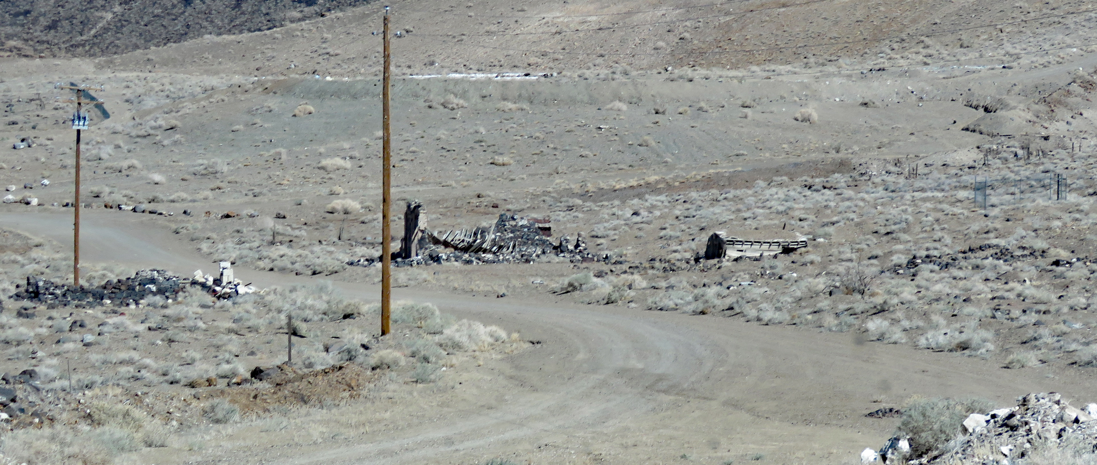
Silver ore was discovered in Candelaria in 1864 but not much happened until 1873 when the Northern Belle Mine went into production. A 20-stamp mill with three furnaces was built to process the ore. The dry stamping process created a fine dust that settled in the lungs of residents causing respiratory tract infections, diseases and even death. The town's population grew to over a thousand but the lack of water plus the 1893 economic depression lead to its downfall. Very little is left but the scars on the mountains, the ruins of the stamp mill, a few wooden structures, the brick front of a collapsed building, and a cemetery.
Follow the paved road off of US 95 for about 6 miles to the town site. It's very barren and desolate and must have been an unpleasant place to work and live. The pavement ends at the town site but if you have high clearance there's a network of dirt roads to explore.
This is all BLM land except for the mine property.We couldn't find a good spot to camp near the town and instead turned up a dirt road on our way back to US 95 and found a quarry which may have been the source of sand used to cover the mine dumps during reclamation work. The view is nice and the ground is level and solid.
The paved road to Candelaria and the dirt road to the boondocking spot are suitable for any RV. Candelaria  38.16227, -118.0828  Boondocking

Tuesday, April 25, 2023

Old US 95 Boondocking - BLM

The section of old US 95 just south of Tonopah is a popular boondocking spot due to it's close location to town and a cellular tower. We've noted the number of RVs lining the road when we've traveled through Tonopah so we decided to stop short of town and try a more secluded spot. We turned right on a unnamed paved road road about five miles south of town and and found a level patch of sandy dirt overlooking US 95 - nice view of the mountain, not another RV in sight, and little noise from the highway.

This section old road is paved. It parallels US 95 and goes through several old mining areas. The mining claims are private land but the rest is BLM with plenty boondocking spots. There are also many unpaved roads running through BLM land on both side of US 95. Dispersed Camping  38.02824, -117.2339

Friday, April 21, 2023

Bombo’s Pond Boondocking - BLM

This small spring feed pond fills a quarry created in the 1970s during road construction. It's really tiny but has been stocked with rainbow trout, largemouth bass, and catfish.

The camping area is a large dirt lot that can accommodate any RV. The most coveted spot is right on the water with easy access for fishing or even launching a kayak. 
We parked on the levee for a nice water view. There are a few spots under the trees that can be accessed by following the dirt road to the north. The road deteriorates after the trees but it's still passable by smaller RVs.
Bombo's Pond is barely off of US 95 so there's traffic noise that dies down at night. Pond  36.88234, -116.75327