Monday, August 12, 2019

Leavenworth, WA & Waterfront Park Trail

  Leavenworth was founded in the 1890s as a lumber town highly dependent of the Great Northern Railroad. In the 1920s the railroad was rerouted away from the town to a safer less avalanche prone path and the lumber mills closed, The depression years of the 1930s added another blow to the town’s economy.

   Local business owners and civic groups started working together in the 1960s to come up with a plan to revitalize the town. The deep valley and steep mountain scenery resembles the alps in Germany so the idea of remodeling the town to resemble a Bavarian village made sense. Today every building in the main section of town follows the Bavarian theme to some degree and tourists flock to the town to enjoy the ambiance and eat, drink, and shop.
   We walked/rolled around town but since we’re not shoppers we just admired the work that went into transforming a turn of the century logging town into a Bavarian village before heading to the Waterfront Park. The Waterfront Park Trail is about 1 mile long, one way, and travels through the woods and along the Wenatchee River.
    Wheelchair access in town is spotty. The sidewalk along US-2, the main route through town, has steep slopes at the cut outs for entry to hotels and other businesses. About a third of the businesses have steps at the entry. The Waterfront Trail is hardpacked dirt for easy rolling but the bridge ends are not flush to the ground and wheelchairs users may need assistance. The trail is on the flood plain and located down a steep hill from the town so drive to Enchantment Park where there’s a lot large enough for RVs.

   Oversized vehicles parking is not allowed in most lots and street parking is at a premium however the city has designated a lot at the west end of town for RV parking. It’s free and overnight parking is permitted for one night every seven days. It’s an easy walk into town. Leavenworth  47.5914, -120.67049
                       
https://www.google.com/maps/d/u/0/edit?hl=en&msa=0&z=15&ie=UTF8&mid=1d4nwGRie74meTvA5J0HjtGLTfPY&ll=47.591409700881044%2C-120.67072010363108

Sunday, August 11, 2019

Bygone Byways Trailhead

   Maybe, as the website states, when this trail was made it was wheelchair accessible, but it no longer is. It’s also a little hard to find. The trail can be accessed from westbound US-2 only. If coming from US-2 eastbound, a short amount of backtracking is required. Look for the road signs and then look for the start of the trail behind the official forest service sign.

   The trail is a loop. Go clockwise and up the short hill for the easier access. This leads to an overlook with a partial view of the Nason Creek tumbling over rocks. The trail stays wide but goes downhill and wheelchair access become impossible due to washed out areas and the overgrowth of berry bushes. The map and text on the website do not accurately portray the mileage. It’s only about 1/3 mile for the loop, not 1 mile.
   The parking area, which is a pull off on the side of US-2, is large enough for any RV. Trail  47.78381, -121.02898
https://www.google.com/maps/d/u/0/edit?hl=en&msa=0&z=16&ie=UTF8&mid=1d4nwGRie74meTvA5J0HjtGLTfPY&ll=47.78401467568149%2C-121.03048372279761

Saturday, August 10, 2019

Old Gold Bar- Index Road

  Just a wide pull off along Old Gold Bar-Index Road where 14 days of  free camping is allowed. It’s managed by the national forest service and has trash cans and a portable toilet.
   Don’t expect to be alone. It gets pretty crowded so your neighbors will be mere feet away. Most of the vehicles the night that we stayed were vans and small RVs but there’s plenty of room for larger RVs. Tent campers can find nice spots in the forest or on the riverbank.

    People camp here for several reasons. Some, like us, want a quiet spot for the night; others want to play in the Skyomish River; and others want the challenge of climbing the sheer granite walls of the cliffs near the little town of Index.

   River access is not accessible. The short Crescent Trail is surfaced with rough gravel and is not accessible. Camp  47.81625, -121.56705

https://www.google.com/maps/d/u/0/edit?hl=en&msa=0&z=15&ie=UTF8&mid=1d4nwGRie74meTvA5J0HjtGLTfPY&ll=47.81695945885323%2C-121.56844401885405

Friday, August 9, 2019

Fort Worden State Park

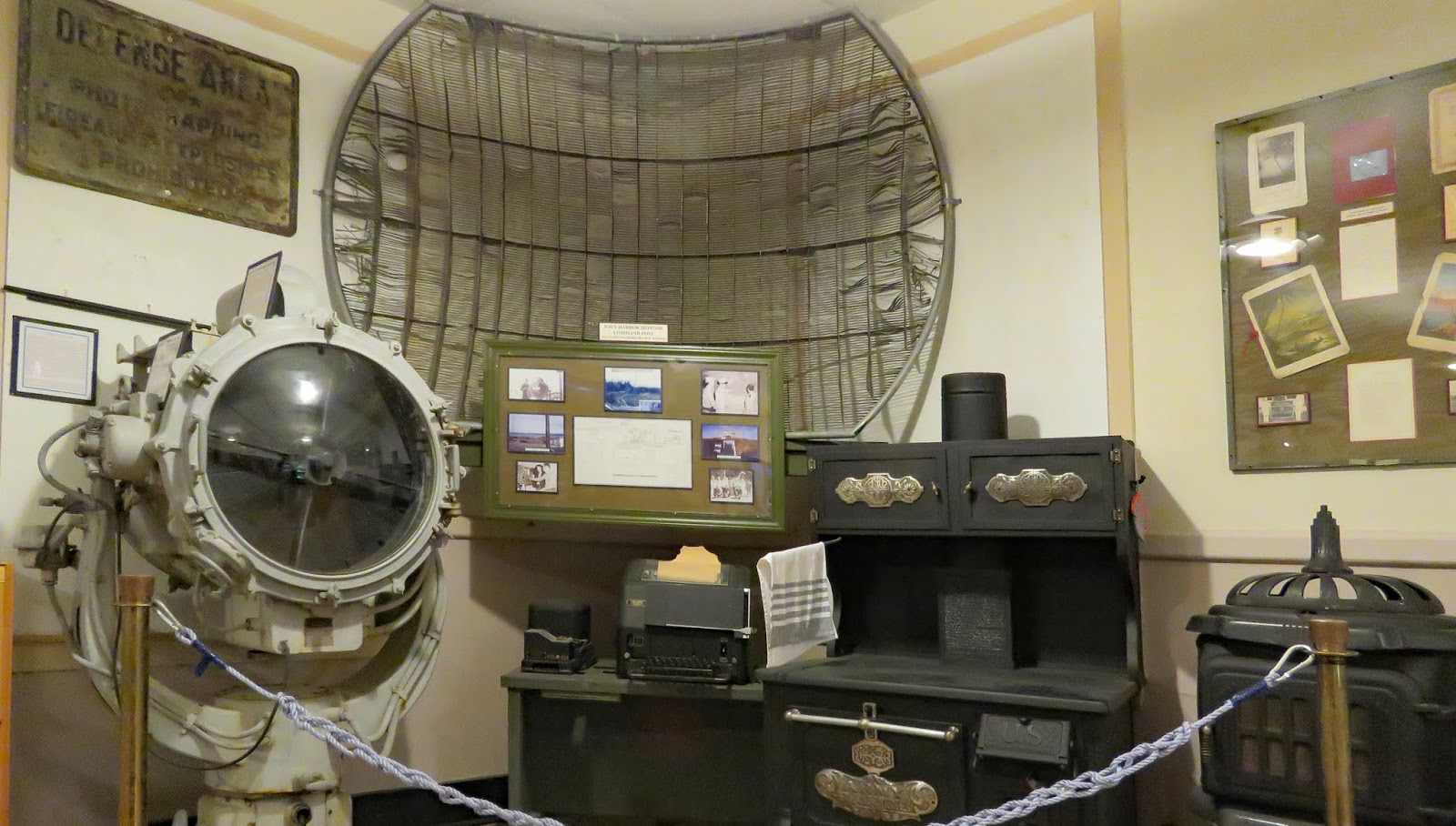
  Around the turn of the 20th century three forts, designed to guard the entrance of Puget Sound, were built on opposing outcrops of land. Over 100 artillery pieces formed a "Triangle of Fire" ready to thwart any invasion from sea. The forts never saw any action but were manned through WWII.

    Fort Worden was an active military base until 1953 - a few years longer than the other two. It was sold to the State of Washington in 1957 and used as a  juvenile detention facility until 1971 when it was transferred to the Washington State Parks Commission. Because the property was always in use most of the historic wooden structures built for housing and administration purposes are still in good condition. Many can be rented for vacation stays. Others house restaurants, museums, performance venues, and oddly enough, college class rooms.
   The park is not very accessible. The road to the lighthouse (the lighthouse is not opened to tour) has a painted line a few feet from the curb designating it as a walking trail but essentially you’re walking on the road. This is marked on the map as an ADA accessible path. The sidewalks in the area where the buildings are located do not have good curb cuts. The paved walking and biking roads that circle around the gun emplacements are very hilly. The Coast Artillery Museum has a ramp at the rear but no sign at the front (where there are steps) indicating where to go. The Commanding Officer’s Quarters Museum has steps and no ramp.
    Both buildings of the Marine Science Center are accessible. The main display in the museum is a orca whale skeleton. The whale was found beached on the Olympic Peninsula in 2002. Examination and analysis of her body found very high concentrations of DDT and PCBs. Interactive displays and videos explore the impact people make on the ocean ecosystem.  The aquarium has tanks filled with a beautiful variety of local fish and invertebrate species plus several touch tanks with starfish, anemones, and other sea creatures. Definitely worth a visit!
  There’s a beach campground and a forest campground – both very popular so reservations are necessary. We did not stay at either campground.
   There are numerous parking lots where RVs will fit. Even though everything is within walking distance, I recommend that visitors with mobility issues park at one of the beach lots to see the Marine Science Center and moved to one of the lots in the housing area to visit the Coast Artillery Museum. The sidewalks are not in the best condition and there’s a steep hill between the two locations. Science Center  48.1362, -122.76187   Park  48.13451, -122.77042

https://www.google.com/maps/d/u/0/edit?hl=en&msa=0&z=14&ie=UTF8&mid=1d4nwGRie74meTvA5J0HjtGLTfPY&ll=48.136547789053395%2C-122.77724982173987

Wednesday, August 7, 2019

Fort Flagler State Park

   Around the turn of the 20th century three forts, designed to guard the entrance of Puget Sound, were built on opposing outcrops of land. Over 100 artillery pieces formed a "Triangle of Fire" ready to thwart any invasion from sea. The forts never saw any action but were manned through WWII.

  The Washington State Parks Commission acquired Fort Flagler in the 1950s. Many of the buildings constructed in the 1930s and 40s are available to rent by either groups or individuals. There are over 100 campsites – very popular so reserve in advance, trails, beach access, a small museum, and gun emplacements to explore.
   The museum is mostly accessible but a narrow door limits access to one room. We did not stay at the campground. Most of the sites looked like they could be used by a wheelchair visitor.  The rest of the park has limited access due to the hilly terrain and many steps at the gun emplacements. Park  48.09488, -122.69497
https://www.google.com/maps/d/u/0/edit?hl=en&msa=0&z=14&ie=UTF8&mid=1d4nwGRie74meTvA5J0HjtGLTfPY&ll=48.089118714843565%2C-122.71038489820342

Tuesday, August 6, 2019

Fort Townsend State Park

   Fort Townsend was built in 1856 to protect settlers from the Native Americans which must not have been much of a problem because it closed three years later. It was reopened in 1874 and operated until 1895 when a fire destroyed it. Nothing is left of the early buildings but there is an interesting WWII era brick tower that housed a 2 million volt x-ray machine used to examine the workings of Japanese torpedoes so that they could be diffused.

   The park has two campground loops, one for tents and one for RVs. We stayed in the RV loop which has thirteen sites, very close to each other and lined up side by side. Amenities include restrooms with showers, potable water, and a dump station.  Due to the tight sites I don’t recommend camping here with an RV.
   None of the sites are specifically designated as accessible but most are usable. The trail to the beach is not accessible. The trails in the park marked with dashed lines on the map are wide and hard packed but have long, steep hills. Wheelchair users may be able to access them with the assistance of a strong helper. Park  48.07417, -122.78869
https://www.google.com/maps/d/u/0/edit?hl=en&msa=0&z=14&ie=UTF8&mid=1d4nwGRie74meTvA5J0HjtGLTfPY&ll=48.07611750956859%2C-122.79321159074976

Thursday, August 1, 2019

Kilchis Point Reserve

   Two connected loops that travel through the forest and across small streams lead to an out-and back trail and a bird watching station on the Tillamook Bay. The total distance is only two miles. Seventeen interpretive signs give details about the native plants and the history of the Native Americans and early settlers in the area.
  The first loop is concrete paver stone. The second loop and the trail to the bay are hard packed dirt and gravel. The trail has a few short grades. Some of the boardwalks and the ramp to the bird watching station do not meet flush with the ground. The bay shore is not accessible. Wheelchair users may need assistance at the difficult spots.
     Drive past the first parking area to the larger lot where RVs will fit. Trail  45.51251, -123.88071
https://www.google.com/maps/d/u/0/edit?ll=45.512603375887835%2C-123.88110247728486&spn=7.911423%2C16.062012&hl=en&msa=0&z=18&ie=UTF8&mid=1gM7a_TAFMpg6ncUflVh6U6zexPE