Sunday, March 3, 2019

The Water Conservation Garden

     A short trail loops past drought tolerant demonstration gardens and exhibits promoting sensible landscaping for water conservation. Informative signs provide details. Although this garden is designed to provide ideas for local homeowners it’s also a very pretty place for everyone to enjoy.

     The paths are hard packed sandy soil so pushing is easy but wheelchair users may need assistance on the hilly sections.

    RVs will fit if parked across the spaces.  Garden  32.74267, -116.93897
https://www.google.com/maps/d/edit?mid=1xJqWzy65eI4BVW6oU8R89jdR0oY&msa=0&ll=32.74034745838345%2C-116.94462625879441&spn=5.452431%2C8.031006&z=15

Saturday, March 2, 2019

Golden Acorn Casino

    Park in the lot near the casino entrance It's large and doesn’t appear to fill up. It has a slight slope so leveling may be necessary. Truck parking is on the opposite side of the casino and noise is blocked by the building.

    Good curb cuts can be found at the handicapped parking spaces. The casino has plush carpeting and many of the machines have hard to reach money and card slots. Casino  32.70299, -116.35597
 
https://www.google.com/maps/d/edit?mid=1xJqWzy65eI4BVW6oU8R89jdR0oY&msa=0&ll=32.700983387504735%2C-116.36348947165118&spn=5.452431%2C8.031006&z=14
             

Friday, March 1, 2019

Imperial Valley Desert Museum

  Excellent exhibits covering human and natural history of the Imperial Valley are the focus of this small museum. An interactive display depicts how  sediment from the Colorado River delta created the Imperial Valley and ancient Lake Cahuilla. Lake Cahuilla grew and shrank at least four times and was a dry lake bed when settlers arrived in the late 1800s. The breach of an irrigation canal dike in 1905 from Colorado River flooding formed the Salton Sea. This landlocked body of water gets most of its inflow from irrigation runoff and is polluted and very salty however a large collection of Kumeyaay pottery and other artifacts testify to the presence of nomadic people when the ancient lake was fresh water.
The museum is accessible but the interactive video screens are at an angle that is hard to see from a seated position. The short loop trail is not accessible due to the lack of a ramp from the pavement, steep sections, loose sand, and uneven surfaces.

    The parking lot is large enough for any RV. This is a Harvest Hosts location so members are welcome to stay overnight. Museum 32.73139, -116.00059

https://www.google.com/maps/d/edit?mid=1xJqWzy65eI4BVW6oU8R89jdR0oY&msa=0&ll=32.73160222684003%2C-116.01115449545489&spn=5.452431%2C8.031006&z=14


Monday, February 25, 2019

Mittry Lake

   A four mile dirt road provides access to dispersed camping sites along the eastern edge of Mittry Lake. The clearings along the shoreline are the most popular – very scenic but prone to becoming mudholes when it rains and and close enough to get dust from road traffic. Other areas are located in the gravel and rock pits; in the brushy bottomlands; and in the large clearing by the boat ramp.

   We found a great spot on an elevated section by a gravel pit. This area gets crowded but the road leads to a more private clearing with a few trees and a view of a canal. Our little group camped in this spot ( where the two RVs are in the background of the photo) for a few days.

    Unfortunately our visit was cut short by a brush fire. With the windy weather and the dry brush we decided being safe was the wisest decision so we left only to return a day later. Since the brush fire was still flaring up we camped in a less desirable spot in the rock pit close to the entrance and far way from any brush. The fire was on the far side of the lake and the RVs in the first photo below were apparently not in any danger because nobody was evacuated.

   Camping is free but limited to 10 days per year. Although it has few amenities there are dumpsters, vault toilets, and picnic tables at the boat ramp.

   The ground is hard packed but rocky and rolling around may be difficult in some areas. Boondocking
32.81291, -114.47561
https://www.google.com/maps/d/edit?mid=1OJ-6Mxgh6qyAajlI6zo1ezSe4iY&msa=0&ll=32.820819689676725%2C-114.47884817541228&z=14

Friday, February 22, 2019

Sidewinder Road Boondocking


     Sidewinder Road cuts through private land before hitting this small block of BLM land. It continues through another patch of private land and then onto a large area of BLM land so make sure you’re on public land before setting up camp.

    It’s pretty barren with desert brush and a view of the mountains. The ground is dirt and closely packed smooth stones. Rolling is fairly easy.

There’s plenty of room for any RV. Sidewinder  32.78392, -114.7575
https://www.google.com/maps/d/edit?mid=1xJqWzy65eI4BVW6oU8R89jdR0oY&msa=0&ll=32.77603769611282%2C-114.76426071609148&spn=5.452431%2C8.031006&z=14

Saturday, February 16, 2019

Cibola National Wildlife Refuge

   The refuge was established in 1964 to provide habitat for migratory and local birds. Over hundred species of birds have been recorded on the refuge in addition to many small mammals and reptiles. The refuge covers 18,500 acres and includes a 3 mile driving loop, a road that dead ends at an overlook, a small visitor center, and two short walking trails.

   The visitor center is accessible. The short trail at the visitor center is very rocky and not accessible. The binocular scope at the overlook is too high to be from a seated position. The nature trail along the loop road is gravel and hard packed dirt. It’s accessible but assistance may be necessary. The cutouts in the boards forming a blind at the overlook are a little too high but it’s possible to peek through the boards to see the pond. We did not drive to the end of the dead end road.

   The roads and parking lots are large enough for any RV.

  A large area of BLM land is located almost directly across from the refuge. The first 1000’ is state trust land which requires a permit so go in a little way to hit BLM property. The terrain has formed little plateaus with gullies between them so each makes a semi-private little campsite large enough for any RV.  Refuge  33.36355, -114.66912

https://www.google.com/maps/d/edit?mid=1OJ-6Mxgh6qyAajlI6zo1ezSe4iY&msa=0&ll=33.36363737908725%2C-114.66759780527957&z=17

Monday, February 11, 2019

More Colorado River Boondocking


   One of the best things about the RTR gatherings us that we get to meet and become friends with people who have had vastly different life experiences, who have lived all over the country and world, and who bring new and different ideas into discussions. When the RTR is over everyone wanders off to find camping spots which is how we ended up down on the Colorado River again, enjoying the good company of new and old RTR friends who discovered this great campsite.

   The public land along the river is managed by three agencies – the Bureau of Land Management, Arizona State Trust, and the Bureau of Reclamation.  Our camping spot happens to be part of the Bureau of Reclamation which, as I understand it, has basically the same rules as the BLM.

   We really enjoyed this spot because it’s a short distance off the main road so we had no traffic passing by and it’s on the backwater channel of the river with lots of bird sightings.  It’s also large enough for group camping.  There are so many good camping spots along the river that it’s not very hard to find a suitable spot for any group or activity.  Boondocking  33.53095, -114.55602
https://www.google.com/maps/d/edit?mid=1OJ-6Mxgh6qyAajlI6zo1ezSe4iY&msa=0&ll=33.51516364235199%2C-114.56605642253072&z=13

Friday, February 8, 2019

Bluewater Casino


    A lot has changed at this casino since our visit in 2013. At that time the parking lot was small and there was a $5.00 daily charge after the first night but now free RV parking has been added along the edges of the paved lot. There’s plenty of room for everybody. There are also large sandy lots along the entrance road. This is tribal land and there’s a $15.00 charge per night. Signs are posted with a phone number to call for a permit.   We did not visit the casino but according to my last post  - “The casino is roomy, fairly smoke free and has easy to move chairs and easy to reach money and card slots”.  Casino  34.16594, -114.26943

https://www.google.com/maps/d/edit?mid=1OJ-6Mxgh6qyAajlI6zo1ezSe4iY&msa=0&ll=34.16516253559054%2C-114.27282251219481&z=15
  

Monday, February 4, 2019

Eldorado Canyon and Techatticup Mine

    For 70 years men dug gold, silver, copper and lead from the Techatticup Mine. This mine and others in Eldorado Canyon yielded millions of dollars in precious metals. The mine closed in 1945 and sat abandoned until Tony and Bobbie Werly bought it and the surrounding 51 acres in 1994. A few dilapidated buildings and some old equipment sat on the site. Over the years the Werly have restored and rebuilt buildings. Self described pickers and hoarders, they’ve added a large collection of old vehicles, mining equipment, antiques and pieces of scrap which are all artistically arranged. The site is not authentic but it’s a must see for anyone interested in photographing old buildings and old cars.


    All visitors are requested to sign in at the general store. Touring the site is free but there may be a charge for photography.  For $15.00 visitors can take a guided walking tour which includes a short trip into the mine. Although the general store has a few items for sale, it’s mostly filled with antiques, artifacts, and photographs. There’s very little written historic information but I think the walking tour includes it.
   The general store is accessible. Some of the site is surfaced with hard packed fine sand and is fairly accessible. Other areas have large, loose gravel which is difficult to push through. Few of the buildings are opened to visitors and most are not accessible. The walking tour does not have any steps and may be accessible with help. We did not go on it.
    The mine is about 13 miles southeast of US 95 on Route 165 which cuts through Eldorado Canyon.  Driving along Route 165 you’ll come to the small desert town of Nelson, continue for another 1 1/2 miles to the mine site. The parking lot on the right is large enough for any RV. Route 165 dead ends with a turn around loop and overlook at the Colorado River. We did not go that far.

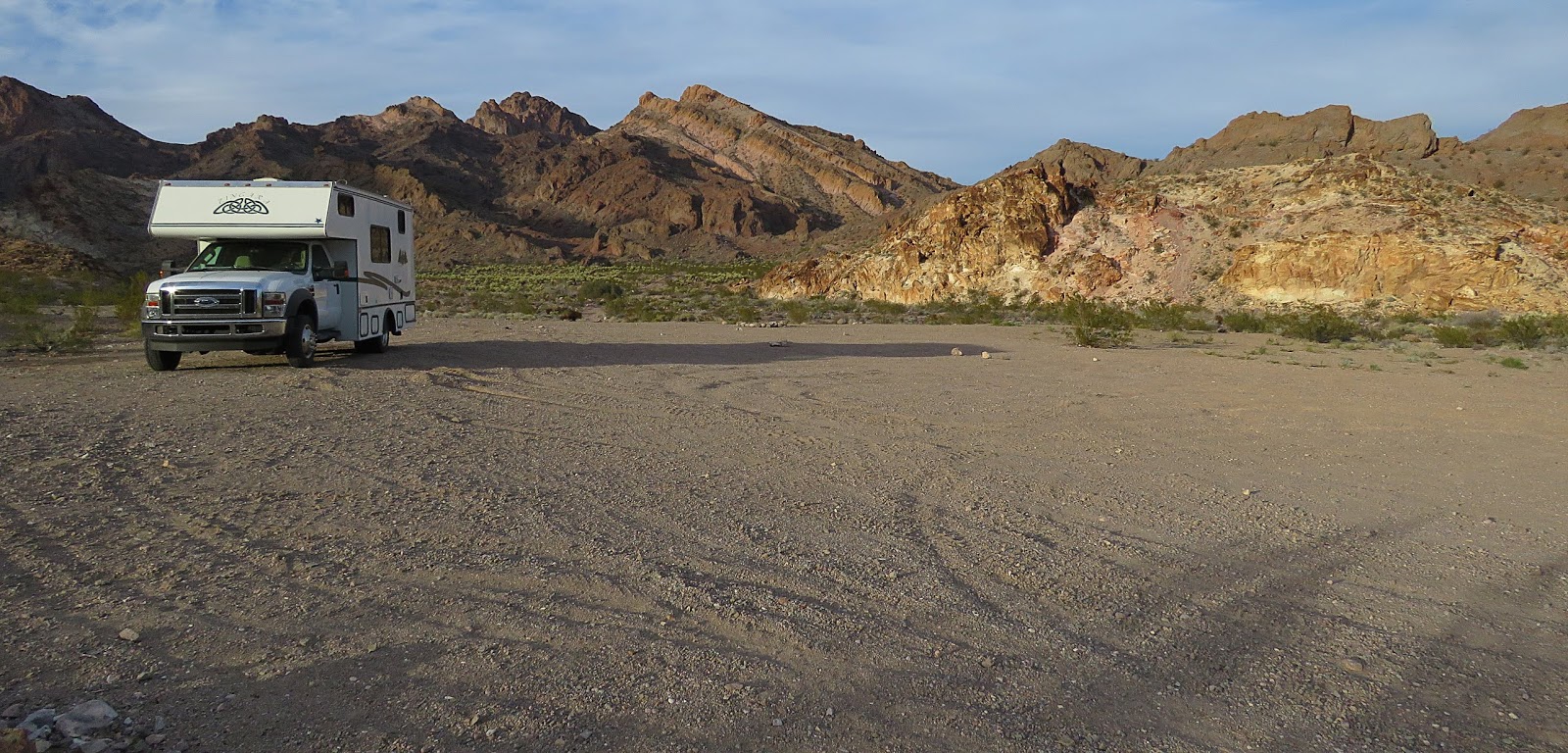
   The mine site is surrounded by BLM land. It starts about 5 miles in on Route 165 and continues to the mine. There are several good boondocking spots before the town of Nelson but the best spot is just west the mine. It’s large with a slight slope and great views of the mountains and the mine buildings. A small wash may make the road a bit rough but any RV should be able to make it. Mine  35.7094, -114.80394

https://www.google.com/maps/d/edit?mid=1gxKwv9ahfkSb9e6MLeSt0hMDxaY&msa=0&ll=35.71236663028624%2C-114.8106669890384&z=14