Monday, September 17, 2018

Hoover Mason Trestle at SteelStacks

IMG_4381
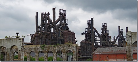
  The Bethlehem Iron Company, the embryo of Bethlehem Steel, was founded in 1860 to make iron rails for the Lehigh Valley Railroad. In 1873 the company constructed long stone buildings to house Bessemer converters and began producing steel, a stronger and more versatile metal. As the company expanded, the  stone buildings were put to other uses but sections are still standing today.
IMG_4378IMG_4437
  Eventually Bethlehem Steel grew to cover 1600 acres and became know for its innovative method of creating a strong but lightweight  beam that was essential in the construction of tall buildings and long bridges.  80% of the buildings in New York City skyline were built using Bethlehem beams. Bethlehem steel was also used in many iconic structures including the Golden Gate Bridge, Madison Square Garden, Rockefeller Center, and the Hoover Dam.
IMG_4345
   In 1995, after being in business for 135 years the mill, which had not been updated to modern steel making standards and could not compete against small mills and imported steel, was shut down. Former steelworkers looking out the windows of their homes on the hill above the mill saw a clear sky, a silent and deserted mill, and the end of way of life that had been passed down through generations. Fortunately, even as many of mill buildings were being demolished, the massive complex of blast furnaces was saved. Most of the land was sold to developers but the nucleus where the blast furnaces are located is being developed as a cultural center called SteelStacks.
IMG_4416IMG_4435
   SteelStacks is the site of performing arts center, a festival area, a free concert stage, a cinema, an outlet mall, a museum, and the Sands Casino. A visitor center offers local information, a short video about Bethlehem and the mill, and guided tours of the Hoover Mason Trestle. The tour has a fee but free self-guided tours may be taken anytime the trestle is open. The trestle is a 1/4 mile, elevated, concrete walkway that allows visitors to get a close up look at the amazing jumble of pipes, ladders, gangways, rivets, bolts, conduit, smoke stacks,and beams that make up the blast furnaces. Interpretive signs explain the functions of the mill. Since the area is a work in progress many of surrounding buildings are fenced off but walking around and peeking through the chain-link is interesting. I’m hoping that in the future a brochure or signs explaining the history of these buildings will be available.
IMG_4419IMG_4321IMG_4360IMG_4315IMG_4375IMG_4397
   All of the venues at SteelStacks are accessible. The sidewalks and curb cuts are in good condition. An elevator near the visitor center provides access to the trestle. The casino is accessible.
IMG_4404
  The visitor center lot is large enough for any RV. The casino has a large parking lot with a section for RVs and buses but sleeping overnight in an RV is prohibited. The security team was very considerate and did not knock on our door until 8:00 AM so we got a good night’s sleep. :-)  Trestle  40.61491, -75.37019
pennsylvania2

Sunday, September 16, 2018

Lehigh Valley Zoo

IMG_4272

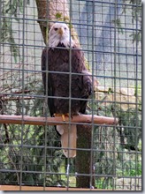
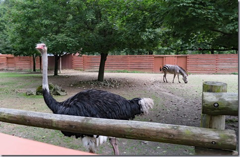
  The zoo is located in the middle of the Trexler Nature Preserve, which was founded in 1906 by Harry C. Trexler, a local industrialist, to provide a free roaming habitat for elk and bison. In 1935 the County of Lehigh took over ownership of the Preserve and the zoo was established in 1974. This is a very small zoo with a paved loop of less than a mile. Larger animals include giraffes, zebras, camels, and oryxes. Cats, birds, farm animals, and reptiles fill the smaller enclosures. All of the animals seem well cared for.  Elk and bison still roam the preserve and can be seen by driving along the exit road. There aren't many places to stop and signs warn against approaching the fencing which looks very unsubstantial.

IMG_4303IMG_4275  IMG_4247IMG_4294IMG_4269IMG_4254 IMG_4251IMG_4283

  The zoo is located on the top of a hill. The walkway entrance to the zoo slopes steeply down. The main section is flat and there’s a climb to get back to the parking lot so wheelchair users may need assistance.  Most of the animals are easy to see.

   Follow the directions on the website if you’re driving a large vehicle to avoid the low height of a covered bridge. The one way road into the zoo and back out is narrow, curvy, and has a shallow creek crossing where water may be running over the road. School buses use it so it should be fine for large RVs. The parking lot is large enough for any RV.  Zoo  40.65822, -75.62685

pennsylvania2

Saturday, September 15, 2018

Jim Thorpe Memorial

IMG_4244
   Jim Thorpe, born in Oklahoma, and a member of the Sac and Fox Nation, was a natural athlete. He won Olympic gold medals in the 1912 pentathlon and decathlon and played professional football, baseball, and basketball. After his sport career ended in 1928, he held odd jobs, working in construction, as a bouncer, a security guard and a ditch digger. He died in 1953 of heart failure.

  Strangely, he is buried at this roadside memorial on the outskirts of a small Pennsylvania coaling mine town, a place he had never even visited. The original plans for a memorial at his gravesite in Shawnee, Oklahoma were thwarted when the governor of Oklahoma vetoed the funding. Thorpe’s wife, Patricia, angered by the slight, heard that the town of Mauch Chunk was looking for a way to attract people to their town and offered her husband’s remains if the town would change its name and build a memorial to him. Kind of a weird proposal but the town followed through on its promise  and built a very nice memorial. Statues depicting Thorpe as a football player and showing Thorpe with a discus were installed in 2007 and 2011. The Spirit of Thunder and Lightning, an abstract sculpture, was dedicated in 1998. Interpretive signs give details on Thorpe's life and athletic accomplishments.
IMG_4245IMG_4246
  Paved walkways provide access.

  Any size RV can navigate the loop drive and fit in the parking along the back edge. Memorial  40.88477, -75.72575
pennsylvania1

Thursday, September 13, 2018

Steamtown National Historic Site

IMG_4172

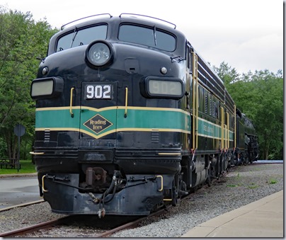
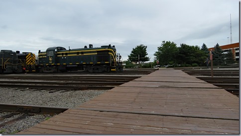
  Steamtown is a must visit for railroad and history buffs and little kids who are fascinated by trains. It’s located on the yards of the former Delaware, Lackawanna and Western Railroad, one of the oldest rail lines in northeastern Pennsylvania, and features a working turntable, roundhouse, history museum, and technology museum. Most the more than 20 locomotives and 75 pieces of rolling stock, were collected by F. Nelson Blount, a millionaire seafood processor from New England, who founded the original Steamtown in Bellows Falls, Vermont. Blount’s death in 1967, air pollution regulations, track maintenance, and declining visitation all led to a decision to relocate the collection to Scranton, PA. The DL&W station was renovated to house an excursion business which was owned jointly by the the city and a private developer. It opened in 1986, only to face bankruptcy three years later. The National Park Service took over and after more renovations opened Steamtown as an historic site in1995.

IMG_4175

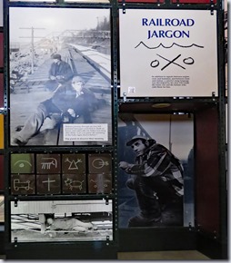
  The museum exhibits cover the history of railroading, the people and jobs involved in running a railroad, and detailed explanations of the actual workings of steam and diesel engines. The roundhouse is used for light-duty maintenance and repair and can be viewed from an elevated walk on a self guided tour or down on the floor by guided tour. Short train rides around the yard and longer excursions are available but not everyday so check the schedule before visiting. The museums and all tours are free, however, there’s a charge for the train rides.

         IMG_4216IMG_4217IMG_4222IMG_4177IMG_4229   IMG_4235IMG_4233         IMG_4223IMG_4218
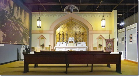
   The museums and areas inside are accessible. Train cars that can be entered do not have ramps and therefore are not accessible. Visiting everything requires passing through several heavy doors. The design of the site makes navigating a bit confusing. Look for elevators and ramps so as not to miss anything. The main exterior exhibits in the turntable and parking lot areas are accessible. The entire acreage where stock is stored is open to the public but most of the ground is too rough to be accessible. It’s possible to see a lot of that area from the wooden boardwalk ramp that goes to the Mall at Steamtown but getting to the ramp involves crossing multiple train tracks. Use caution as these are active tracks and small wheels could get stuck in the spaces by the tracks. The park website states “Beginning with the 2017 season and until further notice, train rides are NOT handicapped accessible” which may mean that they will be accessible sometime in the future. 

IMG_4215IMG_4213IMG_4210

  Long RV/bus spaces are located on the far end of the lot but if it’s not busy you can park closer to the entrance.  Steamtown  41.40889, -75.67329

pennsylvania1

Tuesday, September 11, 2018

Anthracite Heritage Museum

IMG_4188

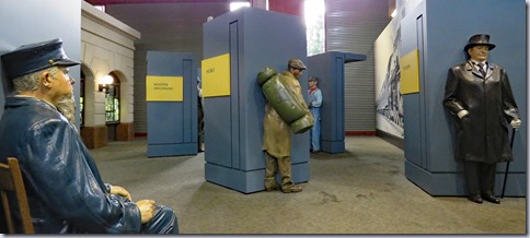
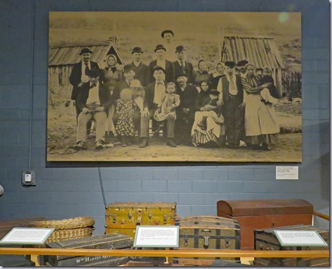
  The stories of immigrants leaving their home countries in search of a better life in the coal mines of Scranton, Pennsylvania are well told through exhibits and artifacts. The first to arrive were experienced miners from England and Wales. Eventually more than three dozen nations were represented as people escaped famine, poverty, and overcrowding in Europe. Most were not familiar with mining but jobs were plentiful and both men and boys were needed. Women and girls worked in the silk and lace mills that opened to take advantage of a cheap and willing labor force. It wasn’t an easy life but the families survived, forming fraternal and benefit societies, and blending their customs and cultures into the growing town. After reaching peak production in 1917 the industry went into a steady decline and there are no deep mines in the area today.

         IMG_4186IMG_4193IMG_4192IMG_4189IMG_4197IMG_4202IMG_4204  IMG_4183IMG_4184

  The museum is accessible.

   The parking lot has two levels. RVs will fit in both lots - parked lengthwise across the spaces - but if the lots are busy there may not be room to turn around. Our RV is small so we could park in an accessible space in the upper lot.  Museum  41.41759, -75.7159

pennsylvania1

Monday, September 10, 2018

Hickory Run State Park

IMG_4150

   It was past Labor Day when we visited and very few of the 381 sites were occupied, giving us many choices. We found one that was level, shady, and roomy. The sites vary greatly and most that we saw are not very good – close together, mucky looking, and not level. The park could use some work.

  The camping prices for Pennsylvania state parks are confusing.  The website starts with a base price ($1.00 extra for non-residents) and then each extra item is added on – weekends, showers, electricity, water, sewage, pet, and extra vehicle fees plus a $6.00 transaction fee. It gets a bit ridiculous. A full hookup, one night stay, on the weekend, with a pet ends up at $55.50! Seniors and people with disabilities get a discount of $4.50.

  None of the sites are designated as accessible. The site where we camped, #374, is large and fairly level with small gravel and hard packed dirt so it’s easy to roll around. The table top has a short overhang.

IMG_4157

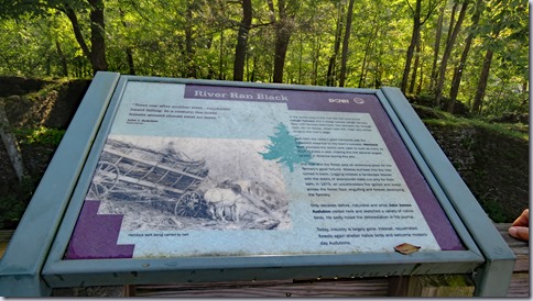
  The park has 44 miles of trails of varying difficulty. We did not try them but instead drove 5 miles west to the D&L Rail Trail. The trail is over 140 miles long, running from the town of Bristol, PA to Mountain Top, PA.  We parked in the lot on the west side of the Lehigh River and walked/rolled about 2 miles south. This part of the trail is hard packed, crushed stone and has a slight downgrade as it follows the river downstream. Trees block the river view as it’s not super scenic. Stop at the Lehigh Tannery Historic Site on the east side of the river to see the ruins of a tannery that was destroyed by fire in 1875. The railing blocks the view for people in wheelchairs and the sign is too high to read. Both lots are large enough for any RV. Tannery Road off of Route 534 has a strange tilt and incline so use caution if you’re driving an RV.  Campground  41.02442, -75.68673   Trail   41.03835, -75.7618

IMG_4170IMG_4142IMG_4138

pennsylvania1