Saturday, September 8, 2018

Eckley Miners' Village

IMG_4122

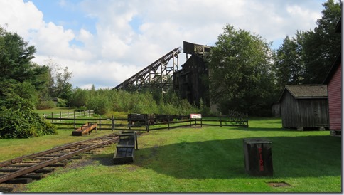
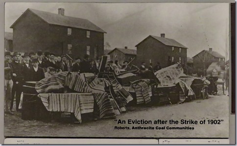
  In the mid 1800s hundreds of small company owned towns dotted the anthracite coal regions of Pennsylvania. Each centered around the towering headframe of a coal mine where husbands, fathers, and unmarried men, descended every day to spend up to 12 hours blasting through the rock, shoveling coal, breathing in coal dust, and hoping that there would not be an unplanned explosion, cave-in, or flood. Boys as young as 9 worked picking rocks out of the coal after it was broken into chunks, opening and closing ventilation doors, and leading the mules that pulled mining cars. The towns were isolated so the company supplied everything. Each town had a school, churches, and a company store where supplies were sold at inflated prices. Many miners were paid with company scrip that could only be used at the company store.
IMG_4125IMG_4104

   Eckley was founded in 1854 and by 1860 had 150 houses. Mine foremen and their families rented the single dwellings. Miners and their families lived in one side of duplex houses which were different sizes depending on the skill level of the worker. In the late 1870s 1,500 people lived in the town but when strip mining operations started in the 1890s fewer workers were required and most people eventually moved away. Unlike many other mining towns, where the houses were sold when the mines closed, Eckley remained a company town. Very little changed over the years, so it made a perfect location for the filming of the 1970 movie, The Molly Maguires starring Sean Connery. The movie portrays the secret society of Irish-American miners who fought for miners’ rights and were considered heroes by some, terrorists by others. 
IMG_4097

  The movie revived interest in the town and it was bought by a group of Hazleton area businessmen who deeded it over to Commonwealth of Pennsylvania in 1971. Over 50 original buildings remain including the miner owner’s house, the Catholic Church, and the rectory. The Episcopal Church was relocated from another town. The company store and headframe were built for the movie. Four of the buildings are opened for guided tours during the summer. A few more buildings are opened for special events. Self guided tours are also available by either walking or driving through the town. Some of the houses are still occupied and those properties are off limits.  A small visitor center features a movie and good exhibits about the lives of the men, women, and children who lived in coal patch towns. The ecological damage caused by strip mining is easily visible from the highway.

IMG_4103

IMG_4113       IMG_4111IMG_4115IMG_4112IMG_4128IMG_4118IMG_4134

   The visitor center and gift shop are accessible but the museum doors are heavy. The town streets are gravel covered and run slightly downhill. Some buildings have ramps but the thresholds at the entrance doors are high.

IMG_4107

  The parking lot is large enough for any RV.  Museum  40.99527, -75.85593

pennsylvania1

Thursday, September 6, 2018

Vanishing Centralia

IMG_4082

  In May 1962 the volunteer fire company in the little coal mining town of Centralia, PA started a fire in the community landfill which was located in an abandoned strip mine pit. This was a standard practice at the time as a way to handle growing piles of trash. Unfortunately the fire was not adequately extinguished and it burned through the pit into abandoned mining tunnels beneath the town. The fire smothered for almost 20 years before the ground began sinking due to the burning of coal pillars that held up the tunnel roofs. Steaming vents opened around the town. Carbon monoxide seeped into the houses. Federal money was allocated to relocate the residents because it had become unsafe to live in the town.

   Most of the people accepted the settlement offers and moved. The businesses and houses were leveled and grass and trees have taken over the properties. Five house still stand and since they are not in any danger of collapsing from subsidence the owners have been granted the right to stay for the rest of their lives. St. Mary's which sits on a hill is the only church, out of five, left standing.

                     IMG_4081IMG_4088

  Visiting the remains of the town is eerie. There are no street signs. There is no sign for the town limits. The town has been wiped out of existence. The streets are empty and trees overgrow the smaller ones. Steps lead to nowhere. We stopped at Centralia in 2010 and found a few places where steam was raising from the ground but that seems to have stopped as the fire moved to deeper levels in the mine. 

IMG_4085IMG_4083IMG_4091

  The streets are in fairly good condition so it’s easy to roll along but it’s hilly so wheelchair users may need assistance. Most of the streets are still opened so you can also drive and see the sights. One of the main attractions is a section of Route 61 that is closed due to cracks and settlement and is now covered with graffiti. Piles of dirt at each end make it impossible to access with a wheelchair.

  Park on any of the streets but do not trespass on the property of the few remaining residents.  Centralia  40.79972, -76.33939

IMG_4086pennsylvania1

Hollywood Casino at Penn Race Course

IMG_4078

   Do not follow the “oversized vehicle parking” signs. Instead use the main entrance road and make a left at the first intersection. Follow the road around the curve and park in the lots on the right. These lots get little use.The truck lot is located farther along the road down a hill and is heavily used by truck drivers.

This is not a good casino for visitors using wheelchairs. Since the parking lot is lower than the casino the pathway to the entrance has a set of steps. To avoid the steps it’s necessary to go through the valet parking garage and out the garage entry drive. All of the slot machine chairs are fixed in place so the machines at the ends of the rows are the only ones that are usable.This also makes it difficult to reach some of the ticket and card slots. Casino  40.39507, -76.66383

pennsylvania2

Wednesday, September 5, 2018

Brown's Orchards and Farm Market

IMG_4058

   It’s been 7 months since our last Harvest Hosts stop (at the B.B. King museum in Mississippi) and almost a year since we stayed at a Harvest Hosts farm market. There haven’t been many along our route so we were looking forward to our stay at Brown’s Market. It was great - quiet at night with beautiful scenery in the day and a helpful, friendly contact person.

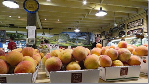
  The market was founded in 1948 and has grown to include a deli, candy island, specialty canned foods, bakery, cafĂ©, floral department, retail greenhouse, and ice cream stand. Apples, sweet corn, peaches, plums, cherries, strawberries, pears, asparagus, and pumpkins are grown on the farm and sold in season. Local crops and produce from other states are also available. We bought peaches, plums, and cantaloupe (all very good), cheesy tomato bread (meh), rye bread (good), honey (haven’t tasted yet) and ice cream (yum).

IMG_4066IMG_4064

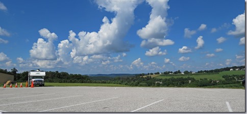
   Joe, the contact person, requested that we park parallel to the grass near a storage shed so that we wouldn’t have a problem getting out if the lot was busy. He set up orange cones to save the spot for us. We parked a little crooked so that the sun only hit our front window because it was really hot. We had a beautiful view out our side window of the orchards and farmland.  Market  39.84329, -76.71177IMG_4067IMG_4062

pennsylvania2

Tuesday, September 4, 2018

Carroll County Farm Museum

IMG_4052

   When Carroll County, Maryland was created by the Maryland General Assembly in 1837, one requirements was the construction of an almshouse to care for the poor, elderly, and sick who could not care for themselves or did not have family that could help them. The almshouse, in operation from 1853 until 1965 and housing up to 50 people at a time, was much more than just a place to live. Crops and animals were raised on 340 acres of land and everyone strong enough worked to support the operation. The property included a summer kitchen, wash room, baking room, barns and other outbuildings.

IMG_4032

   After the almshouse closed a group of residents and county officials decided to use the buildings and property to create a museum complex depicting the life of a farm family in the 1880s. The amount of donated items is quite impressive – everything from the smallest household utensils to large farm equipment. Many items were new to us like a machine that separates clover seed from weed seed and another that makes oil from wormseed.

IMG_4038IMG_4039IMG_4030

  The bottom floor of the almshouse, furnished as if a farm family lived there, is opened on the hour for guided tours. Other buildings are self guided. The rooms on the second floor of the summer kitchen building have spinning, weaving, tinsmithing, chair caning, and broom making exhibits. There’s also a room about the almshouse period but we were disappointed at the limited information that was provided. Farm equipment and other artifacts are displayed in the barns. Heritage breed animals are kept in a row of pens and in the pasture. Most of the buildings are original to the property. Exceptions include a small log cabin and a large log barn built in 1794.

IMG_4014IMG_4017IMG_4031IMG_4049

  The gift shop and the almshouse are wheelchair accessible but the rest of the property is not very accessible. Most of the rooms on both floors of the summer kitchen building have steps or high thresholds at the entrances. Steep ramps, steps, high thresholds, and uneven ground make access to almost all of the other buildings difficult. The paths are paved with a few rough areas.

IMG_4024IMG_4025

   The parking lot is large enough for any RV. Museum  39.55879, -76.99509

maryland1

Monday, September 3, 2018

Greenbelt Park

IMG_4010

   Even though the park is managed by the National Park Service, it isn’t a national park and therefore has no exceptional scenery or historic significance but it does provide inexpensive camping with easy access to I- 495, the Baltimore-Washington Parkway, and Washington DC.

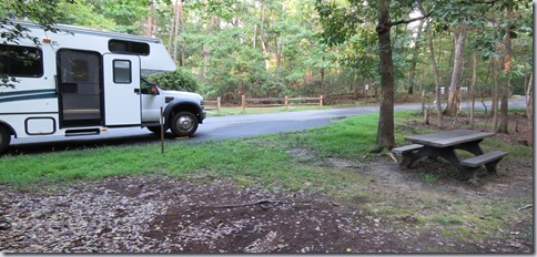
   The campsites have tables, fire rings, and grills. The restrooms have showers and there’s a dump station and potable water. The parking pads are narrow. Many are short and not level plus some sites have overhanging branches so choices for campers with large RVs are limited.

   Reservations are required. The fee boxes have been eliminate but there is a phone number posted so same day reservations may be possible. Check-in is not required, in fact, we never saw a park employee during our one night stay at the beginning of Labor Day weekend. Some loops were already closed for the season and few people were camping in the open loops.

   Two sites, 69 and 70 in B loop, are designated as accessible. They are not accessible but they are close to the restrooms. Site 70, where we stayed is parallel to the road, too narrow, not level, and does not have a good path to the table which is down a slope. The parking pad for site 69 is too narrow, not level, and the ground around the picnic table is a tangle of roots. The park has several trails through the woods but they do not look accessible.  Campground  38.99569, -76.89511

IMG_4007IMG_4012maryland1

Saturday, September 1, 2018

National Museum of Natural History

IMG_3970

  The National Museum of Natural History building was constructed in 1911 to house the growing collections that were originally in the Smithsonian Castle and later moved to the National Museum Building. Some sections of the museum are a bit outdated especially the Hall of Bones and the cases displaying birds that were collected in the nineteenth and early twentieth centuries. Other exhibits cover dinosaurs, mammals, geology, gem stones, human origins, and the oceans.

IMG_3980

IMG_3989 IMG_3997IMG_3996

                   Art made from trash that was found on beaches

IMG_3974

  This a popular museum for kids so it can get crowded. The Hall of Dinosaurs is undergoing a massive upgrade and will reopen in 2019 so it will be even busier for a while.

IMG_3994

   The accessible entrance to the museum is located on Constitutional Ave. If you park on Madison Drive, like we did, take a little time to walk/roll through the Sculpture Garden and Pollinator Garden. The gardens and the exhibits in the museum are accessible.

IMG_3999IMG_3987

   We parked on Madison Drive which is located south of the museum. DC has recently implemented fee parking along all of the streets where parking was previously free. On most streets the fee is $2.00 an hour payable by credit card or phone app. The spaces are not marked with lines so RVs fees are the same as car fees. The maximum time is 3 hours, the same as it was previously. In the past this was not enforced but now it’s necessary to pay attention to the time which puts a crimp in long walks or long museum visits. A benefit of the parking fees is that spaces are easy to find. Spaces that would have filled by 9:30 in the morning are still available at 12:00. Museum  38.89205, -77.02597

maryland1