Sunday, March 18, 2018

Natchez Trace – Mile 193.1 to Mile 320

IMG_0700

 Mile 221.4   Old Trace – Even though the trace hasn’t been used since the 1880s there are still sections like this where it’s easy to imagine the travelers trudging along and creating a depression.

IMG_0721

IMG_0723

Mile 232.4   Bynum Mounds -  A paved path makes a loop past two burial mounds that are about 2,000 years old. Four people, most likely royalty, were buried in the mounds. The path is accessible.

IMG_0734

Mile 261.8  Chickasaw Village Site – Concrete paths follow the foundation lines of a fort and three houses that were in use into the early 1800s. The paths are not connected so the site is not wheelchair accessible.

IMG_0746

Mile 266.0   Parkway Visitor Center - The only interpretive center along the trace with exhibits covering the history and geology of the entire route.

IMG_0747

Mile 269.4  Confederate Gravesites -  Graves of 13 unknown Confederate soldiers. Nothing is know of the circumstances of their deaths and how they came to be buried here. Paved accessible path.

IMG_0754

Mile 286.7  Pharr Mounds – The largest archeological site in northern Mississippi. Eight burial mounds used between 1-200 AD.

IMG_0761

Mile 293.2   Tennessee-Tombigbee Waterway – The waterway  connects the Tennessee River to the Tombigbee River. This shortcut was first proposed in the mid 1770s by Sieur de Bienville, the founder of Mobile, but not constructed until 1985. Short, paved accessible trail with a few rough spots.

IMG_0766

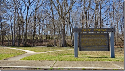
Mile 308.4  Cave Spring – Small cave probably used by Native Americans as a source of water and building stone. Short, paved trail to overlook.IMG_0773
IMG_0767

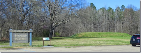
Mile 308.8   Bear Creek Mound - Village site was occupied as early as 8,000 B.C. and a temple sat on top of the large flat mound.
IMG_0774

Mile 320  Side Trip – The trace campgrounds do not have dump stations so we looped off the trace to spend the night at Rose Trail County Park Campground. The campground has four spurs that all dead end in turnarounds. Two are full hookup; one has water, electricity, and a dump station; and one appears to be a tent camping area. There are only two restrooms and many of the sites lack tables. None of the sites are designated as accessible but most are usable. 

IMG_0779

Trace  33.41752, -89.26746

mississippi1

Saturday, March 17, 2018

Natchez Trace – Mile 54.8 to 193.1

IMG_0693
 Mile 88.1   Cowles Mead Cemetery – Politician and plantation owner who died in 1849 and is buried in this small cemetery. Short accessible trail.
IMG_0675IMG_0676
Mile 105.6  Reservoir Overlook – Early travelers wouldn’t recognize this section of the trace. The trace and road follow almost the same path but the early travelers would have been deep in the woods instead of on the shoreline of this large reservoir.
IMG_0679
         IMG_0688
Mile 106.9  Boyd Site – Native American burial mounds from the Late Woodland and Early Mississippian periods (circa 800 to 1100 A.D)
IMG_0682
Mile 122.0  Cypress Swamp – Half mile walk through tupelo and cypress swamp. Not accessible due to steps but can be viewed from parking lot.
IMG_0689
IMG_0691
Mile 175.6  Cole Creek Trail – Short walk through hardwood forest and tupelo/cypress swamp. Not accessible due to steps but can be viewed from parking lot.
        IMG_0701
IMG_0705
Mile 193.1  Jeff Busby Campground -  18 site free campground with restrooms and tables. Accessible site has an accessible table and is near the restroom. This is the only campground of the three on the trace that filled during our trip. Drive to the end of the road for a view from one of the highest points in Mississippi – 603 feet! :-D 
IMG_0709
IMG_0713
Trace  32.08881, -90.79928
mississippi1

Friday, March 16, 2018

Natchez Trace - Mile 0 to Mile 54.8

         IMG_0806
  Before starting a drive along the trace stop at the Natchez Visitor Center and pick up the Natchez Trace Parkway map published by the national park service. The map has every stop marked along with a short description and the exact mileage from the southern end. The road itself has brown mileage posts marking each mile so by following along with the map it’s easy to see exactly where you are.  I’m going to post the more interesting sites since there are over 100 places to stop and see along the way.

Mile 5.1  Elizabeth Female Academy Site – The first school of higher learning for women in Mississippi. Founded in 1818 and closed in 1845 when the capital moved to Jackson. A short, paved, and accessible trail leads to the school ruins.
IMG_0600
IMG_0598
 Mile 10.3   Emerald Mound – The second largest temple mound built in the US. Built and used from 1300 – 1600. The opening in the gate is not wide enough for wheelchairs.The paved trail to the top is very steep.
IMG_0606
IMG_0613
Mile 12.4   Loess Bluff – Fine soil blown south from the plains and deposited in Mississippi during the ice ages. Loess is very fertile but easily eroded.
IMG_0615
Mile 15.5   Mount Locust Plantation and Inn - built in 1780 and the only surviving inn of more than 50 built along the trace. A paved accessible trail leads to a view of the simple plantation house which is not accessible due to steps.
IMG_0617
IMG_0620
  Detour! The Windsor Ruins is a must stop. This is the antebellum mansion that Sherman DIDN’T burn.  It was accidently burnt in 1890 and the only things left are the concrete and brick columns and iron railings. It would cost almost 5 million dollars to build today. The road to the mansion was closed at the southern end so we went to Port Gibson and took Carroll Street to Rodney Road to get to the mansion ruins from the north. Parking area is large enough for RVs.
IMG_0637a
IMG_0631
IMG_0654
Mile 54.8  Rocky Springs Campground and Old Town Site- Free 22 site campground with paved parking pads and restrooms. Most of the sites are pull through and large enough for any RV. The accessible site has concrete under the table which has an extended top.
IMG_0658
         IMG_0657
   The town site has a packed gravel trail to a church built in 1837 and still in use today. Another trail winds through the town site and past a couple of old safes. The trail to the church overlooks ravines caused by poor farming practices. The church trail is accessible with assistance. The town trail is not accessible.
IMG_0663
         IMG_0664
Trace  31.54599, -91.36809
mississippi1

Thursday, March 15, 2018

Natchez Trace

IMG_0594

  The Natchez Trace was used by Native Americans for centuries as a travel and trade route between villages however large numbers of  European Americans didn’t use the trace until the early 1800s when President Thomas Jefferson put the Army to work blazing and widening it. When finished the trace was wide enough for a wagon and connected Nashville, Tennessee to the Mississippi River at Natchez. It was used by emigrants, slave traders, preachers, and armies but the most well know travelers were the "Kaintucks”, farmers and boatmen from the Ohio River regions of Pennsylvania, Ohio, and Kentucky, who floated their whiskey, tobacco, corn, wheat, and other crops down to Natchez.  After selling their cargo, they sold their log rafts for the lumber and began the 444 mile trip north to Nashville on foot or horseback, stopping at rustic inns which had been established every 10 to 15 miles along the trace.

IMG_0603

  Steamboats and railroads put an end to heavy travel along the trace and it had almost disappeared by the 1930s. The CCC began working on a road that closely followed the trace after President Roosevelt signed the legislation for its creation in 1938 but it wasn’t completely finished as a continuous road until 2005. The road is smooth two lane with a 50 mph speed limit and little traffic. Restrictions for RVs are 55 feet in length including a tow vehicle, 14 feet in height , and 40,000 pounds in weight. A few more restrictions are listed here. Most of the turn outs are small but RVs will fit except on busy days.

  The scenery is of forest and fields, pretty but not as spectacular as some other scenic byways. Turn outs with historic signs, Indian mounds, short trails, and historic sites are frequent.  There are three small campgrounds – no hookups and no fee.

IMG_0684

IMG_0730

  We’ve decided to drive the entire route from south to north following the trail of the “ Kaintucks” to Nashville. In the past we’ve always spotted something interesting off of the trace and then didn’t get back on after our detour so it’ll be a challenge.  :- D  I’ll post the first section tomorrow since this post is kind of long already.  Trace  31.54599, -91.36809

mississippi1

Tuesday, March 13, 2018

Natchez Visitors Center

IMG_0515

 Around 700 AD the Plaquemine culture settled in a large village with ceremonial mounds near Natchez. Their descendants, the Natchez Indians, were still living there when the French arrived in 1700s. Control passed from the French, to the British, and then to the Spanish. After the Revolutionary War Britain ceded their territories to the US including the city of Natchez which was still controlled by Spain. It wasn’t until 1789 the border disputes were settled and Spanish claims to Natchez were surrendered and the area became part of the Mississippi territory. 

 In 1860, there were 340 planters in the Natchez region who each owned 250 or more slaves. Cotton was planted on flat, fertile flood plain on the western side of the Mississippi but many of the wealthy plantation owners preferred to live on the bluff in Natchez. The city survived the Civil War with little damage and still has over 500 antebellum era buildings. In 1931 to attract tourists the women of the Natchez Garden Club started showing their houses and gardens. This has become a twice-a-year event and is a major tourist draw.

 A historic timeline of Natchez history lines one wall of the visitor center.  A special exhibit about the Forks of the Roads slave market was on display during our visit. A short video about Natchez can be viewed – $2.00 fee. The center has all of the usual tourist information and a nice view of the Mississippi River.

IMG_0521

IMG_0510

  UPDATE 2024 - OVERNIGHT PARKING IS NO LONGER PERMITTED

The visitor center has RV spaces where parking for 2 nights is permitted. There’s a dump station, fresh water, and a couple of electric outlets – all free! The RV parking area is marked for buses only. Large RVs with towed cars or trucks towing fifth wheels will have to be unhooked to fit in the spaces. The two spaces farthest from the center have working electricity. The dump station is at the northwest end of the lot. The water is on the hill at the southwest end of the lot or near the visitor center ramp.  The lot is sloped so leveling is necessary. The center of town is only about 1 mile away so it’s an easy walk.

IMG_0509

 It’s all uphill trek from the RV parking to the visitor center so wheelchair users may need assistance. The sidewalks and curb cuts in town are often in bad condition and sometimes missing. Visitor Center  31.55408, -91.41314

mississippi1

Monday, March 12, 2018

Longwood Plantation House

IMG_0586

  This house is an stunning example of the incredible amount of money plantation owners made off of the back breaking labor of enslaved people.  In an attempt to outdo the town houses of their neighbors in Natchez, Haller Nutt and his wife, Julia Williams Nut, hired architect Samuel Sloan of Philadelphia to design and build what would be the largest octagonal house in America.

   Using clay found on the land slaves made more than a million bricks.  Work on the house began in 1860 but in 1861, when news of the Civil War reached the Natchez area, the carpenters, brick layers, and other craftsmen who were from the north dropped their tools and headed home. The brick work and the exterior were complete but very little had been finished on the interior. The Nutt family and their descendants lived in the basement until the 1960s. IMG_0572

IMG_0577

IMG_0573

  The first floor and the basement, which is furnished with original family pieces, are opened for tours. Unfortunately at the time of our visit the basement was closed for repairs due to damage from a broken sprinkler pipe so we visited the first floor only.

  The basement is accessible but the first floor is not due to steps. (Tony pulled me up) The grounds are hilly and uneven. The outbuildings are not included in the tours and do not have exhibits but a few pieces of equipment are stored in the carriage house.

        IMG_0588

  Follow the signs for RV parking. It’s a grassy area past the car parking area. Longwood  31.53812, -91.40585

mississippi1