Friday, August 25, 2017

Art Museum of Eastern Idaho

IMG_6448

  Three small galleries and a hallway feature changing exhibits of art by Idaho artists. Hand tooled saddles and photographs of ranching activities were the focus of the main exhibit when we visited. Lesser exhibits featured the artwork of local artists - all  were available to purchase. A few sculptures are on the grounds outside. Photography is not permitted inside.

  The museum is accessible.

   The parking lot is large enough for RVs if backed up over the grass or parked lengthwise across the spaces.  Museum  43.48994, -112.04473

idaho1

Thursday, August 24, 2017

Airway Beacon and Arrow in Dubois, Idaho

IMG_6447
   In the early days of aviation pilots used landmarks to chart their course which worked fine in the more populated eastern US but not as well in the west or at the night or in stormy weather. The US Post Office realized the benefit of using small planes for fast mail delivery and came up with a solution for night flights, inclement weather, and the lack of landmarks in the west. Between 1923 and 1933 1500 beacons were erected to guide the pilots over 18,000 miles of airmail routes. The beacons were spaced approximately 10 miles apart with large, concrete arrows, painted bright yellow, and positioned on the ground pointing in the correct direction.
                       IMG_6446
  By the 1940s navigation and radio technology had improved to the point where the beacons could be phased out. Many towers were removed and the concrete arrows crumbled but there are still 321 towers and 115 arrows scattered across the US. The beacon and arrow in Dubois, which are in very good condition, were recently restored by a couple of aviation history enthusiasts. The beacon is located south of Dubois in the small Dubois Municipal Airport. There aren’t any signs pointing to it or explaining it’s significance.  Beacons   44.16886, -112.22433
idaho1

Wednesday, August 23, 2017

Big Eddy Campground

IMG_6326
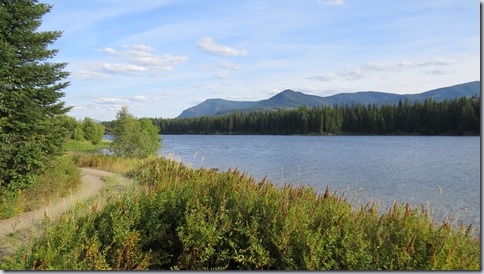
  This five site campground sits on a hill above Cabinet Gorge Reservoir, a large lake that is popular with local fishermen. The lake is pretty but the campsites do not have views.
IMG_6329
   None of the sites is marked as accessible but most are useable.

  The campground loop road has a few tight turns. The sites are large enough for 30’ RVs.  Campground  48.06661, -115.92437
montana1

Leadore City Park

IMG_6411

   There isn’t much in Leadore but this little city park is pretty nice. Picnic tables sit under large trees and are scattered around in a grassy field. The sites aren’t marked so just pick a spot that you like and set up camp. The camping fee is minimal but an addition fee is charged for showers. Amenities include restrooms and fresh water but no dump station. Any size RV will fit.

   The ground is fairly hard so rolling around is not difficult. The restrooms and showers are signed as accessible but we did not check them out.

        IMG_6413

Campground  44.68679, -113.36957

idaho1

Tuesday, August 22, 2017

The Eclipse–Wow!

IMG_6439

  Watching the sun – Donald, (a brand new van dweller!), me and Suanne

   Our eclipse plans were made just about month ago because we weren’t sure where we would be. We’re so glad we decided to camp in the zone of totality. What a cool experience!

   Our private little camping spot started filling with cars early this morning. I don’t know how they found this road but by the time the eclipse started there were 50 cars parked along the sides of the road and it’s only 1000’ long.

IMG_6419

IMG_6431

   Leave the eclipse photos to professionals with the correct equipment  because this is what you get:  :-D

                         IMG_6435

IMG_6436

    A 360 degrees sunrise when the sun peeked out from behind the moon.

        IMG_6437

  Less than seven years until the next one! April 8, 2024

44.17487, -112.30955

idaho1

Sunday, August 20, 2017

National Bison Range Visitors Center

IMG_6353
   Bison were hunted almost to the point of extinction due to greed and a misguided government policy designed to eliminate the largest food source of Native Americans living in the plain states. The theory was that a lack of bison would force the Native Americas onto reservations and eventually they would assimilate into a farming and ranching lifestyle.

  By 1908 it was obvious that the few remaining bison had to protected. The Range was established as a home for a herd that grew from four calves brought over the mountains to the Flathead reservation by a member of the Pend d’Oreille tribe. The herd is still small with a total number between 350-500.
IMG_6351
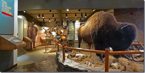
  The Range has a small visitor center with displays about the bison and the Native Americans who depended upon them. The only way to see the Range is by driving. There are a few short trails but hiking over the grasslands is not permitted. West Loop, a short 1 mile loop starts near the visitor center.  Prairie Drive is a 14 mile trip out and back that follows the Flathead River. Red Sleep Mountain Drive is 19 miles long and takes about 1 1/2 – 2 hours to complete. It’s one way until it joins Prairie Drive to complete the loop.
IMG_6378
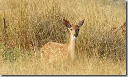
  Since we didn’t have a lot of time we only drove Prairie Drive. We saw few bison so we surmised that they were all at higher, cooler elevations on Red Sleep Mountain. We did see many other animals along the very scenic river valley.
IMG_6359 IMG_6369
IMG_6377
The visitor center and two short trails -  a crushed stone, 1/3 mile loop at the visitor center and and a paved, 1/3 mile loop at the day area are accessible.
IMG_6344
IMG_6345IMG_6396
  The visitor center and day use parking lots have room for RVs. Trailers and RVs over 30’ are not permitted on Prairie Drive and Red Sleep Mountain Drive. West Loop has no restrictions.
IMG_6349
  We stayed at the rest area along US 93, two miles north of Ravalli. It has long RV spaces and is quiet at night.
      IMG_6400
Range  47.36728, -114.2556
montana1

Saturday, August 19, 2017

Old Molson Museum Ghost Town

IMG_6277

   In 1898 George Meacham and John Molson founded Molson as a base for gold mining in the hills. The gold didn’t pan out and the town went bust in 1901. A few people stayed on and settled down to homestead. 1904 brought welcome news of a railroad line coming right by Molson and the town experienced another boom. More change, unwelcome this time, came when the townsfolk discovered that JH McDonald, owner of the local stage line, had quietly bought up the town site acreage. In 1909 McDonald kicked everyone off of the land and the town was moved 1/2 mile north. Trains stopped running past Molson in 1935 and the population dropped again. There isn’t much left of either old or new Molson today - just a few house along the streets of New Molson, a schoolhouse, an old store building, vacation homes, ranches, and the Old Molson ghost town.

IMG_6279

   Buildings have been moved to the original town site to form a small town. Farming and mining equipment and other artifacts are displayed on the grounds and in the buildings. The brick schoolhouse, which had over 100 students in the 1950s, is now a museum.

        IMG_6271IMG_6284

The main floor of the schoolhouse is accessed by a stair lift. The basement and top floors are accessed by stairs only. The basement displays can be seen from a viewing window cut into one of the entry floor walls. A paved path circles around some of the displays at Old Molson but the buildings do not have ramps so access to very limited.

There aren’t any services in Molson however dry camping is permitted in the pull offs along Sidley Lake, just a little over a mile north. This is fish and wildlife site where a Discover Pass is usually required to park or camp but since there are no signs about a fee I think it’s okay to camp here without the pass.

IMG_6289

        IMG_6288

The parking areas at the schoolhouse and Old Molson, and at the pull offs at the lake are all large enough for RVs.

  Thank you Gary and Sharon for coming to visit us!

        IMG_6282

Molson   48.97611, -119.19979

washington1 copy

Friday, August 18, 2017

Waiting for the Eclipse

IMG_6415

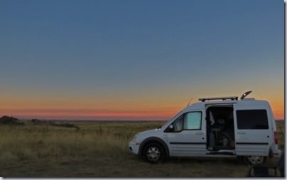
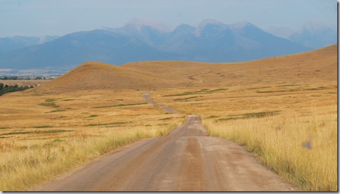
   Experiencing a total solar eclipse is a once a  lifetime thing so we didn’t want to miss it. With all of the news coverage of the expected crowds we decided to find a quiet spot on BLM land and hang out until Monday. This is a great spot! We’re just a few miles off of the interstate but we can’t hear or see it. The skies are clear blue, the temperature is about 80 degrees, a cool breeze blows through our camp, and the plains stretch in all directions.

  We’re sharing the spot with our friend Suanne. We are just west of Dubois, Idaho so if anyone else is in the area and wants to join us let me know.

Thursday, August 17, 2017

North Cascades National Park

IMG_6249

  The 504,781 acres of the North Cascades Park were granted some protection in 1897 when they were designated a Forest Reserve to be managed by the US Forest Service. Many people believed that they would be better protected as a national park and the issue was debated several times over the years. In 1968 the area was finally given national park status. 93 percent of the park is wilderness with access by trails only. 

  With so much of the park wilderness we thought that we would  just be driving through but surprising a number of short accessible trails are located right off of route 20 which bisects the park. All of the accessible features are listed HERE with sort descriptions of each. They are in order starting at the west end of the park and going east. We did not visit all of them but of the ones we did this is what we found:

IMG_6194

Visitor Center and Sterling Monro Trail – very short boardwalk, completely accessible, a low railing at view point. Haze from forest fires obscured many of the views during our visit. The visitor center is accessible.

IMG_6179

IMG_6174

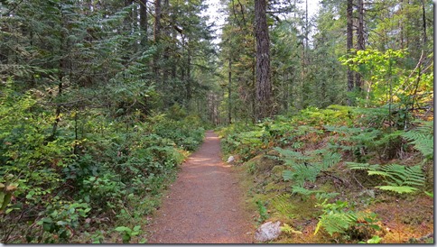
River Loop Trail – excellent one mile long loop, wide, hard packed surface. The off shoot trail that goes to the visitor center is steep and most wheelchair users will need assistance.
IMG_6182

Linking Trail – hard packed one mile trail.

IMG_6193

Rock Shelter Trail – short, steep, gravel surface. Most wheelchair users will need assistance. Not much to see at shelter.

IMG_6220

Newhalem – paved paths in town area with interpretive signs. Follow the town road or drive to the parking lot to see the power house. Newhalem is a company town built by Seattle City Light in 1917. The Gorge Dam power plant began providing electricity to Seattle in 1924. It and two more hydro- electric dams on the Skagit River, built in 1930 and 1940, supply 20 percent of the city’s power.

IMG_6201

IMG_6210

Trail of the Cedars – short loop, half wide and gravel, other hard packed dirt and crushed stone with one hill. Wheelchair users may need assistance.

IMG_6195

Gorge Overlook Trail – the first section, steep but paved, leads to an overlook.  A crushed rock and packed dirt trail completes the loop. Most wheelchair users will need assistance.

IMG_6221

         IMG_6222

IMG_6226

Diablo Lake Overlook – very good, paved with interpretive signs.

IMG_6242

IMG_6240

Happy Creek Forest Walk – very short loop of boardwalk and gravel. Slight uphill.

IMG_6247

Rainy Lake Trail – excellent, one mile long paved trail that ends at an alpine lake. Slight grades. Wheelchair users may need assistance.

IMG_6259

IMG_6255

  We stayed at the Newhalem Campground in the accessible site in loop C. The site is very good - wide, level and paved with an extended top on the table and a fire ring with high sides. The paved trail to the restroom is used by other campers. Back in so your outdoor area is on the opposite side.

IMG_6168

   The visitor center, overlook, and all of the trails except for Happy Creek have plenty of parking for RVs.  Park  48.66599, -121.26845

washington1 copy