Saturday, May 31, 2025

Gray Reef Campground

Gray Reef Reservoir is a Bureau of Reclamation project but the campground is managed by Natrona County so America the Beautiful and other federal passes aren't honored for half-price camping. 

 
The campground has10 campsites, a fishing pier, a boat ramp, and two restrooms. Pay at the kiosk. We camped in site 1 which is south of the kiosk, past the main campground loop. It's also the site of a boat ramp to the reservoir so campers must take care to not block the entrance to the ramp. 

 Site 10 is designated as accessible but we did not check it out. There's also an accessible fishing pier. The ground is hard packed so rolling is easy.  Campground  42.5645, -106.70314


Friday, May 30, 2025

Martin's Cove Visitors' Center

From 1846 to 1869 more than 70,000 Mormons passed through the Sweetwater Valley on their way to Salt Lake City. Most were part of large wagon trains but in 1856, in an effort to assist impoverished European Mormons, handcart companies were formed. Five people were assigned to each handcart which had a three feet by four feet box and was capable of carrying 250 - 500 pounds of cargo. They relied on several trading posts including Fort Laramie  in Wyoming to supplement their small amount of supplies.
While the first three handcart companies experienced 
illness, hunger, and a number of deaths over 800 people successfully completed the 1,300 mile trip from Iowa City to Salt Lake City. But to be successful the companies had to start on the trip by late May. Unfortunately the fifth and six companies didn't leave Iowa City until mid and late July. They encountered a host of problems including the loss of 30 cattle and a lack of supplies at Fort Laramie. The companies were separated by about 100 miles but both were caught in a blizzard on October 19 as they made their way to South Pass to cross the Continental Divide. When church leaders in Salt Lake City heard of their plight rescue wagons with supplies were sent to meet the companies. Even so more than 200 of the 980 people who started on the journey died of starvation and exposure. 

Martin's Cove is named after the Martin company which sheltered in the cove for five days. The Mormon Church bought the property from the Sun family who had established a ranch in the area in 1872. The ranch house has been converted into a museum that tells the tragic story. Docents are on hand to answer questions. Besides the museum there's a reconstructed trading post that had been abandoned when the companies passed through the valley, the Sun Ranch buildings, a short trail with sculptures, a trail to Devil's Gate, and a trail to Martin's Cove. 

The museum is accessible. The Sun Ranch buildings were not opened and we did not go to the trading post or on the short trail. We did go on both the Devil's Gate Trail and Martin's Cove Trail. Devil's Gate Trail is not accessible due to deep ruts and loose gravel. It does not go to a good view of the river and the cut in the rock although there is a narrow path that appears to go down to the river. 
Martin's Cove Trail is a wide gravel road and fairy accessible but wheelchair users may need assistance. The docents will give ATV rides to visitors who can not make the walk but they must stop at the entrance to Martin's Cove because that is where their property ends and BLM land begins. The signs that indicate Martin's Cove Trail is two miles long are misleading. It's about five miles round trip with an elevation gain of 354 feet to complete the loop into the cove. Turn around at the gate to BLM land to avoid a dip with deep, loose gravel and the uphill loop. 
 
There are paved accessible spaces where short RVs will fit. Longer RVs should be parked in the designated gravel lot. The gravel is somewhat difficult to push through. Cove  42.44183, -107.21861


Thursday, May 29, 2025

Independence Rock State Historic Site

The Sweetwater Valley was a popular camping spot for fur trappers on the their way to the Green River Rendezvous in Pinedale, Wyoming. A party of trappers, who celebrated Independence Day on July 4, 1830 near the large granite rock that bulges out of the valley floor, named it after the holiday. It became a well-known landmark for the more than  400,000 people who passed by the rock from1840 and 1869 as they traveled west by wagon train to Oregon, California, and Salt Lake City. 

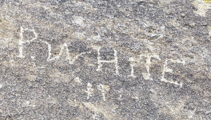
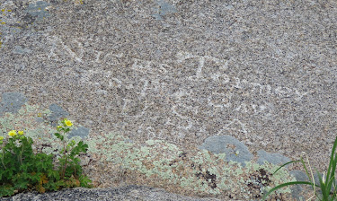
The rock made an inviting canvas to the travelers who scratched, chiseled, and painted their names on it. Many have faded or  weathered away but there are still hundreds of names that can be
seen. A paved path with interpretive signs leads to the base of the rock and to a group of plaques and chiseled names from the 1920s. A one mile path circles the rock and it's possible to climb to the top.

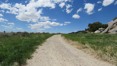
The entrance to the path has a zig zag fence opening that is too narrow for a wheelchair. The gate next to it has a chain without a lock so it can be opened.The paved path is accessible. When it reaches the base of the rock turn left to see the 1920s names. The path becomes dirt after that and too rough to traverse. Backtrack and continue on the gravel path to see more names. This path has some sections with loose, deep gravel but can be done with assistance. Turn around at the wooden zig zag fence opening. I think that most of the names are on the level top of the rock but there are still a few to be seen from the path. 

This is also a rest area with restrooms and separate parking areas for cars, trucks, and RVs. The RV section is large but the truck parking faces towards it so it can be noisy. There's more RV parking near the entrance to the path where it's a little quieter. There's also a dump station and potable water. Rock  42.4928, -107.13711
  

Wednesday, May 28, 2025

Devil’s Gate Overlook

The overlook gives visitors a sweeping view of the Sweetwater River valley where trails west - the California Trail, Mormon Trail, Oregon Trail, and Pony Express Trail -  met as they passed through  valley. 

Millions of years ago the valley was filled with sediment. As the river flowed through the valley it cut down through the dirt and eventually hit granite and kept cutting. Years of erosion exposed the ridge and the slot that was an important landmark and source of wonder to travelers. 

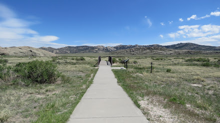
 The overlook has a short, paved, and accessible trail with interpretive signs.  Overlook   42.4373, -107.21756


Tuesday, May 27, 2025

Carbon County Museum

The galleries in this small museum cover Native American, military, railroad, and mining history. There's also an extensive exhibit on law enforcement from the days of forts to modern times. The garage level holds large items such as a1920's LaFrance fire truck, a sheep wagon, and a race car. 

 
The museum is partly accessible. The ramp to the entrance is very steep. A good portion of law enforcement exhibit is on an elevated platform without a ramp for access. The garage level has a short flight of stairs and no ramp. 
 
Parking is on the street. The sidewalks do not have curb cuts. Museum  41.79088, -107.24685 

Monday, May 26, 2025

Museum of Northwest Colorado

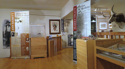
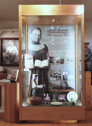
 Located in the former Colorado State Armory , the museum exhibits touch on many aspects of pioneer and cowboy history with a special emphasis on notable individuals, both honorable and notorious, plus a few who were just eccentric characters. 

The original stage features a large painting by local artist, Israel Holloway, who worked on it during the COVID epidemic while the museum was closed. At 16’x10’, it's the largest watercolor in the world. The second floor houses a collection of  saddles, guns, and spurs donated by collector Bill Mackin.
 
   
The accessible entrance is on the left side of the building, down a long ramp. There isn't a bell so call beforehand. A lift accesses all the floors. There's a platform lift on a short flight of stairs that accesses the  area behind the stage. The ramp to the room housing Bill Markin's collection is very steep. 
Parking is on the street.The sidewalks and curb cuts are in good condition.  Museum  40.51593, -107.54741