Thursday, January 23, 2020

Ten Years of RTR Gatherings!

    2020 is a big milestone for the RTR which was started by Bob Wells as a gathering of about 25 people who met in the desert to form friendships and share ideas. Over the years Bob’s website and YouTube channel have influenced and helped many more people. Homes on Wheel Alliance, which was founded in 2018 and now sponsors the RTRS, is providing another way to support nomads who are struggling and need a little help.
    This year has brought a lot of changes to the RTR. The BLM officials made finding a site to hold the RTR difficult. The areas offered were too remote, too dusty, or too expensive. After months of exhaustive searching by Suanne Carlson, co-founder of HOWA, a decision was made to hold the RTR seminars at the La Paz County fairgrounds, south of Parker, Arizona. This is not an ideal situation because attendees can not camp at the fairgrounds and must drive in every day from their camping spot on BLM land. Car pooling is encouraged. Most of the seminar attendees are new to van dwelling which is the usual scenario. The seminars never attracted as many people as the general RTR gathering. Most of the people who came to the RTR gatherings over the years to enjoy the comradery of fellow nomads have formed groups on their own this year.
   As a trustee and representative for HOWA, I been spending my days manning the HOWA booth and answering questions. It’s always fun to hear the stories of new van dwellers – how they made the decision to hit the road and where they plan to go when the weather warms up. Lots of excitement and smiling faces.

    We really miss camping in the midst of the larger gatherings but as volunteers, we get to stay at the fairgrounds and we don’t have a daily drive. Next year will probably bring more changes but even as the RTRs evolve they still carry on Bob Well’s mission to help people live the best life that they can!  RTR 34.01964, -114.23318
Map


              The free pile has graduated to tables.
    Signing the van
                              Always good to see old friends.
Trying out the electric bikes. Thanks to Lectric eBikes!
Bubbles! 
Seems like there's always a film crew following Bob.
 
Volunteer parking

Friday, January 10, 2020

Still Camping in the Desert

   There are many spots to camp for free in southern Arizona and California which makes it easy to spend the winter where it’s sunny and warm. Most of our camping in this area is on BLM land and there are a few simple rules -  “Dispersed camping is allowed on public land for a period not to exceed 14 days within a 28 consecutive day period….After the 14th day of occupation, the camper must move outside of a 25 mile radius of the previous location.”  Since rules vary by location and state – A permit is needed for campfires in California and some areas require signing in with a host – checking  the rules for each area is a good idea.

    We’ve been moving to a new spot every few days. Mostly they’ve been places where we’ve stayed in previous years however we recently camped at a new area – American Girl Mine BLM land in California. Gold has been mined here since the early 1800s and it’s believe to be the first mining district in California. The last large mining operation closed in the 1990s but a good number of ore haulers traveled back and forth along the road while we were camped so there is still some type of activity at the mines.
   The dispersed camping area is very large level and mostly level. There’s enough room to satisfy people who want their own private spot and to accommodate large groups of friends camping together. The city of Yuma is less than 20 miles away and has a wide variety of stores and services. All of this plus easy access to the Mexican border town of Los Algodones makes American Girl Mine a popular place.

   The ground is hard packed so rolling around is fairly easy. American Girl Mine  32.8356, -114.81039
https://www.google.com/maps/d/edit?mid=1xJqWzy65eI4BVW6oU8R89jdR0oY&msa=0&ll=32.837952973383736%2C-114.81906121714428&spn=5.452431%2C8.031006&z=13

Friday, December 20, 2019

Camping Down by the River

   We’re hanging out in Ehrenberg, Arizona on little piece of public land by a back channel of the Colorado River. We’ll probably be here until late December, enjoying the company of friends and completing little projects on the RV, so I won’t be posting very often. Happy Holidays to everyone!

Sunday, December 15, 2019

Desert Signpost & Shoe Fence

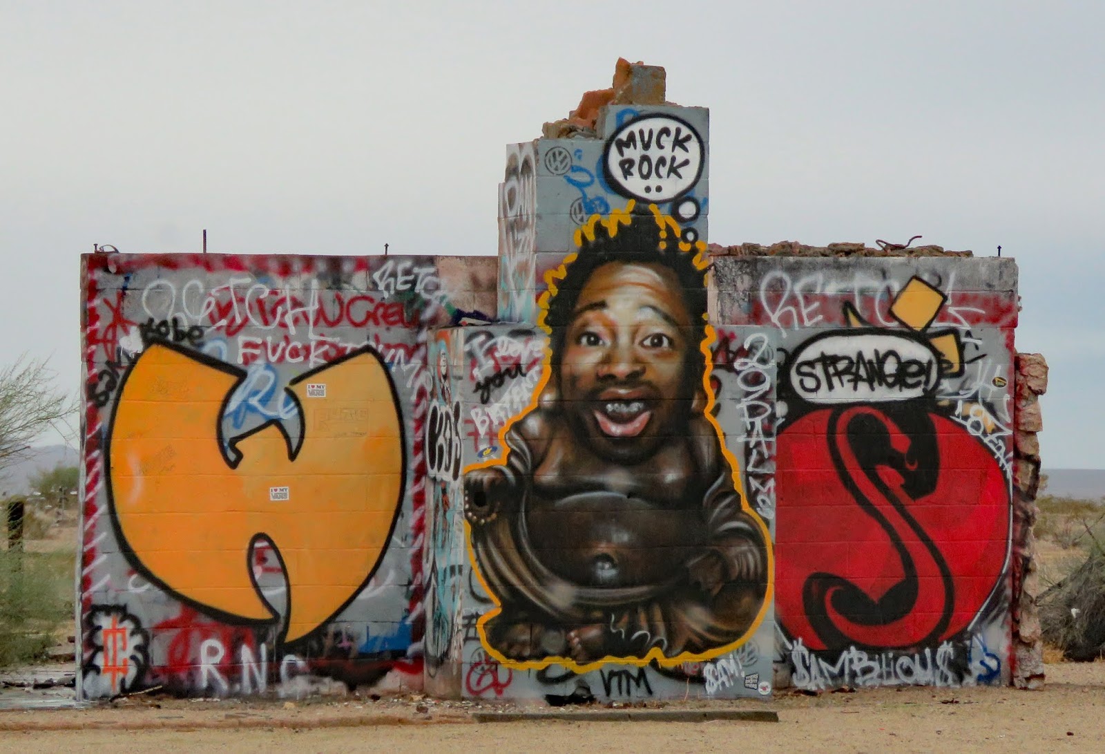
   It seems that people find driving across the desert boring and do strange things to amuse themselves. ;-)
   The desert signpost, abandoned gas station and graffiti wall, and the shoe fence are on a 15 mile stretch of California 62 to the west of the non-existent town of Rice.

   All of the sites have parking areas large enough for RVs. All can be viewed without leaving your vehicle. Signpost  34.08839, -115.10448  Shoe Fence  34.08313, -114.8477
https://www.google.com/maps/d/edit?mid=1xJqWzy65eI4BVW6oU8R89jdR0oY&msa=0&ll=34.0960877138894%2C-115.09660680952987&spn=5.452431%2C8.031006&z=11

Thursday, December 12, 2019

Tortoise Rock Casino

    The lot designated for overnight stays is in the northeast corner. It has a slope so leveling may be needed. Check-in at the security desk is required.

   The chairs are a bit hard to move. The money and card slots are easy to reach. Casino  34.11999, -116.05046
https://www.google.com/maps/d/edit?mid=1xJqWzy65eI4BVW6oU8R89jdR0oY&msa=0&ll=34.12122032292863%2C-116.05229298738237&spn=5.452431%2C8.031006&z=16

Monday, December 9, 2019

Noah Purifoy Desert Art Museum of Assemblage Art

   Noah Purifoy, who was 87 when he died, spent the last 15 years of his life creating more than 100 works of arts which are spread over 10 acres of desert land. Purifoy earned a BFA from Chouinard Art Institute and his art has been featured in galleries around the world.
   The art is created with found materials and many of the sculptures are changing are they react to the elements.
   The ground is mostly hard packed sand but some areas on the outskirts are soft and hard to push through.

    Many of the streets are unpaved and narrow. Follow the directions on the website you’ll be fine however turning around if you’re towing may be a bit difficult. Parking is located across the road from the site. Art   34.19529, -116.28845
https://www.google.com/maps/d/edit?mid=1xJqWzy65eI4BVW6oU8R89jdR0oY&msa=0&ll=34.202642143876936%2C-116.29363101591747&spn=5.452431%2C8.031006&z=12

Saturday, December 7, 2019

Desert Christ Park

   A partnership in the 1950s between a preacher and a self- taught sculptor resulted in this park which features over forty steel-reinforced, concrete statues depicting scenes of Jesus’s life. My favorite is the one with dreadlocks.

   The park is on a hillside with paths that wind past the statues. A few are located on the church property next door.

   The park is not accessible due to the steep slopes and sandy soil but it’s possible to see some of the statues without leaving your vehicle.

  The gravel road to the parking lot is very steep and narrow but the parking lot is large enough for RVs. Park  34.12943, -116.43942
https://www.google.com/maps/d/edit?mid=1xJqWzy65eI4BVW6oU8R89jdR0oY&msa=0&ll=34.202642143876936%2C-116.29363101591747&spn=5.452431%2C8.031006&z=12

Thursday, December 5, 2019

Dixon May Fair RV Park

   Twenty-eight spaces, lined up side by side on two edges of the parking lot, are available for RVers except when events are taking place at the fairgrounds. The sites are fairly wide and sixteen are full hookup. Even though this is one of our least favorite types of camping we needed to charge our batteries (no sun!) and dump our tanks while visiting family over Thanksgiving so we were happy to find the RV park opened.

    The spaces can not be reserved and special arrangements must be made for after-hours and holiday arrivals. We didn’t do this so we were, again, happy to find the gate opened. We checked for a drop box at the office, called the number which didn’t have an option for leaving a message, and couldn’t find the camp host so I sent a check to their mailing address. Hope we don’t get fined for breaking the rules. ;-)  RV Park  38.43804, -121.82189
https://www.google.com/maps/d/edit?mid=1MRNOAwb5okCy61LKgjYrbg3sfpE&msa=0&ll=38.43804616807158%2C-121.82195289882696&spn=10.53912%2C16.062012&z=18

Monday, December 2, 2019

Bodie State Historic Park

   Gold was discovered in Bodie in 1859 but the town’s growth was slow until 1875 when a mine collapse exposed a rich vein of ore. During it’s most productive period, from 1877 – 1881, the town had 30 mines, nine stamp mills, 60 salons, and around 8,000 people. News of gold strikes in Arizona, Montana, and Utah lured many miners away but Bodie’s mines stayed active until the last one closed in 1942. Caretakers watched over the deserted town until 1962 when California State Parks bought it.
   This is one of the best-preserved ghost towns in the US. Most of the buildings fell prey to fire and decay but the 5% that survived are in wonderful condition. The interiors remain as the last occupants left them with miscellaneous furniture, stocked shelves, and stacks of school books.
   Get a walking tour brochure at the visitor center or the red barn. There are 50 stops on the tour. A video about the town runs continuously at the red barn. When we visited the Miller house and the Methodist church were opened. The visitor center was not opened. The mill buildings and surrounding area are open for tours during the summer only.
   Attempts have been made to provide accessibility however most visitors in wheelchairs will still need assistance. The path that goes downhill from the parking lot to the townsite is concrete. The main streets are hardpacked. The red barn is accessible. During the summer arrangements can be made to drive to the barn and borrow a balloon tired wheelchair. The Miller House and Methodist church are not accessible due to steps. The visitor center has a ramp and boardwalk. Peeking in the windows of the buildings is difficult because of the window height, uneven ground, and other obstacles.
   The park is thirteen miles east of US 395 on Bodie Road. The first 10 miles are narrow but paved. The last three miles are washboard dirt – very rough but worth the trip. Parking for RVs is limited to the side of the road past the main parking lot. Since it wasn’t busy when we visited we parked in the main lot and got permission from a park ranger. The road to the park is closed after the first heavy snowfall. Bodie  38.21343, -119.01504

https://www.google.com/maps/d/edit?mid=1MRNOAwb5okCy61LKgjYrbg3sfpE&msa=0&ll=38.21575443226601%2C-119.02660465968353&spn=10.53912%2C16.062012&z=13