Saturday, May 11, 2019

Bothe-Napa Valley State Park

  The campground was fairly empty when we visited mid week however, since the park is located at the north end of Napa Valley, I suspect that it gets busy in the summer.  Amenities include picnic tables, fire rings, food cupboards, restrooms with flush toilets and showers, and a swimming pool. The campsites are roomy, shady, and fairly private due to lots of vegetation between the sites.

   We camped in site 37 which is a designated accessible site. The table top is extended and the ground is hard packed making rolling around very easy. Many of the parking pads for the other sites are very sloped. We did not check out the visitor center, pool, or any of the trails. Park  38.5533, -122.52572
https://www.google.com/maps/d/edit?mid=1MRNOAwb5okCy61LKgjYrbg3sfpE&msa=0&ll=38.55387883572902%2C-122.52828527915688&spn=10.53912%2C16.062012&z=16

Thursday, May 9, 2019

Quarryhill Botanical Garden

   Appropriately named, Quarryhill is  situated on a hillside with several old quarries that have filled to form small ponds. The garden was developed by Jane Davenport Jansen to preserve Asian plants especially rare, and/or endangered species. Most were collected in the wild and brought back to the US as seeds. These include the ancestors to species of roses, camellias, peonies, magnolias, rhododendrons and maples that have been imported to the US.


   The garden is not accessible. The trails are hard packed but most are very steep. Wheelchair users will need a strong, energetic helper to see even a portion of the garden. Visitors who are able to climb into a golf cart can get a ride to a small area of the garden that is almost flat. Longer golf cart tours are available for an addition fee and must be made two weeks in advance.
   The parking lot is large enough for RVs.  Garden  38.37551, -122.51074
https://www.google.com/maps/d/edit?mid=1MRNOAwb5okCy61LKgjYrbg3sfpE&msa=0&ll=38.37563898912155%2C-122.51222182145693&spn=10.53912%2C16.062012&z=17

Wednesday, May 8, 2019

Sugarloaf Ridge State Park

   The narrow and steep park road climbs from the Sonoma Valley to the campground which is located in a high meadow. 50 campsites have picnic tables and fire rings. A central restroom has flush toilets and showers. Other restrooms are vault toilets. Potable water is available but there isn’t a dump station. The length limit is 24’ for trailers and 27’ for RVs.

   Two of the sites are designated as accessible. They’re large and level, close to the restroom and have tables with extended tops. Both were occupied when we arrive but site  #3 where we camped was good except for the slight hill to get to the parking area.

   The park has 25 miles of trails. Some are for hiking only, others are shared with  bikes and horses. Most are go up in elevation and are not accessible. The short Creekside Nature Trail, which is undergoing maintenance,  is fine, hard packed stone and is accessible. The Meadow Trail is a hard packed dirt road with gentle grades and is accessible to the intersection with Hillside Trail approximately one mile in. One section gets muddy but it’s not a problem in  dry weather. Both trails can be accessed from the trail to the amphitheater, between site 12 and site 13. Park  38.43745, -122.51597
https://www.google.com/maps/d/edit?mid=1MRNOAwb5okCy61LKgjYrbg3sfpE&msa=0&ll=38.437337458902476%2C-122.53615475822875&spn=10.53912%2C16.062012&z=14

Cache Creek Casino Resort

   The RV parking lot sits high above the casino. It’s gravel, dusty, and very unlevel. Most RVers park at the far west end where’s a bit more level and out of the way of truckers and bus drivers who also use the lot. Not recommended unless you need a quick overnight stop. Sign up for a club card and get $25.00 on the card that can be used for food, fuel, anything but alcohol and gambling. The buffet is pretty good.
  Shuttles drive through the lot every 15 minutes. Some have wheelchair lifts but the drivers do not  strap down wheelchairs which can be dangerous as the hill down to the casino is steep.

   Most of the chairs are fixed in place so the casino is not good for wheelchair users.  Casino  38.73832, -122.14094
https://www.google.com/maps/d/edit?mid=1MRNOAwb5okCy61LKgjYrbg3sfpE&msa=0&ll=38.737067360036285%2C-122.14390744190388&spn=10.53912%2C16.062012&z=17

UC Davis Arboretum and Public Garden

   The trails of the garden run along both side of the Putah Creek. The entire loop is 3.5 miles but crossover bridges allow for shorter walks. Plants from different countries and environments are grouped in small gardens along the trails.

     The trails are paved but are in poor condition in some spots. Wheelchair users may need assistance due to steep hills.

    We parked in Visitor Lot 55.  An all day pass is $9.00. Weekends are free and anyone with a disabled placard can park for free at any time. There’s also on-street parking on Garrod Drive. Garden  38.53106, -121.76221
https://www.google.com/maps/d/edit?mid=1MRNOAwb5okCy61LKgjYrbg3sfpE&msa=0&ll=38.53058147153787%2C-121.76291562385995&spn=10.53912%2C16.062012&z=17

Tuesday, May 7, 2019

Jan Shrem & Maria Manetti Shrem Museum of Art

  The museum has three galleries featuring changing exhibits. Large pieces filled the galleries when we visited so it didn’t take long to see everything.
   The museum is accessible.

   This map – here – has parking options marked. The large lot marked as Visitor Lot 1 is the best one for RVS. An all day pass is $9.00. Weekends are free and anyone with a disabled placard can park for free at any time. Museum  38.53209, -121.74918
https://www.google.com/maps/d/edit?mid=1MRNOAwb5okCy61LKgjYrbg3sfpE&msa=0&ll=38.532881009307076%2C-121.74873702042436&spn=10.53912%2C16.062012&z=17

Sunday, May 5, 2019

California Automobile Museum

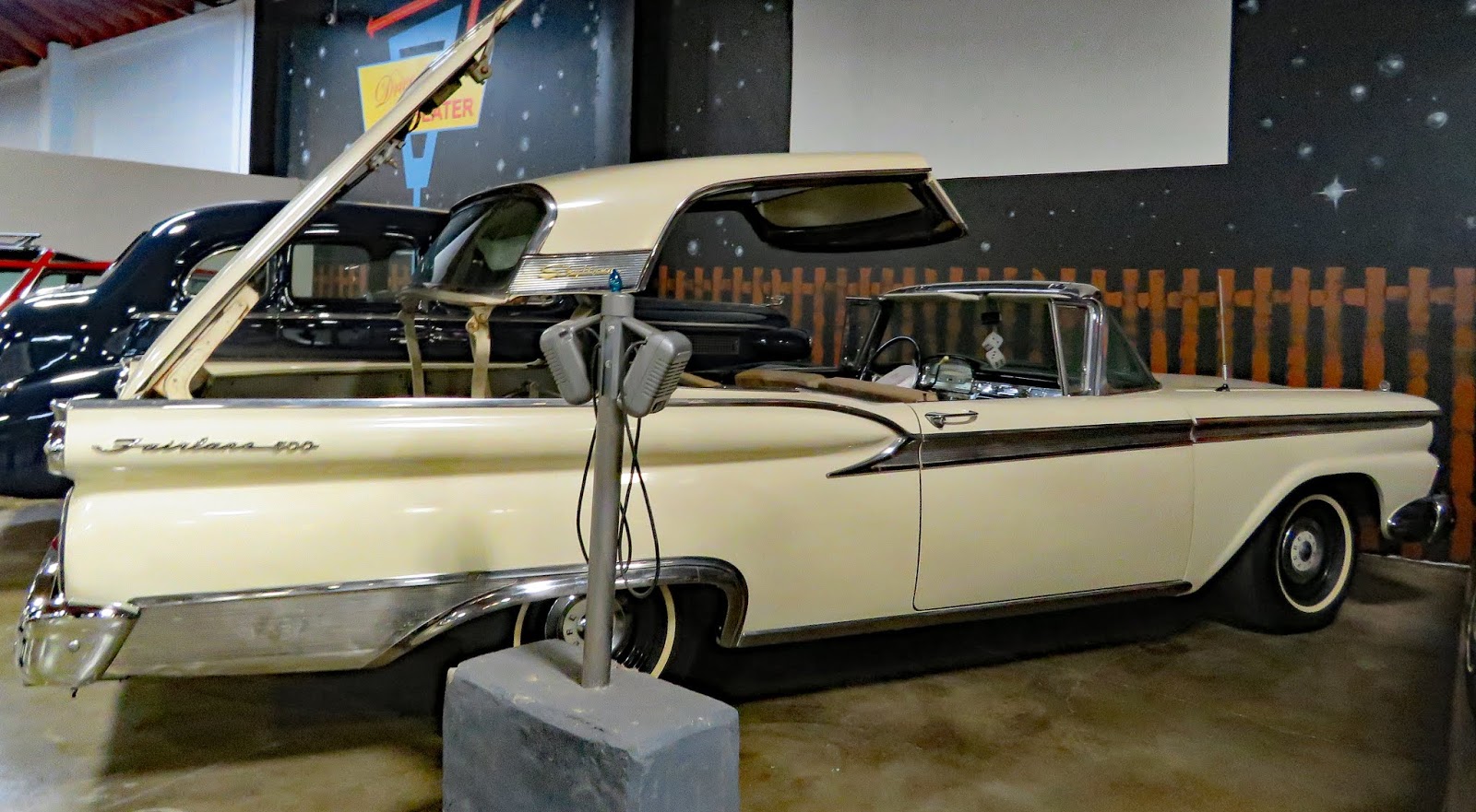
    From it’s debut in 1987, which showcased Edward Towe’s collection of Fords, the museum has grown to include 130  vehicles of various makes spanning 120 years. The cars are arranged in themed displays with historic information on each car. One gallery is reserved for special exhibits which was all about microcars when we visited.


   The museum is accessible except for the three or four cars that visitors may sit in for photographs.

   Two accessible spaces in front of the museum are long enough for short RVs. More parking where any RV will fit is available in the lot on the opposite side of V St. Museum  38.57082, -121.51162
https://www.google.com/maps/d/edit?mid=1MRNOAwb5okCy61LKgjYrbg3sfpE&msa=0&ll=38.57113903885555%2C-121.5119435641517&spn=10.53912%2C16.062012&z=18

Saturday, May 4, 2019

Folsom Lake SRA-Beals Point Campground

  Folsom Lake Dam was built in 1955 to provide flood control, hydroelectricity, recreational opportunities, and drinking and irrigation water. Activities include hiking, camping, biking, fishing, boating, water-skiing, and horseback riding.

   We camped in the non-hookup section of the campground. The sites vary greatly. Many are primary for tents with tables located downhill or uphill from the parking pads. These sites are generally large. Four of the sites are designated as accessible. We camped in site 13 and site 20. Site 13 is the best of the four with a large flat parking pad and a table with an extended top. It’s also close to a restroom. Site 15 is close to a restroom but it’s dug into the hillside and not very scenic. Site 20 is narrow and down a steep hill from the restroom. Site 10 is large with a dirt parking area that is downhill from the road and a good distance from the rest room. The full hookup section has two accessible sites. They’re wide and level. This section is newer so there isn’t as much shade but it’s popular and may fill especially on weekends.
    The park is a good place to access the American River Bike Trail however you must climb a hill in the campground first. This can be avoided by driving about a mile south and parking at the Parks and Recreation Dept lot on Old Folsom Road. The trail is 32 miles long, completely paved and in good condition. It runs from Beal’s Point to Old Sacramento.
    A half mile loop trail follows the lakeshore at the picnic area. Getting there from the campground involves a climb uphill and then a downhill roll but the parking lot is large so driving works too. The trail is paved but some sections are in poor condition. The lake level is high now that the drought has broken. Park  38.72076, -121.17167
https://www.google.com/maps/d/edit?mid=1MRNOAwb5okCy61LKgjYrbg3sfpE&msa=0&ll=38.71983616525406%2C-121.17247889947447&spn=10.53912%2C16.062012&z=15

Friday, May 3, 2019

Locke Boarding House Museum State Park

   The little village of Locke is a forgotten piece of California history. Chinese men came to the US during the 1849 California Gold Rush. They worked building the transcontinental railroad in the 1860s. They built levees and canals to drain the Sacramento Delta, When white mobs burned and plundered Chinese communities in the west during the 1890s the Chinese found a relatively safe haven working in the fields of the delta. Chinese immigrants were not allowed to become citizens or own land but they leased 10 acres of land from George Locke and built a community. During growing and harvesting season the town’s population could reach 1500. By the 1940s and 50s the young people began moving to bigger cities. Most of the residents today are white and many of the commercial buildings on Main Street are not inhabited.

   The town is a National Historic Landmark. There are four museums – the Boarding House, the Chinese Association Museum, the Dai Loy Museum, and the Chinese School. Businesses include a bar, restaurant, and galleries.

   The Boarding House has been completely renovated. The first floor has exhibits about the town. Most of the small rooms on the second floor are furnished to portray different eras and include personal items that the tenants may have owned. A ramp and elevator provide access. The exhibits are accessible.
   The Chinese Association was a social center and is still used as such even though it’s also a museum. It’s accessible.
   The Dai Loy Museum was a gambling house. It’s a cool old building with uneven sloping floors and various types of gambling tables and lottery equipment. The entrance has high threshold and some of the doorways into the smaller rooms are too narrow for wheelchair access.
   The school is not accessible and we did not visit it.

   Parking is very limited.  Small RVs will fit in the lot by backing up over the grass or by parking across the spaces. There isn’t room for large RVs to be parked or turned around in the lot. Locke  38.25131, -121.50938

https://www.google.com/maps/d/edit?mid=1MRNOAwb5okCy61LKgjYrbg3sfpE&msa=0&ll=38.250624758468554%2C-121.51217086046017&spn=10.53912%2C16.062012&z=16