Monday, July 31, 2023

Bird Track Springs Campground

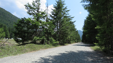
We wandered around on the Umatilla National Forest roads for a week enjoying the cooler elevations and the little forest campgrounds. They were mostly empty which was surprising considering how close they are to cities and how hot it was in the lowlands. The peace and quiet was fine with us. :) 

Bird Track Springs Campground is pretty with towering ponderosa pines and an under-story of lush grass. Three of the sights are accessible. We camped in site 13 which is excellent with a wide paved parking pad and a paved trail to the picnic table and fire ring. The picnic table has an extended top and the fire ring has high sides. The pavement extends under the table and fire ring. A paved trail continues to an accessible vault toilet. 

Bird Track Springs Interpretive Trail Trailhead on the opposite side of Route 244 was overgrown so we did not try it.

Some of the campsites are long enough for almost any RV and the campground roads all have turn around loops at the end.  Campground  45.29857, -118.30731


Sunday, July 30, 2023

Plymouth Park Campground

Summertime in eastern Washington is hot so were happy to be camping under the trees in this little Corp of Engineers campground. The 32 sites are lined up on either side of southern half of the campground loop. The loop is two way but for the hookups be on the correct side you have to go different directions on the loop depending on your site number. Some site are full hookup; the rest have water and electric. There's also a dump station. There isn't access to the water at the campground but you can drive or walk about a mile to the boat ramp and a little beach that are on the islands located just off the mainland. 

None of the campsites are designated as accessible but most are usable, All have paved parking pads that are fairly wide. The picnic table and fire ring areas are surfaced with gravel. 45.93329, -119.34639  Campground


Saturday, July 29, 2023

Halfway Flat Campground

There are only eight sites in this campground but there's also a large dispersed camping area on the other side of  the road. I think there's a charge for the dispersed camping - maybe a few dollars less than the campground fee. Some of the sites can be reserved and it appears to be a busy place on the weekends.

We were in Site 8 which is very large with access to the Naches River. The soil in Site 8 is soft and silty which makes rolling around difficult. Sites 3 and 6 are designated as accessible but I did not check them out.

 The sites are large enough for most RVs but the one lane access road has a very narrow section with a cliff on one side and a drop off on the other side. There were Class As in the campground so people do make it past that section but I think if we camped here again we would stay in the dispersed camping right before the bridge going over Naches River. It looks like there might be good dispersed camping spots on the other side of the bridge too. Campground  46.97826, -121.09639


Friday, July 28, 2023

Ranger Creek Airstrip Dispersed Camping

The campground runs along the both side of the airstrip. I thought we would see planes flying in and taking off but apparently due to the winds and surrounding mountains this is a tricky place for pilots. A plane did take off while we were there and we heard a couple of fly overs but no landings. The history of the airport is a bit of a mystery. It may have been built during WWII as a secluded hiding spot in case of an invasion or as a training field. 

 There are several camping areas. The first area on the east side of the airstrip is roomy so this is where most people with large RVs camp. It's a bit dusty but there are a few sites away from the road and under the trees where vans can fit. The road comes to a Y with the left side going into the forest where the sites are shady and on the short side. The right side goes to a vault toilet and the self-serve fee kiosk plus a couple of nice roomy sites with shade and sun. The map on the information board shows the road continuing to make a loop to the west side of the airstrip but that has been blocked off. To get to the west side you must go back to the campground entrance. The sites on the west side are roomy and private but they may be too tight for big rigs.  

       East side

      West side

 Amenities are limited. The toilets are far away from most of the sites. Tables are scattered. Most sites are not marked so it's similar to dispersed camping. None of the sites are designated as accessible but some are usable. The toilets are accessible.

The entrance road to the east side camping is one of the most potholed roads we have ever driven on. Campground  47.01918, -121.53519


Thursday, July 27, 2023

Federation Forest State Park

 Concern about the destruction of old growth forests led the General Federation of Woman's Clubs of Washington State to start a “Save a Tree” campaign. In 1929 they purchased 62 acres of forest to form Big Tree Park.  Unfortunately in the early 1930s  windstorms, fires, and nearby logging destroyed the forest and the club began looking for a new site. The current site was acquired by Washington State Parks, named Federation State Forest, and dedicated in 1949.  

The park has a campground, picnic shelters, a  small interpretive center and 12 miles of interconnecting trails that loop through stands of Douglas-fir, western hemlock, Sitka spruce, and western red cedar trees. 

The interpretive center is accessible. We did not visit the campground. The Whispering Hemlocks Trail is accessible, surfaced with hard packed dirt. The other trails have roots and hills. We were confused by the signs because the sign at the start of  trail system did not indicated that the interpretive trail was the Whispering Hemlocks Trail. It also do not indicate that it was the accessible trail. At the first directional signs go to the left on the Whispering Hemlocks Trail as shown by the arrow. Trail Map

The parking lot is large enough for RVs. Park  47.15222, -121.68776


Wednesday, July 26, 2023

Mercer Slough Nature Park Trails

In 1917 when the Seattle Ship Canal and locks were constructed the level of Lake Washington dropped 10 feet and what was once a bay became a wetlands and flat farmland with a slow moving slough dividing them. In the 1950s the city of Bellevue began acquiring land to make the park which has grown to 320 acres.

 We walked/rolled along the two loop trails in the park, the Bellefields Trail and the Heritage Trail for  a combined length of 2 miles. Both trail are a combination of boardwalk or hard packed dirt with gravel or mulch. The Bellefields Trail is lined with ferns, shrubs, and trees as it wanders through the wetlands. Mosquitos may be numerous in some sections. The Heritage Trail follows the edge of a blueberry farm and has interpretive signs about the early farms and logging operations. 

The Winters House, built by Frederick W. Winters in 1929, sits on the west edge of the park. Winters was a flower bulb grower who profited from the quarantine of imported bulbs that was in place from 1926 to 1938. The house is normally opened for tours but the due to South Bellevue Light Rail construction it's closed and will not reopen until the project is finished. The self pick blueberry farm is also closed for the duration.

The trails are accessible with assistance due to hills as the trail climbs to street level. The transitions from boardwalk to trail are not even. The boardwalks are in good shape and the trails are hard packed.

 Parking is limited. We parked in the lot for the not-yet-completed Light Rail station but that lot is not really large enough for RVs. Probably the best thing to do, once the station construction is completed, is to park in a large park-and-ride lot and take the light rail to the park. Park  47.58547, -122.18999


Monday, July 24, 2023

Bellevue Botanical Garden

 
Cultivated gardens, restored woodlands, and natural wetlands are spread out over the 53 acres of the garden. We were impressed how by large and well tended the garden is especially since it's a public garden with free admission for everyone.
                       
Due to the hilly terrain most wheelchair users will need assistance to see the entire garden. Download the Trail &Accessibility Guide for information on all of the trails. Trails are concrete, small gravel, and hard packed dirt. 

Oversize vehicles must be parked at Wilburton Hill Park which is about 1/4 mile east. Follow the trail at the south side of the soccer field. This trail leads to the garden parking lot. Garden  47.60937, -122.17839

Angel of the Winds Casino

The oversize parking lot is at the south end of the property. It's a gravel lot but there's a little used asphalt next to it where we stayed after getting an okay from security. Check in is required. It's a fairly long, slightly downhill trek to the casino so people with mobility issue may wish to park closer to visit the casino.

 The casino is accessible. The chairs are a bit heavy but staff and customers are happy to help move them. The card and money slots are easy to reach. Casino  48.21129, -122.18363


Friday, July 21, 2023

Olympic Discovery Trail - Port Angeles

The Olympic Discovery Trail is 135 miles long with more than half a shared hike/bike trail and, at times, an equestrian trail too. The rest is shared roadway. We walked/rolled on the trail east of Port Angeles for about 4 miles out and back. The trail quickly leaves the city and becomes scenic with the Salish Sea on one side and a tree covered hill on the other side. About a mile in the trail passes by the Rayonier Pulp Mill which closed in 1997. The mill grounds have been cleared of most buildings and a extensive cleanup was conducted but the site is still contaminated so it's surround by a fence with warning signs. Fencing continues for about 3/4 of a mile after which the trail returns to better scenery. 

The trail is paved to the Rayonier Pulp Mill site. This section is in good condition and accessible but the mill section is gravel and a bit rough. 

Parking is limited. Most of the pay lots are expensive. We parked on East 5th Street but the trip to the trail is downhill and about 1/2 so I don't recommend it. Try parking on East Front Street instead. Trail  48.11991, -123.42994