Monday, July 29, 2019

The Forth Annual Northwest Get Together

This gathering is organized by our friends Nelda and Gary and is a nice mix of Roadtrek owners and CRVL rubber tramps. It’s held at the  Port of Tillamook Bay RV Park, a no frills grassy campground with a restroom, potable water, and a few scattered tables. We arrived on July 18th and stayed until the last day, July 28th. (way behind on my posts again).

 Everything was very low key with a lot of visiting and sharing meals although a few of the more energetic campers headed out for hikes almost everyday. We hung out at the campground the entire time except for a visit to the Air Museum and a couple of trips to town for supplies. Seeing everyone is always a lot of fun. We’ll be back next year! Park  45.41853, -123.82091
https://www.google.com/maps/d/u/0/edit?ll=45.41874139254065%2C-123.82123141845477&spn=7.911423%2C16.062012&hl=en&msa=0&z=17&ie=UTF8&mid=1gM7a_TAFMpg6ncUflVh6U6zexPE

Saturday, July 27, 2019

Maryhill Highway Boondocking

  The highway narrows and becomes gravel after passing through Maryhill, a small village surrounded by fruit orchards. It almost looks like a private driveway but keep going past the orchards until the road breaks out into the open with sweeping views of the cliffs and Columbia River. Stop and buy some fruit – yum. :-)

   The land along the river is BLM land and camping is allowed in some areas. A few spots that look like they would be good have been blocked off but we found a small site with a great view and a sheer drop to the river. People with larger RVs should continue east to the large gravel area by the John Day Dam. This area can also be accessed from Route 14 which will avoid most of the gravel road.
   The gravel road is passable by an vehicle and the area by the dam is large enough for any RV. The road is actually surfaced with round stones which roll around when driven over so it’s a little noisy and strange feeling. Boondocking   45.69209, -120.78253
https://www.google.com/maps/d/u/0/edit?hl=en&msa=0&z=13&ie=UTF8&mid=1d4nwGRie74meTvA5J0HjtGLTfPY&ll=45.69593512463045%2C-120.80060320272787

Wednesday, July 24, 2019

Yakama Nation Museum


    Dioramas of the natural world, full-sized examples of native houses, and historic information fills this small museum. Photography is not permitted.

   The parking lot is large enough for any RV.  Museum  46.3796, -120.34169
https://www.google.com/maps/d/u/0/edit?hl=en&msa=0&z=17&ie=UTF8&mid=1d4nwGRie74meTvA5J0HjtGLTfPY&ll=46.38014217381529%2C-120.34191814983751

Yakama Nation Legends Casino

    Follow the oversized parking signs. The lot is huge so we parked at the north end away from the trucks. The parking lot is flat and the walk/roll to the side entrance is fairly easy.

   The casino has low pile carpeting, easy to move chairs, and easy to reach card and money slots. Casino  46.37461, -120.33714

https://www.google.com/maps/d/u/0/edit?hl=en&msa=0&z=17&ie=UTF8&mid=1d4nwGRie74meTvA5J0HjtGLTfPY&ll=46.37487829623353%2C-120.33772317493822

Tuesday, July 23, 2019

Stampede Bog Road Boondocking

  This spot, just a mile from the interstate, is very easy to access. It’s large, grassy, and kind of lumpy but hard packed. It appears that someone mows the grass which had me concerned but after searching through several land status sites I can not find any indication that it isn’t national forest land. There are many other opportunities in the area if it’s not possible to camp at this spot. Forest  47.30304, -121.31954
https://www.google.com/maps/d/u/0/edit?hl=en&msa=0&z=14&ie=UTF8&mid=1d4nwGRie74meTvA5J0HjtGLTfPY&ll=47.304866938409305%2C-121.32674507268149

Monday, July 22, 2019

Gold Creek Pond Trail

   Between 1978 and 1983 the site of Gold Creek Pond was a gravel pit used during the construction of I-90. The depression filled with water and is now a beautiful little pond with a mile long trail circling around it.
    
   
   The trail is paved and accessible with gentle up and down grades.
   The parking lot is large enough for any RV.  Trail  47.39641, -121.37889
https://www.google.com/maps/d/u/0/edit?hl=en&msa=0&z=16&ie=UTF8&mid=1d4nwGRie74meTvA5J0HjtGLTfPY&ll=47.396984213428084%2C-121.3803274189886

Saturday, July 20, 2019

Snoqualmie Valley Historical Museum

  Donated items and photographs pertaining to homesteading, farming, and Native American history fill the rooms of this small museum.
   The museum is accessible but the doorway to the Native American room is narrow. Wide wheelchairs may not fit through it. The exhibits in the Farm Shed Building are a little hard to see due to the height of the exterior wall.

  The parking lot is large enough for any RV. Park close to the sidewalk to avoid a long trip through rough gravel. Museum  47.49375, -121.78829
https://www.google.com/maps/d/u/0/edit?hl=en&msa=0&z=18&ie=UTF8&mid=1d4nwGRie74meTvA5J0HjtGLTfPY&ll=47.49390032376127%2C-121.78863959010488

Friday, July 19, 2019

Northwest African American Museum

  The journey of African Americans to the US on slave ships and, after winning their freedom, to the northwest for new opportunities is told in this small museum.  Local individuals are highlighted in the exhibits. The Jimi Hendrix Park, featuring a timeline of Hendrix’s life, walkways and a sculpture, is located on the grounds.
    The museum and the park are accessible.

    RVs will fit in the lot if parked across the spaces. Museum  47.58863, -122.30218
https://www.google.com/maps/d/u/0/edit?hl=en&msa=0&z=18&ie=UTF8&mid=1d4nwGRie74meTvA5J0HjtGLTfPY&ll=47.588986361713694%2C-122.30283914725965

Thursday, July 18, 2019

Vasa Park Resort Campground

   For years we’ve dry camped at either the Emerald Queen Casino in Fife or the Muckleshoot Casino in Auburn but this year we were surprised to see No RV Parking signs at both of them. There are very few campgrounds near Seattle where our daughter and son-in-law live so I had to scramble a bit to find a place. I settled on Vasa Park east of the city so that we could avoid I-5 as much as possible.

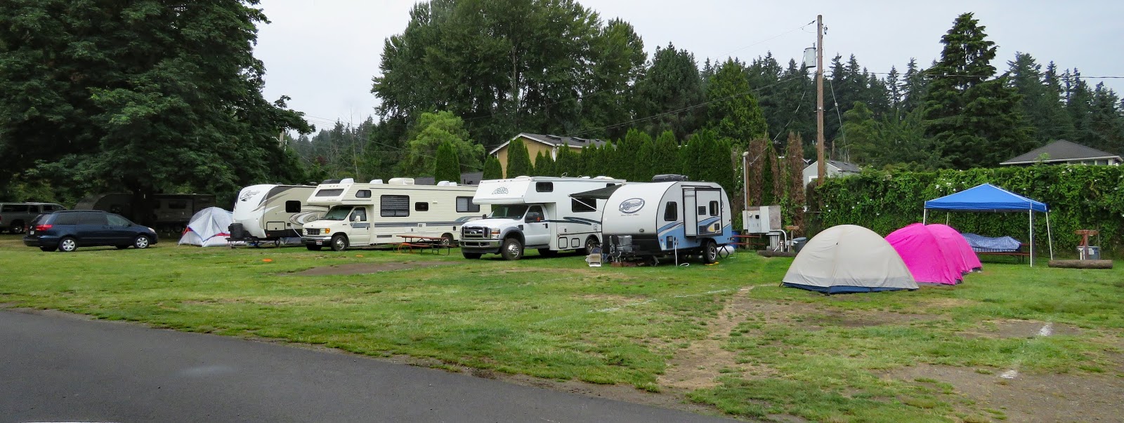
   Vasa Park is not a resort, in fact, it seems more like a community park than anything else. It’s small with only 6 full hookup sites and 15 tent and partial hookup sites. They’re all very close together. The park is right on Lake Sammamish and has a beach, water slides, boat launch, and playground.
   The campground seems almost like an afterthought because the main portion of the park is used by day visitors and for private events. We were there for 4 days and every day a large event was held. At least two were family picnics for Microsoft employees with pizza, barbecue, ice cream, inflatable slides, and train rides – looked like fun!  During events campers are restricted to the camp area, beach, and playground.
   All in all this is not the type of camping we prefer but it’s fine for visiting the city – easy to get to, closer than the other campgrounds, and a bit cheaper than most of them. The full hookup sites fill but I didn’t have a problem booking a site in the partial hookup area. Campground  47.57791, -122.11271
https://www.google.com/maps/d/u/0/edit?hl=en&msa=0&z=18&ie=UTF8&mid=1d4nwGRie74meTvA5J0HjtGLTfPY&ll=47.578100372489274%2C-122.11308245135677

Tuesday, July 16, 2019

Museum of History & Industry

    Nicely done exhibits follow the history of Seattle from the Native American settlements to the present day city.
   The museum is accessible. The bridge room (the building was originally a Navy reserve armory) is accessed by a stairway however there is an accessible entrance on the third floor. It’s located in the Johnson Family Gallery which houses temporary exhibits. The door was locked during our visit and we did not search out someone to unlock it so we didn’t visit the bridge room.

    Parking for large vehicles is very limited in the Seattle area. There’s an accessible lot at the south side of the museum for vehicles 25’ or less. We did not use this lot. Instead we parked at Woodland Park Zoo and rode to the museum with our daughter. The zoo lot has a few long RV/bus spaces. They’re expensive – $18.00 for RVs but free with a handicapped hang tag. Free parking is also available to Woodland Park adjacent to the zoo. Museum  47.62716, -122.3367
https://www.google.com/maps/d/u/0/edit?hl=en&msa=0&z=18&ie=UTF8&mid=1d4nwGRie74meTvA5J0HjtGLTfPY&ll=47.62717058074292%2C-122.33725085284806

Sunday, July 14, 2019

Ballard Locks and Visitor Center

   The Lake Washington Ship Canal was completed in the early 20th century to connect Lake Union and Lake Washington to the Puget Sound and allow easy transportation of lumber and coal from the interior of Washington State to the sound. The locks, which carry more boat traffic than any other locks in the US, allow the boats to “climb” 20 feet from sea level to lake level and vise versa.

   There are lot of things to explore at this site. Paved paths circle through 7 acres of botanical gardens, the result of  40 years of work by Carl S. English, Jr.  Rangers conduct free tours of the locks every day during tourist season. The locks may also be toured on your own. The large amount of boat traffic means visitors will most likely see the locks in action. A fish ladder viewing room is located on the south side of the canal. The fish must climb 21 steps to travel from the ocean to the lakes and continue their journey to riverbed spawning grounds. The fish swim back and forth in this area to acclimate from salt water to fresh water and underwater windows give visitors a good view of them. The small museum has interesting exhibits and videos about building the locks and the lifecycle of salmon.
   The garden, lock viewing area, fish ladder viewing area, and the museum are accessible.

   Parking for large vehicles is very limited in the Seattle area. The parking lots near the locks are too small for RVs. We parked behind the Nordic Museum. Small RVs will fit in this lot (small fee).  Large RVs may fit on the street in front of the museum but due to street construction those spaces were closed when we visited. The sidewalks and curb cuts are in fair condition. Locks 47.66735, -122.39793
https://www.google.com/maps/d/u/0/edit?hl=en&msa=0&z=18&ie=UTF8&mid=1d4nwGRie74meTvA5J0HjtGLTfPY&ll=47.666954974264456%2C-122.39823865822802